Columbus (WCMH) – Looking at the Atlantic things are starting to heat up. One weakening wave that was Fiona, one strengthening Tropical Storm (Gaston), and another wave that requires close watching.
We are now entering into the peak period in the Atlantic Hurricane Season for the next 45 days, with the peak day being September 10th.
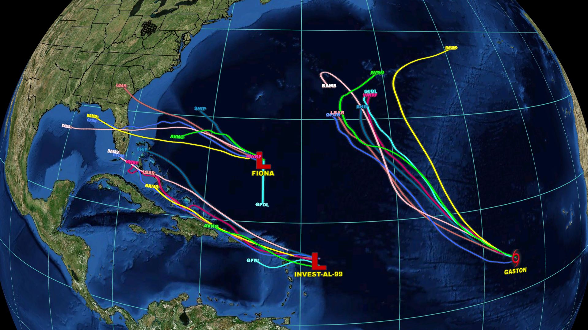
Right now using the “Spaghetti Plots” (below) for each one of these systems you can see the biggest storm, Gaston, has the lowest threat to land. Fiona, or what is left of it, will slide west, along the southern edge of a boundary to the north. The third wave, which has made quite a track from the African coast to the Lesser Antilles, but has still not formed a solid low.
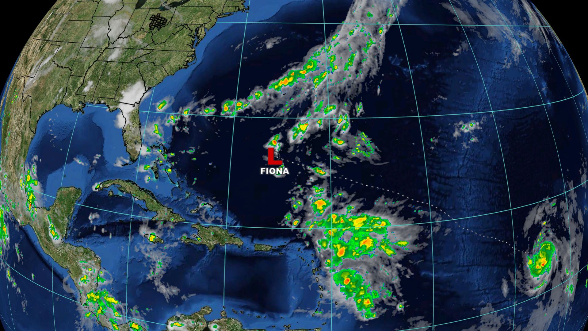
Below is a look at Fiona, basically a cluster of t-storms, and the stretched boundary to the north. This system will continue to push west through the weekend.
Below is the wave south of the remnants of Fiona. This wave has pulsed back and forth between organization and basically the large cluster of storms it is right now.
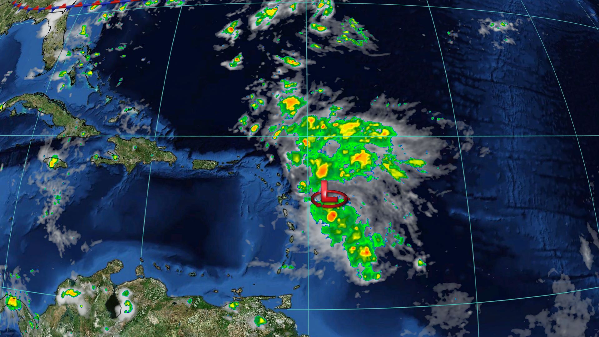
Clearly, it is not a well organized storm right now, but as it continues to push west, it will bring good rains to the Antilles. An Air Force Hurricane Hunter plane investigated the storm today, and based on its findings, the Hurricane Center only has a 40% chance of development in the next 48 hours. The conditions in the area this wave is heading towards is only marginally conductive for storms.
However, as we head into the late week, the storms will enter into a much more favorable area for development. The Air Force Hurricane Hunter will continue to fly this storm the next few days. This system most likely requires the most watching as its the only system at this time that has any potential to impact the United States.
Right now the National Hurricane Center has formation chances at 60% in the next 5 days. I have been monitoring this system closely, and most models are increasing the intensity of this system to a Tropical Storm or Cat 1 Hurricane by 120 hours (5 days). Stay tuned about this storm…
Finally, a close up look below of Tropical Storm Gaston.
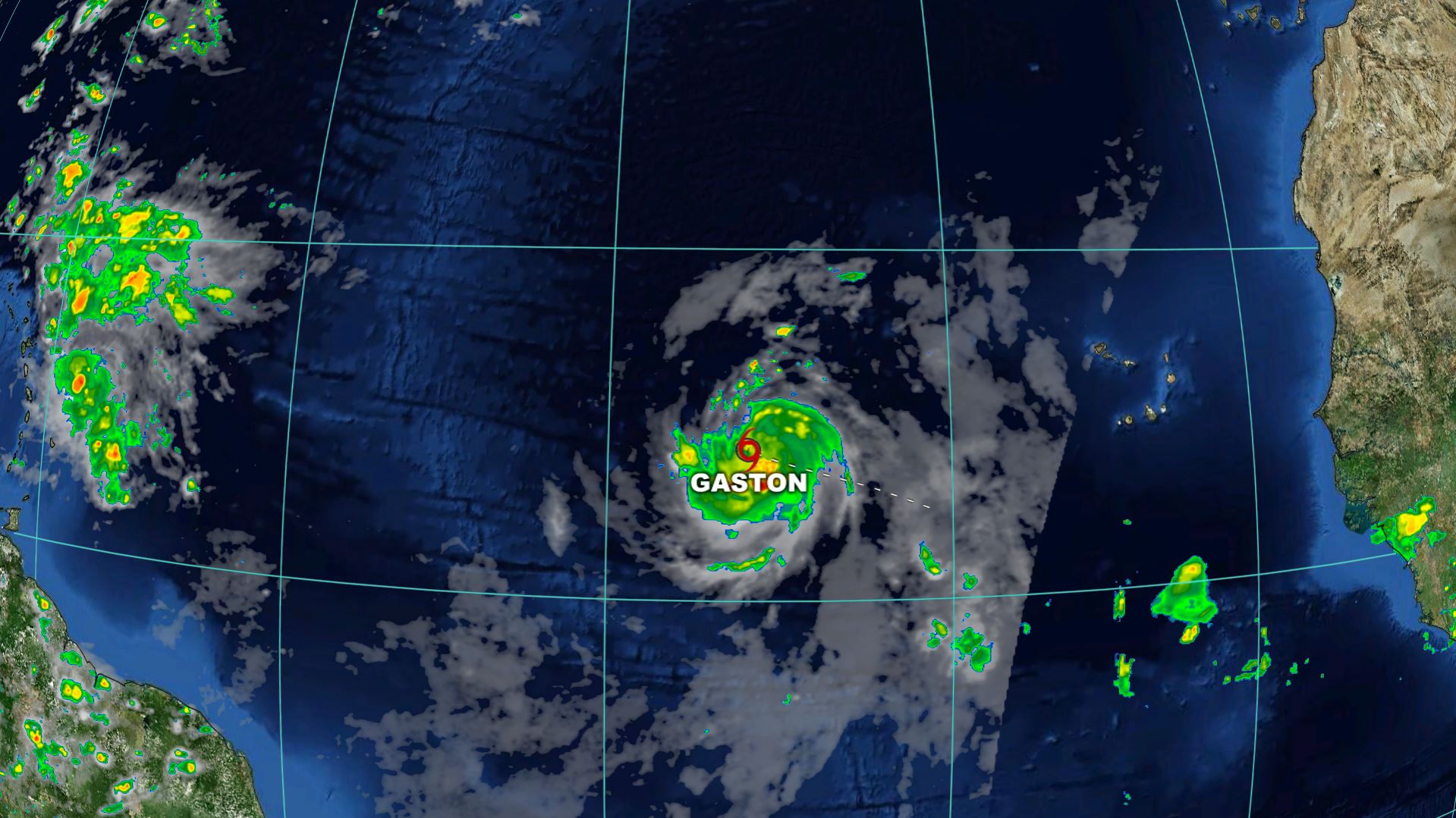
Gaston has winds at 65mph as of Tuesday evening, and is forecast to become a Hurricane by the next update. This will make Gaston the 3rd Hurricane in the Atlantic this season, but should again continue to be no threat to land as it curves to the northwest.Compared to the past few years…
- 2015 11 Tropical Storms, 4 became hurricanes
- 2014 8 Tropical Storms, 6 became hurricanes
- 2013 13 Tropical Storms, 2 became hurricanes
- 2012 19 Tropical Storms, 10 became hurricanes
- 2011 18 Tropical Storms, 6 became hurricanes
- 2010 19 Tropical Storms, 12 became hurricanes
By August 23rd, how many storms had formed each year?
- 2015 4
- 2014 3
- 2013 5
- 2012 10
- 2011 9
- 2010 4
I will continue to monitor the Tropics and post updates online. If you ever have questions about these storms, or anything else, drop me a line at dmazza@wcmh.com
-Dave


