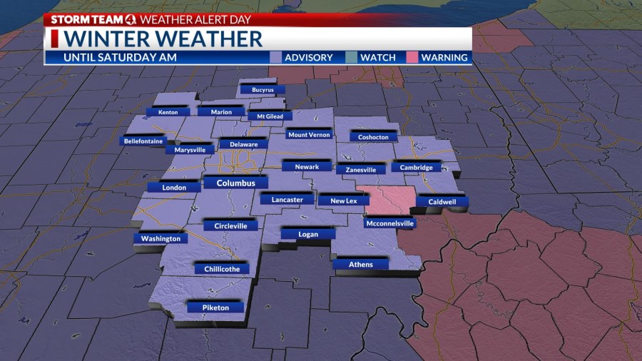
COLUMBUS, Ohio (WCMH) — A winter weather advisory is in effect through early Saturday for a the first widespread light snowfall. A winter storm warning has been issued for the southeastern and northeastern corners of Ohio until midday Saturday, where accumulations will be a little heavier.
Low pressure tracking through the central Appalachians will bring 1 to 3 inches of snow this morning, tapering to flurries by this afternoon. The northeastern corner of the state will see more than 4 inches by this evening due to lake-enhanced snows.

Temperatures in the mid-20s is adequately cold for a powdery accumulation for a fluffy snow. Watch out for slippery conditions on untreated surfaces.
A surge of frigid air will arrive in the wake of the storm this weekend, accompanied by gusty northwesterly winds (20 to 30 mph), sending the wind chill down into the single digits Friday afternoon, and between 0 and -10 degrees overnight through Saturday morning–and as low as -20 in the northern part of Ohio. A few lingering snow showers are likely during the day in lake-effect bands.
Sunday will bring a frigid morning low between 0 and 5 degrees in central Ohio, and some spots could dip below zero with fresh snow cover. Winds will lessen, as high pressure builds in, reducing the harshness of the wind chill factor.
If you are getting tired of the cold, next week will be much milder–with highs reaching the 40s and rain instead of snow.


