QUICK WEATHER FORECAST:
- Today: Showers/ t-storms, high 75
- Tonight: Chance of rain, low 62
- Wednesday: Rain & rumbles, high 78 (62)
- Thursday: Warm & muggy, high 86 (69)
- Friday: Chance of storms, high 85 (63)
- Saturday: Scattered showers, high 77 (57)
Today brings more rain chances back into central Ohio, but later in the afternoon thunderstorms will begin to develop and move as well. At the moment, none of these storms are expected to strengthen to a severe level. Temperatures will once again reach the mid 70s for the daytime high.
Rain chances will continue through at least the middle of the week as Wednesday brings in a few more thunderstorms by the afternoon. A warming trend is also going to continue as high temperatures will reach the upper 70s.
The second half of the work week will also bring summer-like temperatures with highs between Thursday and Friday, reaching the mid 80s. Thursday into Friday night will also bring the chance for a few more storms, and these ones may lean a little bit on the stronger side. The strongest of these storms will arrive Thursday night into Friday.
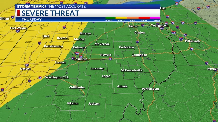
The western portion of central Ohio is already under a slight risk (2/5) for severe weather. Everywhere else will see a marginal (1/5) risk as the storms are expected to weaken the further they move into the state.
Another cold front arrives Friday night bringing more rain. A couple more chances for pop-up storms will kick off the weekend on Saturday. Skies are going to be partly sunny by Sunday and cooler temperatures will settle back in.


