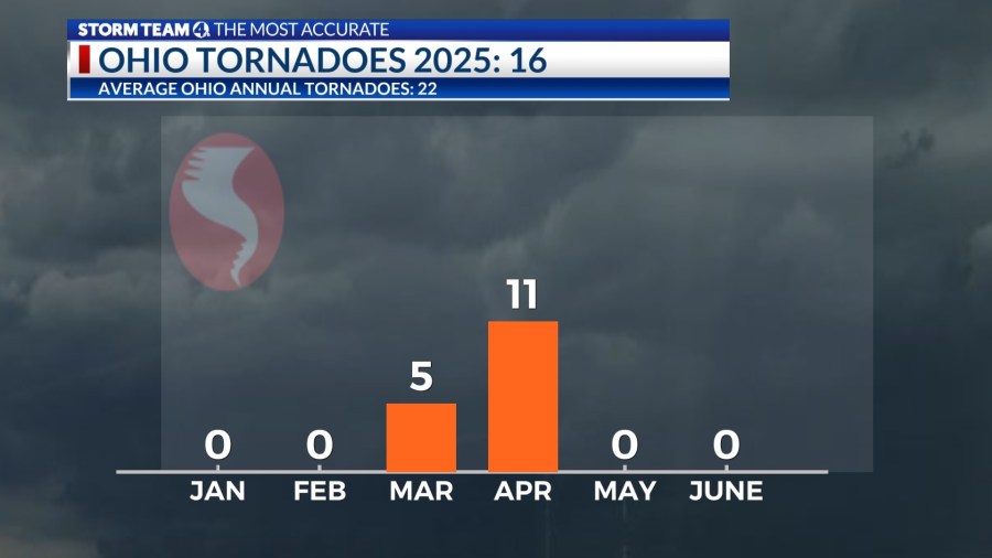
COLUMBUS (WCMH) — After an active early spring, no tornadoes were confirmed in Ohio during the month of May, which has only happened seven times in the past 25 years.
The drop-off is due to a southward of shift of the jet stream, with storms focused across the southern half of the country. Columbus had a 16-day stretch of below-normal temperatures through June 2. Severe storms capable of producing a tornado require heat and moisture (fuel), in additions a strong jet stream in the vicinity.


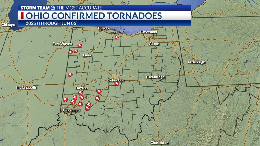
All but four of the tornadoes so far this year have been relatively weak EF0 events, and only one storm touched down in central Ohio–an EF0 tornado (85 mph winds) near Obetz that tracked 2.6 miles on the night of Mar. 30.
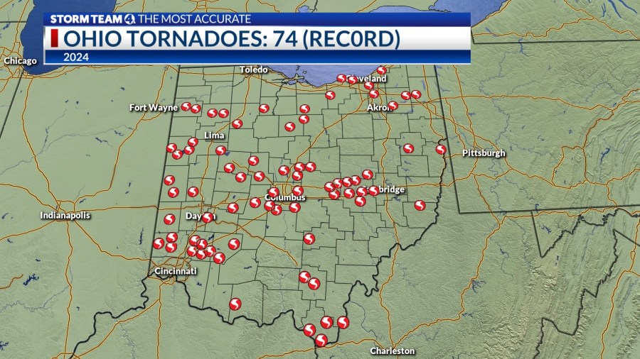
Last year, when a state record 74 tornadoes were confirmed, 23 tornadoes were reported in May around the Buckeye State, which surpassed the average for an entire year. Multiple tornado outbreaks impacted central Ohio, beginning on Feb. 28 and continuing through the spring, before a summer drought curtailed the storm threat. 2024 was also the warmest year on record in Ohio, and in Columbus (57.3 degrees), with records going back to 1879.
The month of May averages more tornadoes than any other month in Ohio and across the U.S. the reason is the frequent clash of cool, dry Canadian air and summerlike heat and humidity from the Gulf. The other key ingredient is wind shear–winds shifting direction with height that adds broad rotation to a column of air under the right conditions.
Nationally, 328 tornadoes were reported in May, fewer than in April (358), and comparable to a very active March (300), based on preliminary reports from the Storm Prediction Center in Norman, Okla.
Through the end of May, Missouri and Illinois have reported 105 tornadoes, second only to Texas (109). A total of 1,042 preliminary unfiltered tornado reports were logged as of May 31 in the U.S., with final assessments often taking many months to complete, removing duplicates for the same event.


