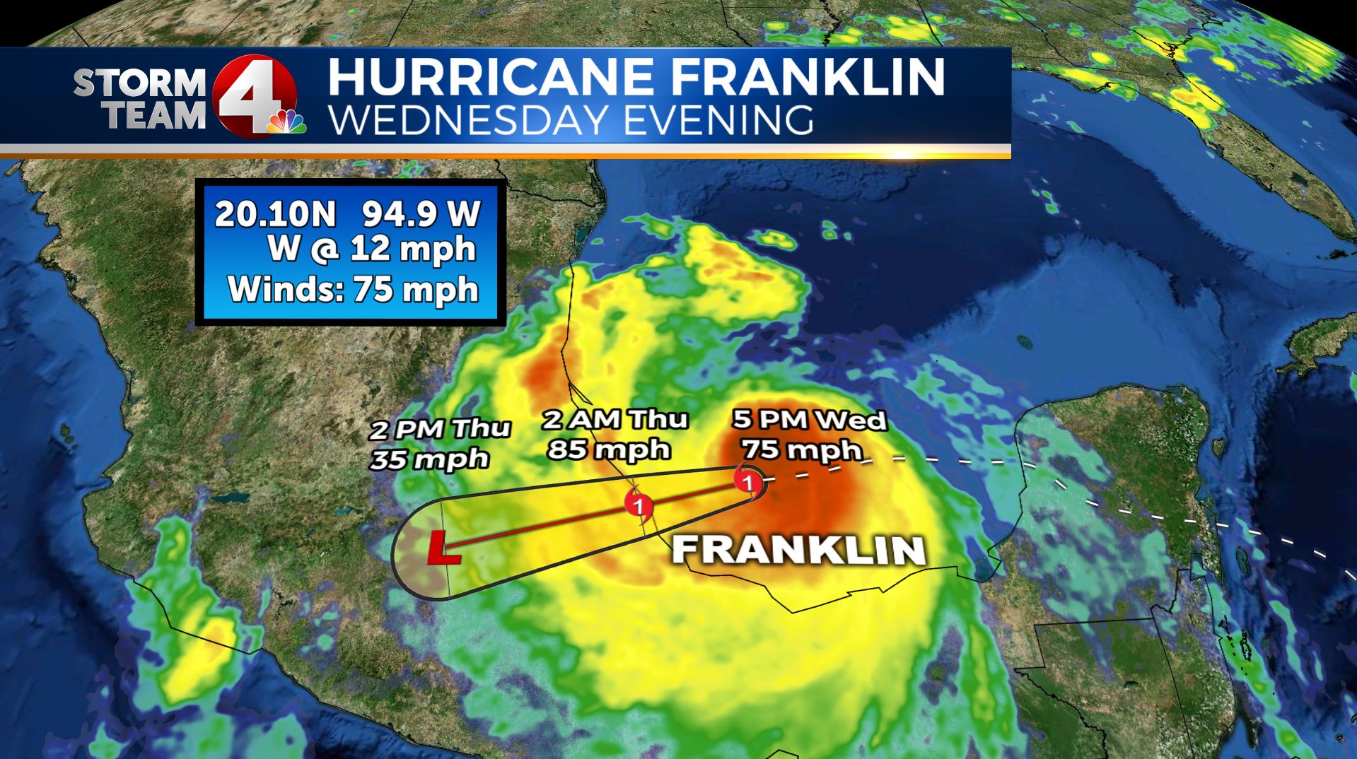
Columbus (WCMH) – As we are getting near the more active part of Hurricane Season, our friends to the south, in Central Mexico are bracing for a hurricane to make landfall.Hurricane Franklin is now a low end Category 1 strength storm:
Winds with Franklin are at 75 miles per hour, making him the first Hurricane of the Atlantic Hurricane Season, but likely not the last.
For the record, in 2016, Alex became our first hurricane on January 10th. This was highly unusual, as it was the first Atlantic Hurricane in January since 1955 (Hurricane Alice, which actually started in 1954 and continued into 1955).Right now, the National Hurricane Center is keeping an eye on two other systems in the Atlantic basin for development.
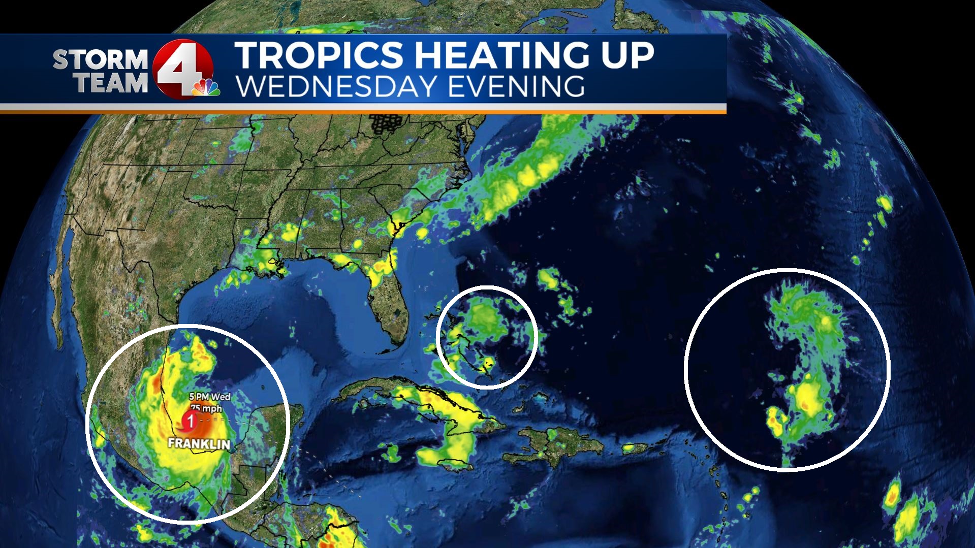
The first, and closer to the US mainland, it a trough near the Central/Northern Bahamas. They NHC has a low end chance of this developing in the next 48 hours (just 10%), and just a 10% chance of forming into a Tropical Storm in the next 5 days.
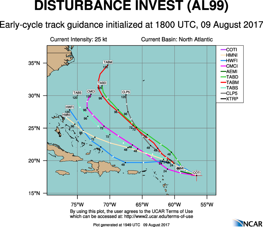
However, there is a low about 300 miles east of the Leeward Islands in the Atlantic they are watching as well. This has a low end chance of forming in the next 2 days, but about a 50/50 chance in the next 5 days.
In fact, about half the available guidance strengthens this low to a Tropical Storm (Gert) within 5 days. The good news if there is some about a tropical storm forming, is it appears it will curve north before threatening the US mainland.
(image/data below from NCAR)
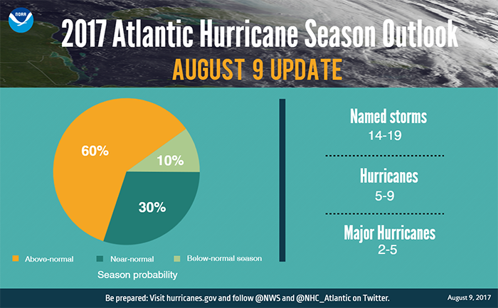
NOAA also upped their forecast a bit today, maybe the most active season since 2010:
- There is now a 60% chance of above normal activity
- 14-19 Tropical Storms are up from 11-17 in the May forecast
- 5-9 Hurricanes is unchanged
- 2-5 Major Hurricanes is slightly higher than the 2-4 forecast in May
If you ever have questions about Franklin, Gert, Tropical Storms, Hurricanes, tropical weather or any other weather, email me: dmazza@wcmh.com
-Dave


