Columbus (WCMH) – Rain, storms, and a cold (cool) front return to the forecast for Thursday. The front is currently sitting to the west/southwest of our area and will continue to lift northeast.
This means we will see scattered clouds tonight, and temps near record levels almost twenty degrees above normal in the mid-60s. Thursday will start off with more clouds west than east, but we will fill them in during the morning.
By mid-morning we could have some isolated showers to the west, and those will push east into the I-71 corridor by lunchtime on Thursday. It will be a breezy day on Thursday already, with south winds running 10-20 mph with higher gusts.
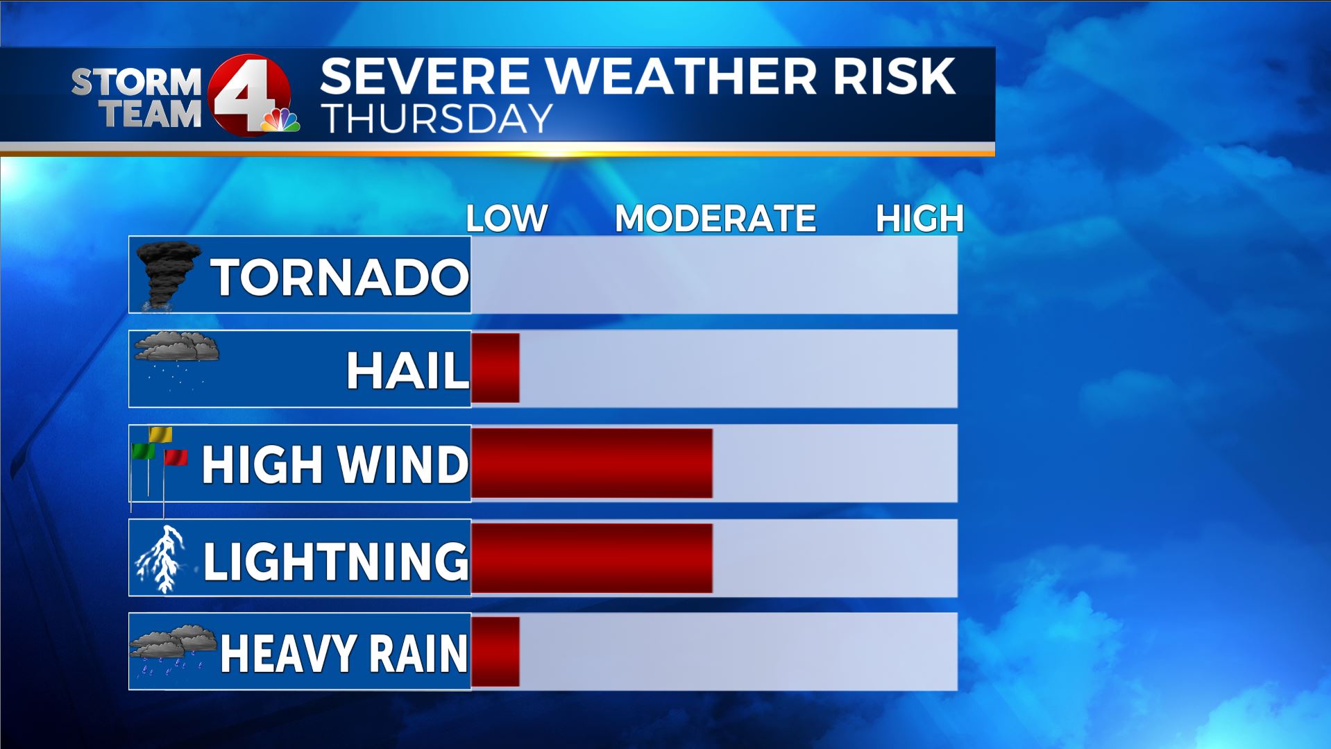
The main threats will be between late morning and late afternoon/early evening (east) for lightning and strong gusty winds with some of these storms, that is why we are under a “Marginal Risk” for severe storms on Thursday.
As of this evening, about 2/3rds of the storm reports have been gusty wind reports, the other 1/3 have been hail reports, but that has been mainly in the deep south.
Once this front pushes east we should see improving weather for the evening commute and overnight Thursday.
A wet weekend will return to the forecast, with a much stronger cold front returning for the start of next week, with the possibility of some below normal temps for a few days too!


