A potent storm traveling from the Central states to the western Great Lakes Saturday evening will push a warm front north through Ohio, accompanied by showers and a few embedded storms. The rain could be briefly heavy, especially across the southern counties.
Thunderstorms with strong winds could break out in the warm air east of the storm track. The highest threat of severe weather will extend from western Kentucky south to Louisiana (orange sector).
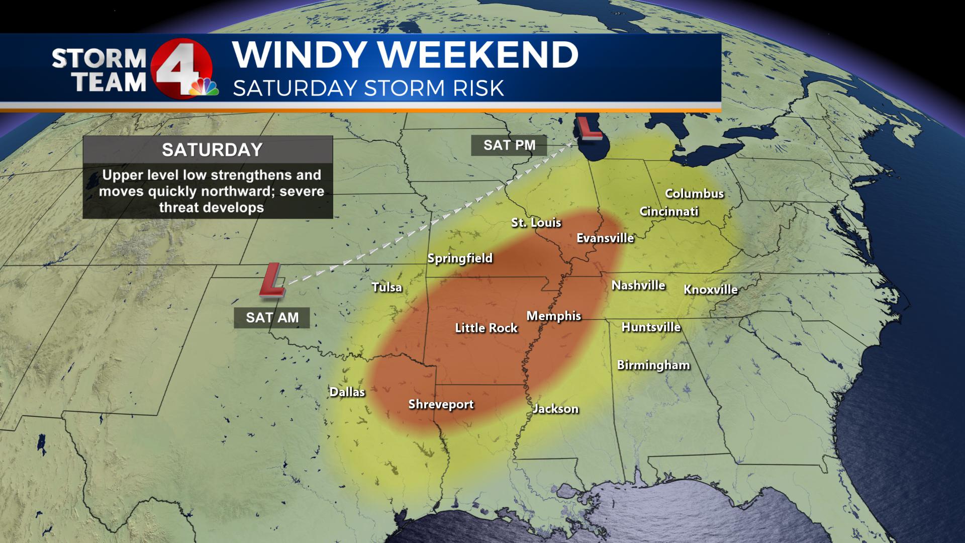
A cold front trailing the powerful low-pressure system will cross the state from the west Saturday night, ramping up any wind gusts that mix down with thunderstorms.
Now would be a good time to secure any backyard items before the wind threat increases. Tree branches could snap when winds exceed 40 mph, which could affect power on Sunday in some areas.
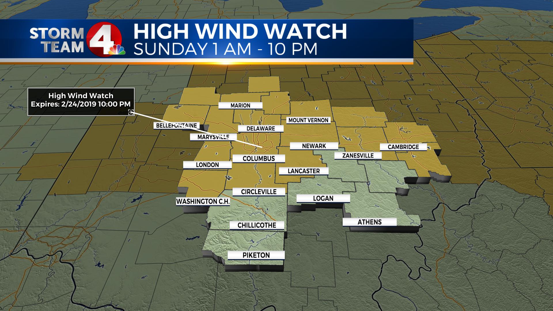
After midnight Saturday night, a high wind watch goes into effect for most of central and northern Ohio for sustained winds of 20-30 mph, and a few gusts in excess of 50 mph.
Strong low pressure will wind up over Lake Superior Sunday morning, drawing much colder air into the Ohio through the day, causing temperatures to fall from the low 50s Saturday to the upper 30s Sunday and Monday.
Snow showers will develop in the colder air Sunday, with little or no accumulation on warm, wet ground.


