A mixture of rain freezing rain, sleet and snow changed to a cold rain on Saturday as the temperature climbed into the mid-30s.
The moisture turned into a heavier snow Saturday from northwest to southeast, and accumulated 2-4 inches, accompanied by strong winds and falling temperatures.
Heavy rain in the southern counties could result in minor flooding, and a flash flood watch is in effect for Athens County and areas south and east through late tonight.
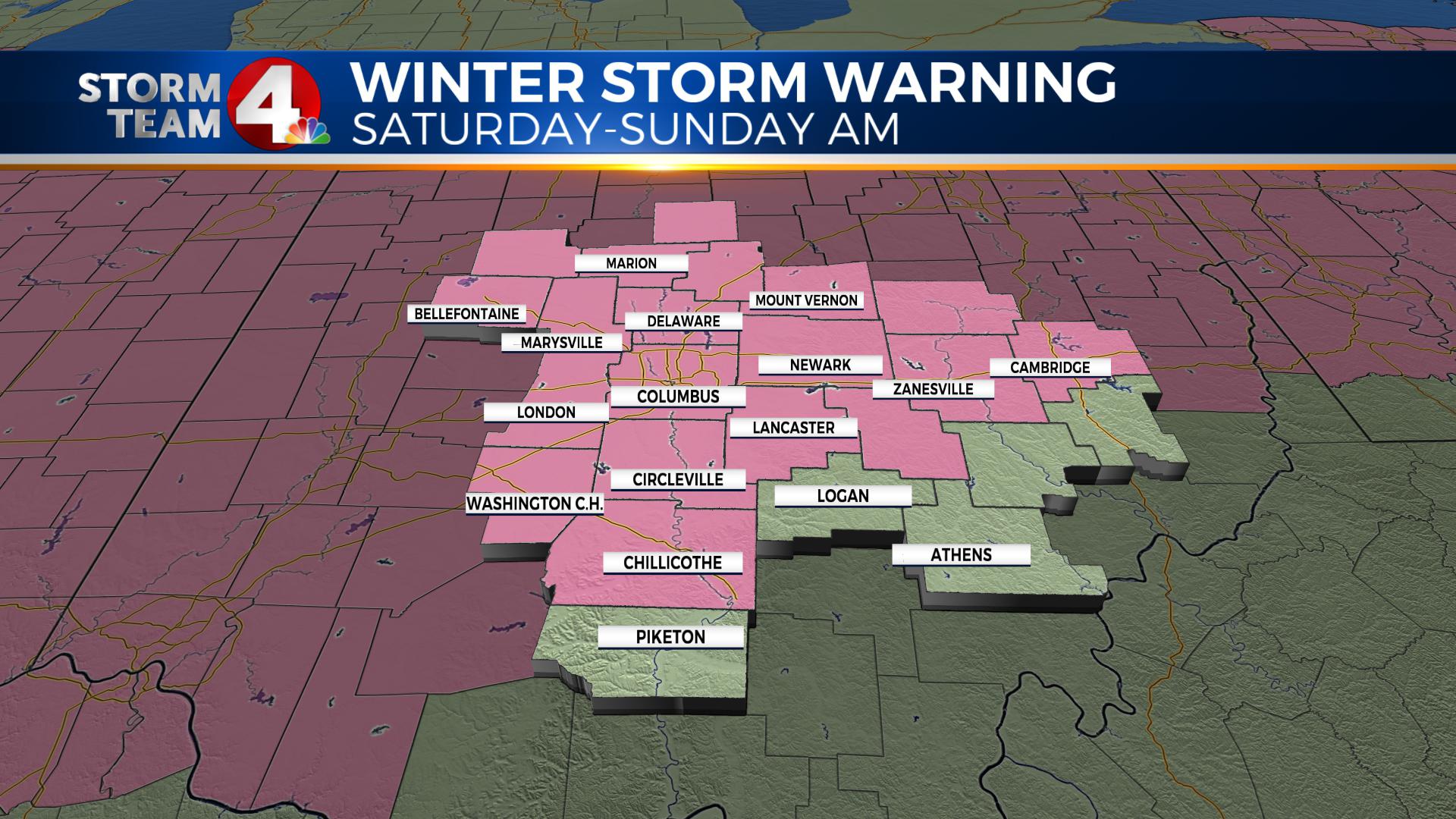

A potent winter storm will track northeast across Kentucky early tonight, bringing increasing wind and falling temperatures after sunset. Plunging temperatures will cause a rapid freeze and very icy travel, with poor visibility at times in blowing snow, before the storm moves east by early Sunday morning.