Columbus (WCMH) – It still is Summer for a few more weeks, and the Summer heat/humidity will fuel storms the next few days. Our rain chances will increase the next few days and stick around into the start of the weekend.
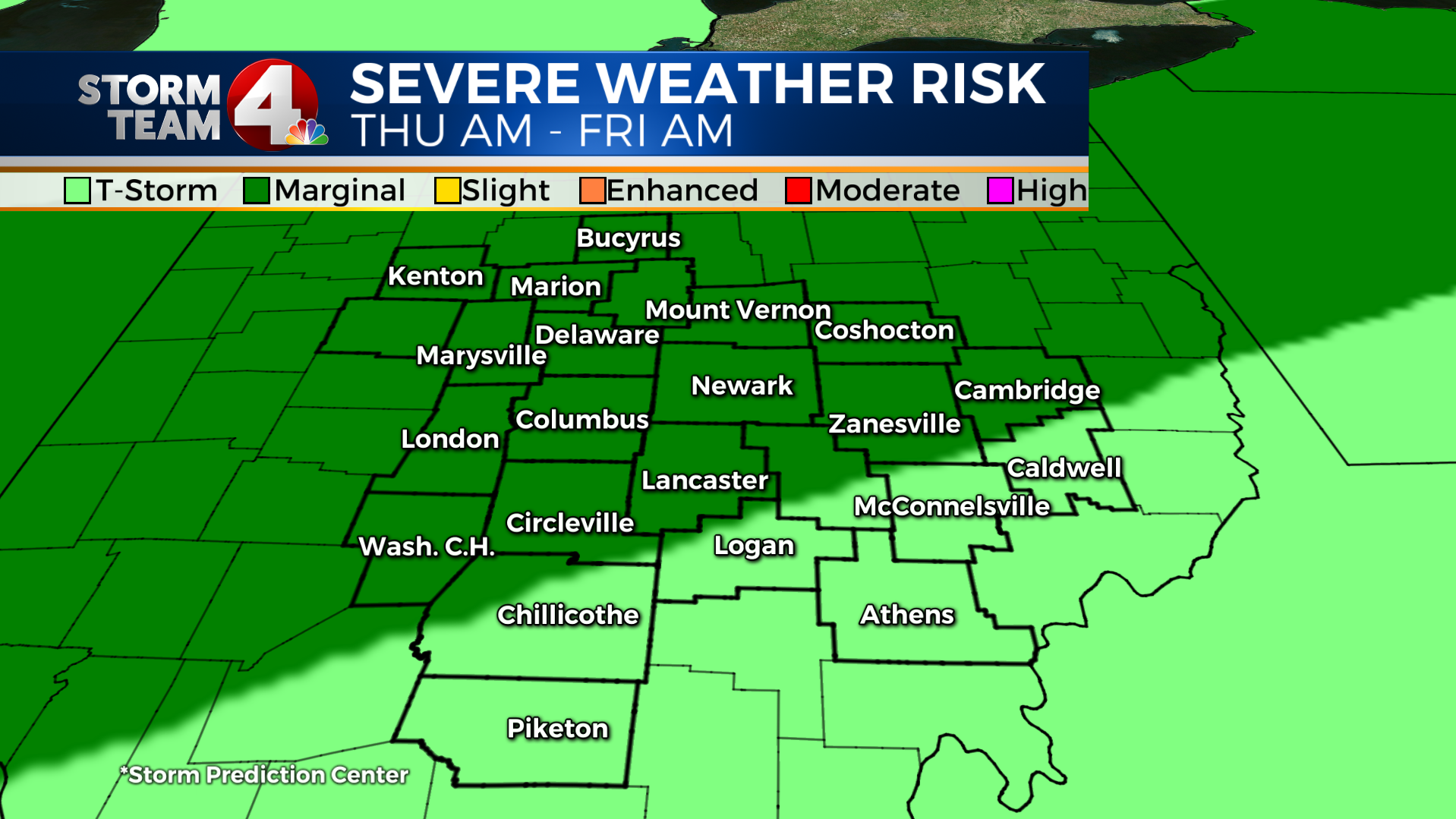
For Thursday the Storm Prediction Center has placed most of our area in the “Marginal Risk” for severe storms.
For our area the biggest risks will come down to the typical risks for us, Winds, Lightning, and Heavy Rainfall.
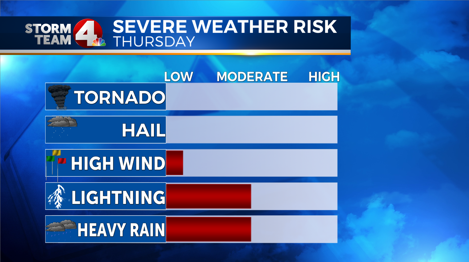
- I do not think there will be any threat of tornadoes with this system on Thursday.
- I think the hail risk will be nil too, as our atmosphere is quite warm, and should not pose a risk for hail
- It will be a breezy afternoon, and at times, some of these thunderstorms may produce stronger wind gusts
- The threat of strong wind gusts is the reason that the SPC has placed us in a “Marginal Risk”
- With our warm & muggy atmosphere, I think there will be a fair amount of lightning with these storms, which is always a threat in storms
- also, our very muggy atmosphere, and the slow movement of these storms, brief periods of heavy rainfall is possible with some of these t-storms.
If you ever have questions about storms, severe storms, or any other type of general weather questions, send them my way: dmazza@wcmh.com