COLUMBUS (WCMH)-The loss of Arctic sea ice tied on September 10 tied for the second lowest extent of ice coverage (1.6 million square miles) since satellite records commenced in 1979, according to the National Snow and Ice Data center. (The least amount of ice was observed in September 2012-1.32 million square miles).
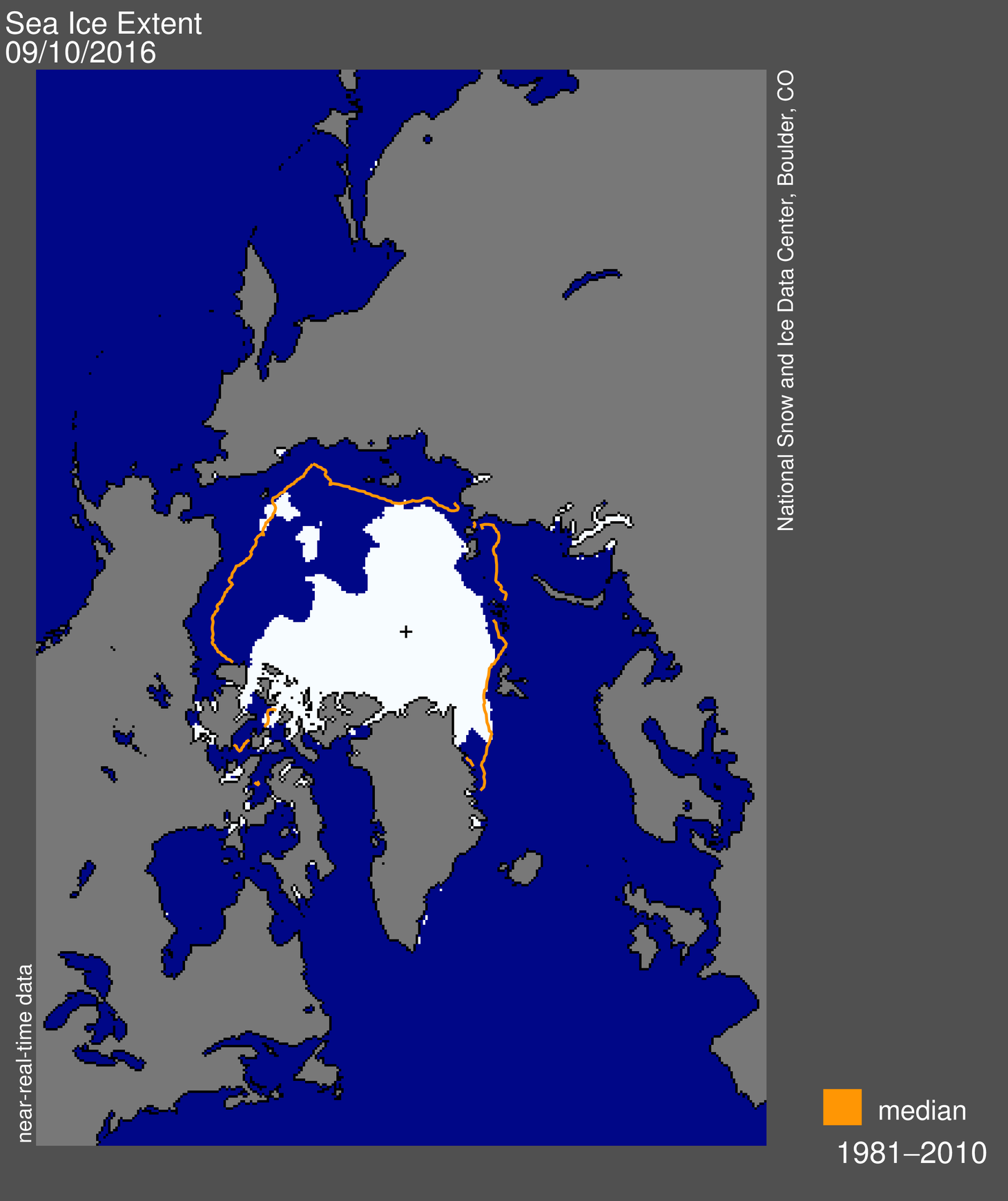
The passage of two strong low-pressure areas may have both churned up warm water and compressed the ice, accounting for some of the recent decrease in floating ice. Extremely warm weather prevailed along the coast of Siberia (16 degrees F above normal) in early September under high pressure, which also increased the central Arctic winds.
The summer weather over the Arctic was generally cloudy and cool, which otherwise would not favor such a significant melting. However, at the end of winter, Arctic sea ice was already at a record low maximum. Summer upper seawater temperatures were also rather warm, contributing the second near-record extent of ice.
At the same time, we start looking at early indicators regarding what the upcoming winter (2016-17) might be like, starting with the end of a record-tying El Nino in the eastern tropical Pacific, which brought the fourth warmest winter in Ohio weather records, going back more than a century, and less than 20 inches of snow in central Ohio.
A neutral Pacific sea surface temperature pattern, rather than a flip to a cooler La Nina, is most likely now, based on NASA data. The history of such changes from anomalous warmth to average favors a moderately cold early to mid-winter period, with near-normal snowfall (27 inches for Columbus). The winter analogs for similar transitions from a strong El Nino to a neutral sea surface temperature pattern occurred in the following winters of 1958-59-58, 1966-67 and 1983-84.)
Either way, this will be a sharp departure from last winter’s relatively balmy conditions.