COLUMBUS (WCMH) — A Flash Flood Watch continues through Saturday 2 a.m. for central and southern Ohio. A Flash Flood Warning is already in place for areas north of Columbus, including Delaware, Union, Hardin, Marion and Morrow counties.
What to expect:
The remnants of Tropical Storm Cindy and a swath of tropical moisture has worked its way into Ohio, colliding with a cold front moving through Ohio Friday to generate rain and storms with heavy downpours, causing localized flooding and considerable ponding on roadways through the afternoon and evening hours. Expect poor visibility at times through the day in tropical downpours.
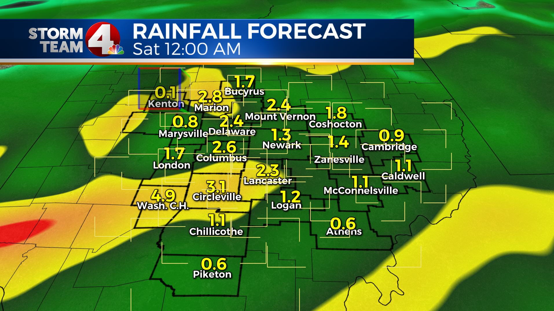
The storm interacting with the frontal boundary will drop at least 2-4 inches of rain on the region, based on our rainfall model, and locally heavier totals could occur with stronger storms moving slowly through the region. There is also the threat of damaging wind gusts with severe cells closer to the path of the circulation center over Kentucky this evening, primarily a risk for far southern Ohio, with a slight risk of an isolated tornado.
The rain will be slow to exit the region, hanging on through midnight, before ending from northwest to southeast overnight. Drier air will bring much better conditions for the weekend, with lower humidity as the remains of Cindy move off the Mid-Atlantic coast.
Bottom line:
Keep your Storm Team 4 Weather App handy the next 12-18 hours, and remember: “Turn Around Don’t Drown!” Statistics bear out that flash flooding was the number one killer in the United States in 2016, often caused by vehicles traveling through a moving current. As little as two feet of flowing water can sweep a car downstream.


