COLUMBUS (WCMH) — Tropical Cyclone #3 strengthened to become Tropical Storm Cindy early Tuesday afternoon.
The system is currently stalled over the northern Gulf of Mexico, but it will pick up a little more speed Wednesday as it heads toward the southwestern Louisiana coast. Cindy is forecast to make landfall Thursday over western Louisiana and eastern Texas.
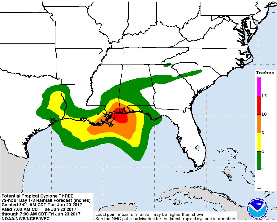
The main threat with this storm is flooding, with up to a foot of rain possible over southeastern Louisiana, southern Mississippi, southern Alabama and the Florida panhandle. Up to six inches of rain is possible over southwestern Louisiana and southeast Texas through Thursday.
Cindy will weaken as it moves north over land late Thursday through Friday. The remnant area of low pressure will then take a hard right over the lower Mississippi Valley as it gets pushed by an approaching cold front.
The tropical moisture will then head towards the Ohio Valley and Appalachians. During this phase, it will help create a strip of heavy rain over portions of Kentucky and West Virginia. At this point, the higher rain totals look to stay south of us here in central Ohio, but it’s something we’ll be watching closely for any shifts in the track.
Either way, with a cold front moving in along with some tropical moisture, the chance of showers and storms will increase for us Friday through at least early Saturday.


