Columbus (WCMH) – Atlantic Hurricane Season is nearing its peak (September 10th) and it sure is playing out like it is supposed to.
Three storms currently reside in the Atlantic Basin, only one at this point has a name, Gaston. There are two more storms, TD 8 & TD 9 racing to form into either Hermine or Ian.
Here is the latest forecast tracks and the spaghetti forecast plots for the storms from the Monday evening forecast. To note, if you have Labor Day weekend plans in the northern part of Florida, or along the Southeast US coast, you might have a rain out ahead.
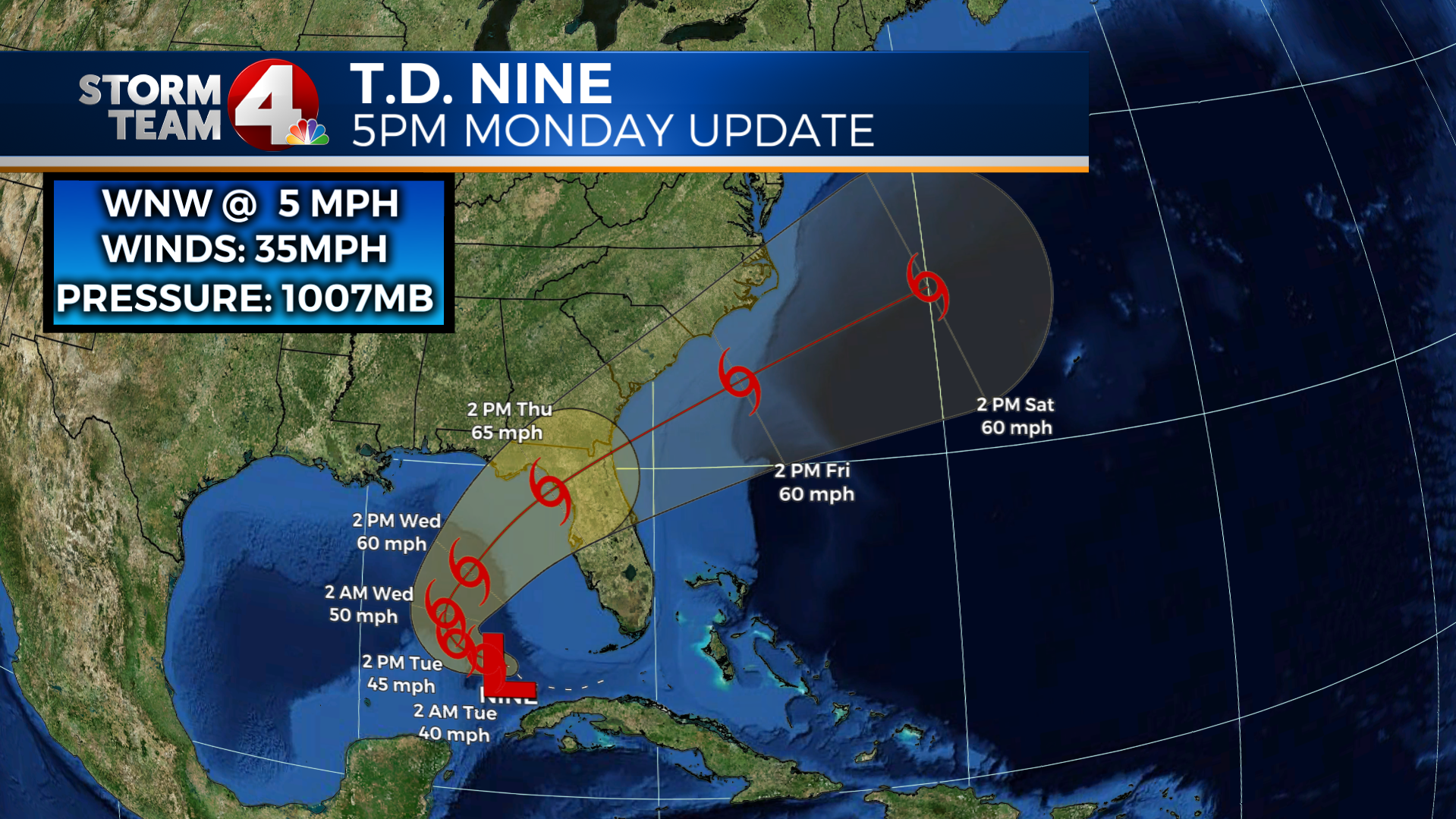
(Below, forecast plot for TD 9, near Cuba)
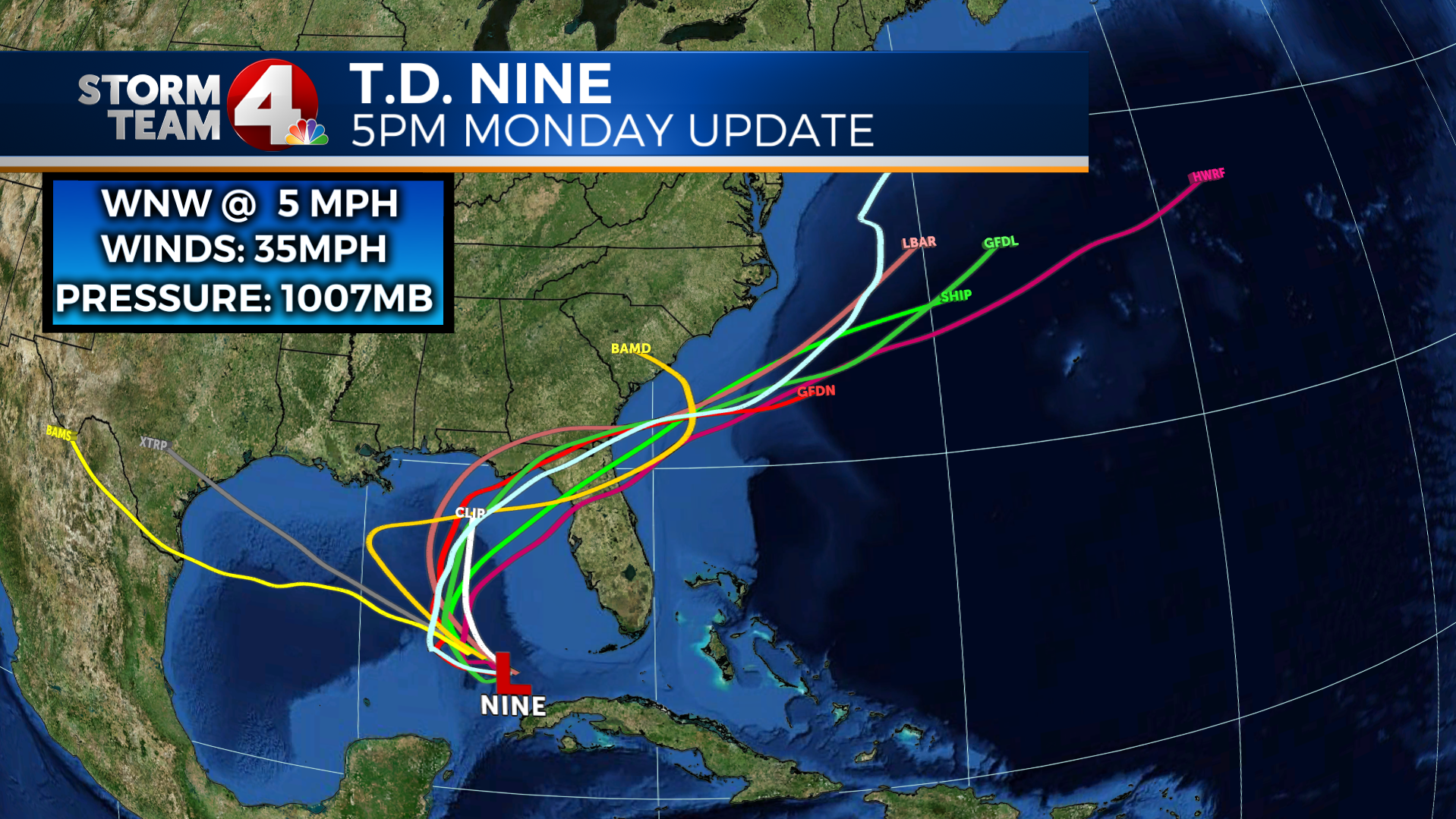
(Below forecast plots for TD 9, grey line is current movement at forecast time)
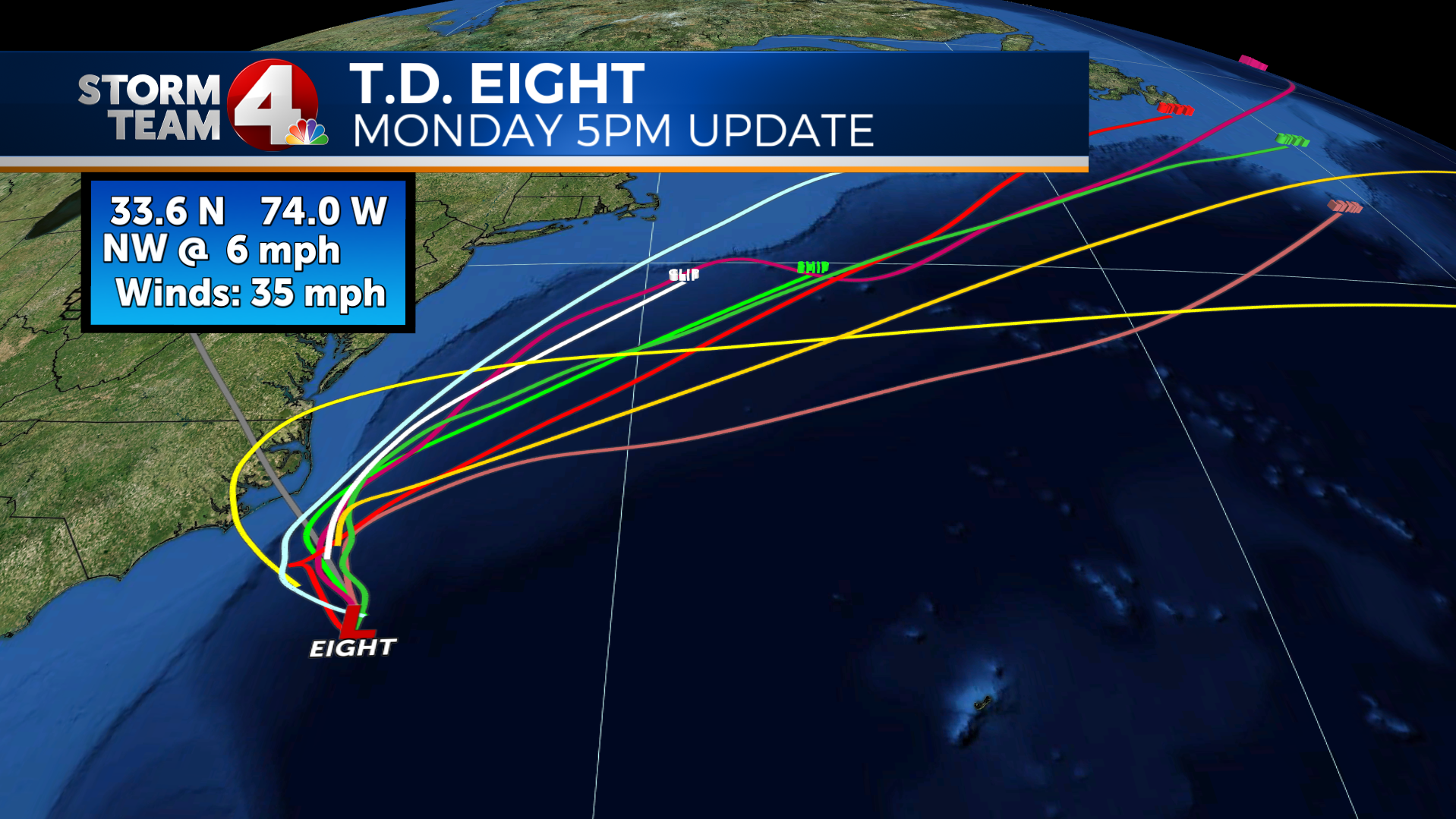
(Below, forecast plot for TD Eight, off Carolina(s) coast)
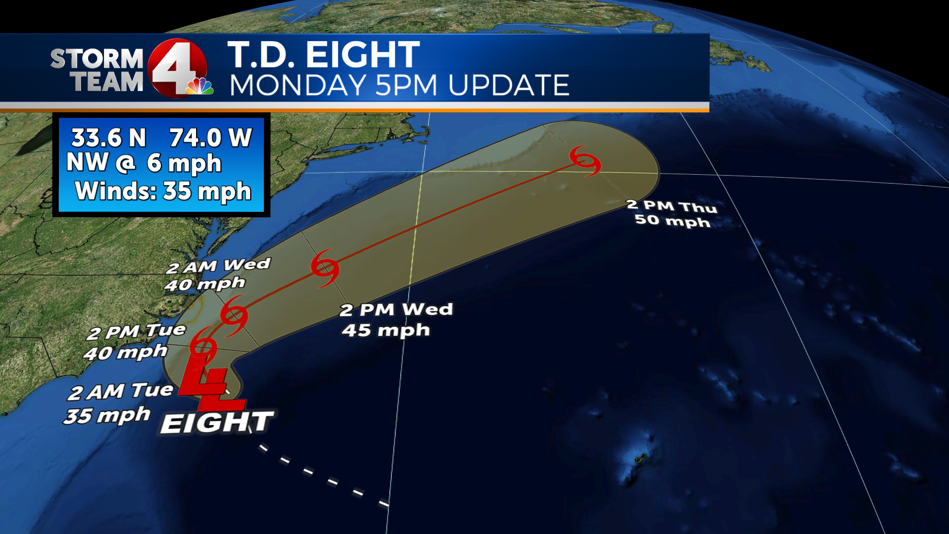
(Below, forecast plots for TD Eight, grey line that heads inland is the current movement for reference)
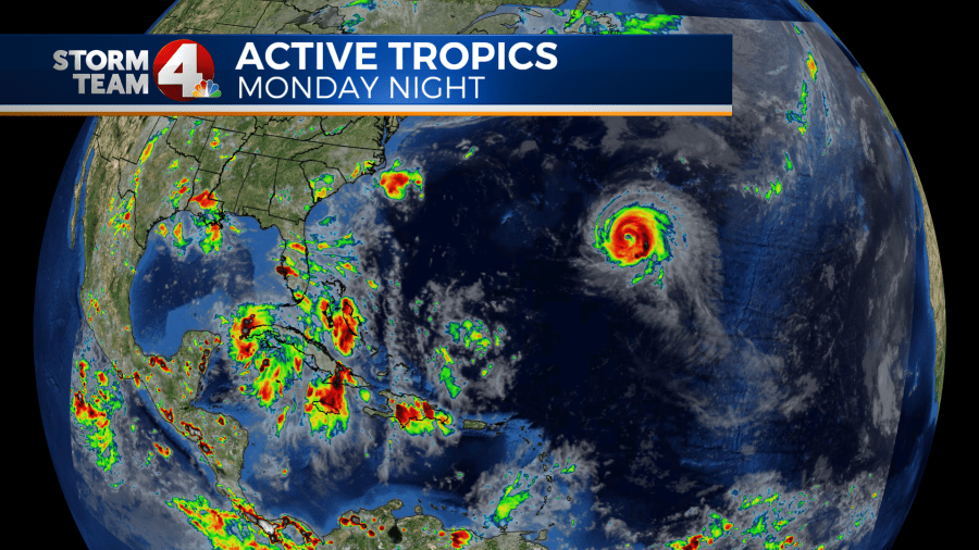
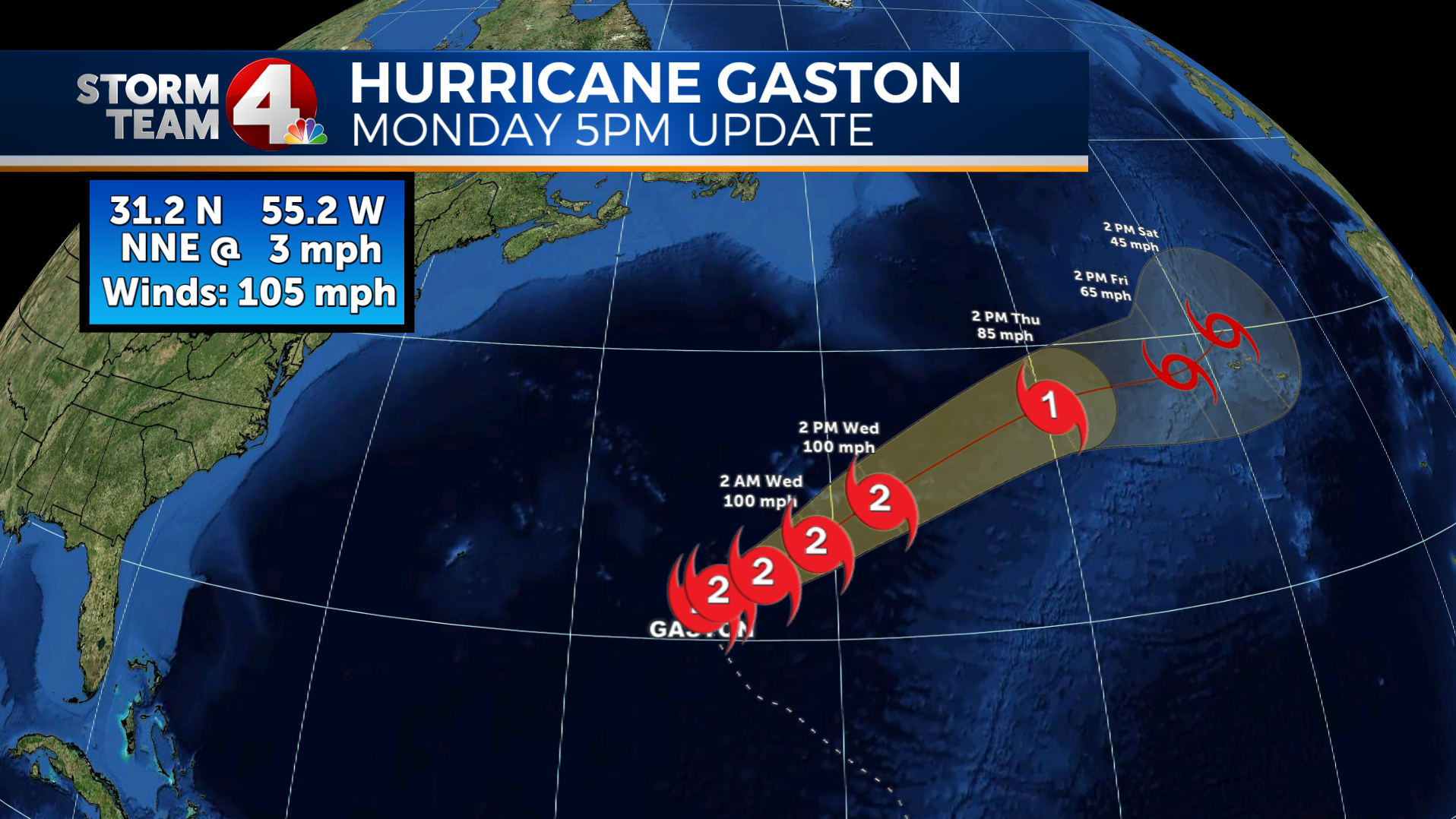
(below, forecast plot for Cat 2 Hurricane Gaston)
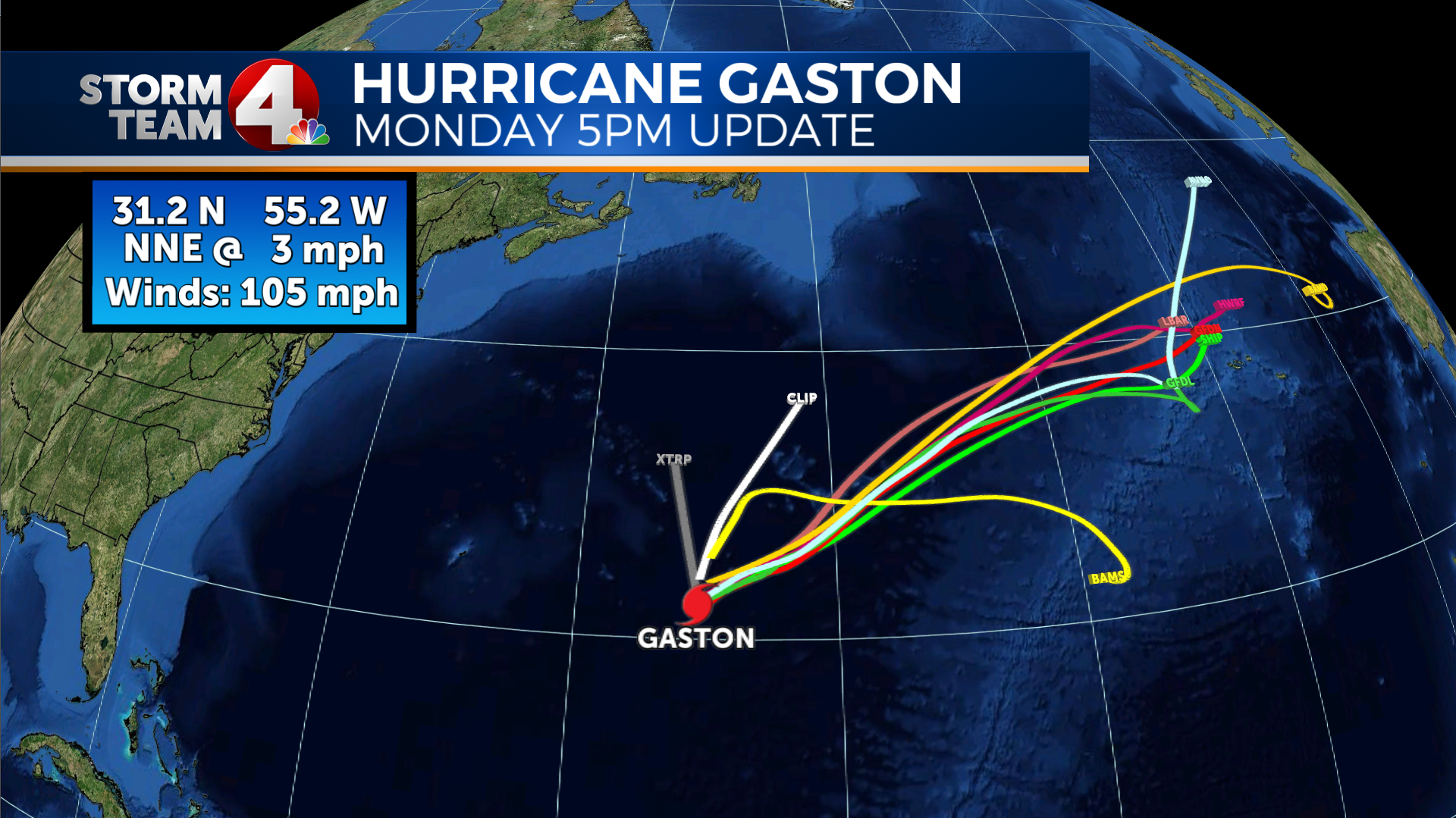
(Below, forecast plot for Gaston, storm heads toward Azores by the weekend)
If you have any questions about the tropics or any other weather, shoot them my way, dmazza@wcmh.com