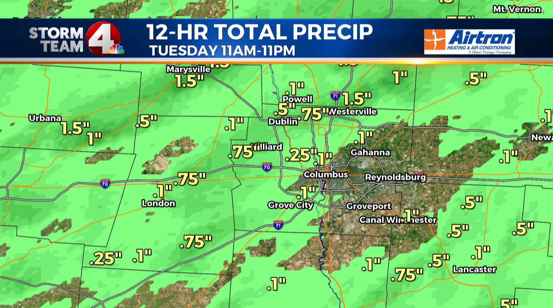
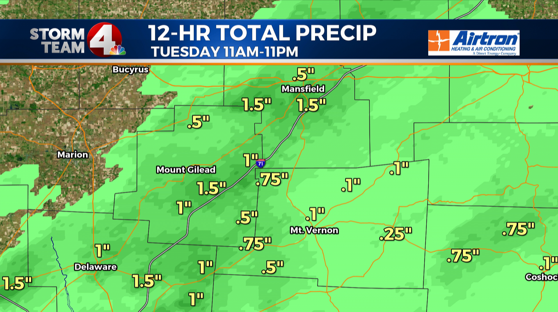
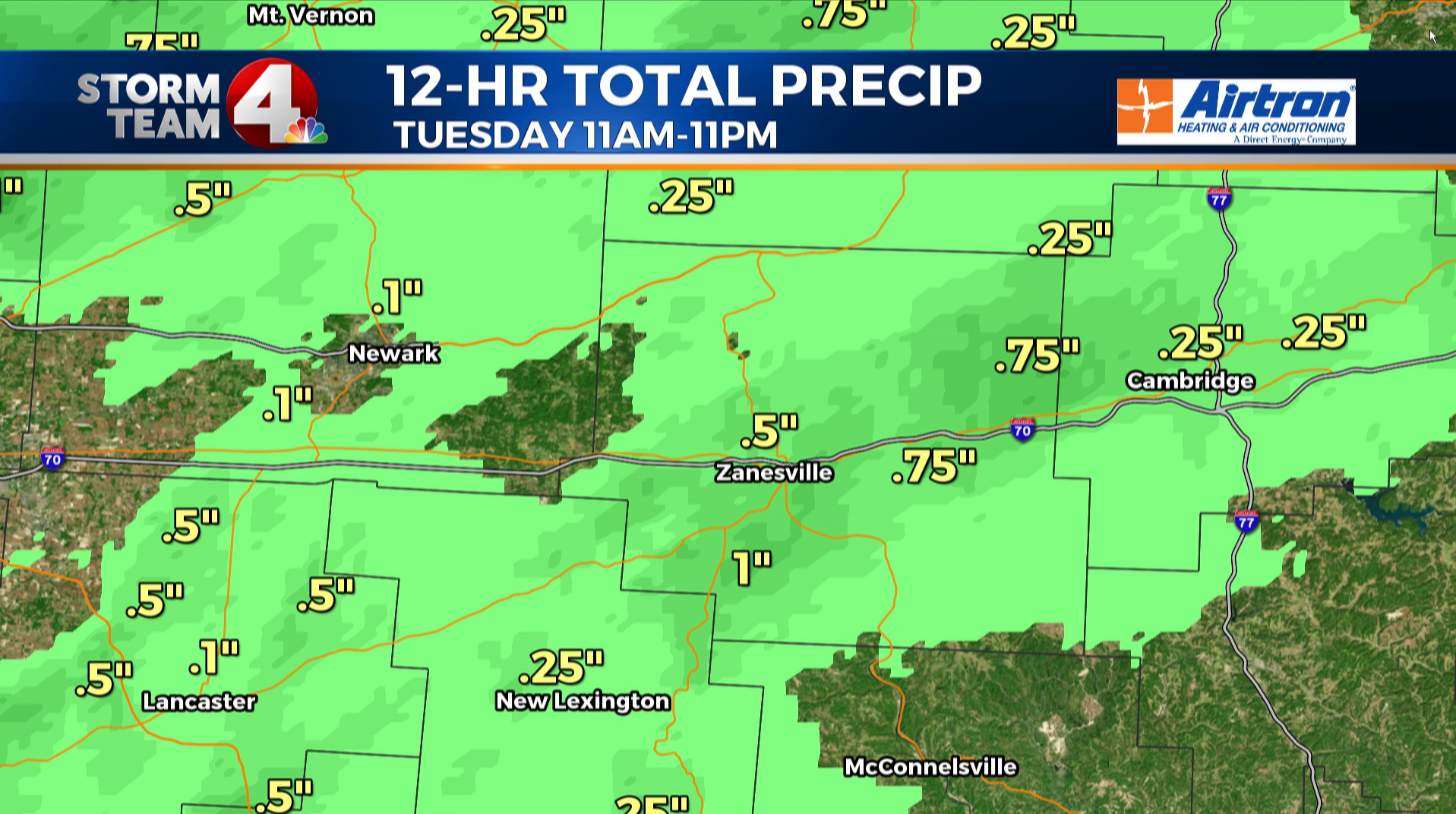
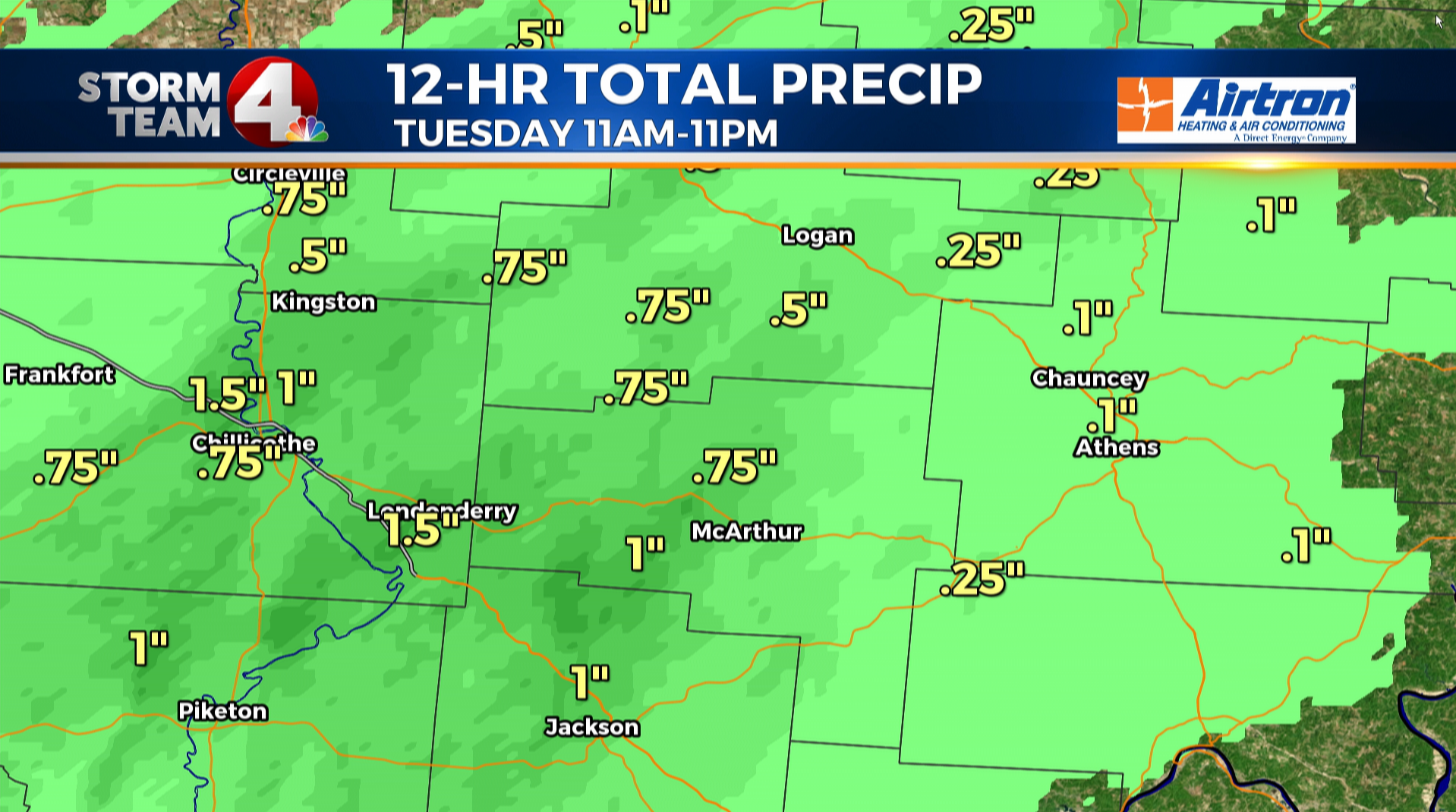
COLUMBUS (WCMH) – Round one of rainfall hit Central Ohio Tuesday late afternoon & evening. It was a welcome site for many people as rainfall is very very needed. In Columbus we are more than 3.76″ below normal for the year in the rainfall bucket.
Tuesday provided a nice preview, or sneak peek for what lies ahead for the rest of the week and into the weekend ahead. Our weather pattern over Ohio does not offer any major changes in the next few days, so we will continue to pump copious amounts of moisture into our area, and then just wait for heating to bubble up rain & storms.
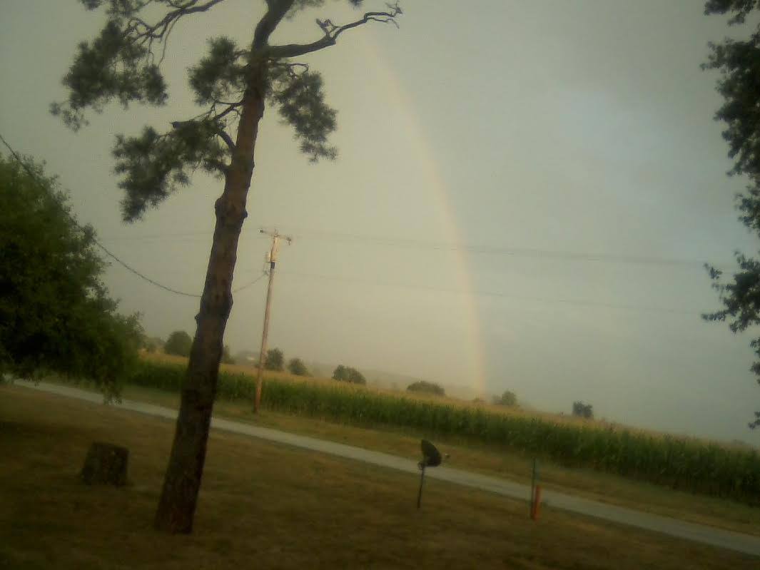
Tuesday it provided some folks with great rainfall and some clearly awesome photos as well.
First lets look at the radar estimates for rainfall in our area for the afternoon period until 11pm Tuesday: spectacular
(Below: Metro)
(Below: North)
(Below: East)
(Below: South)
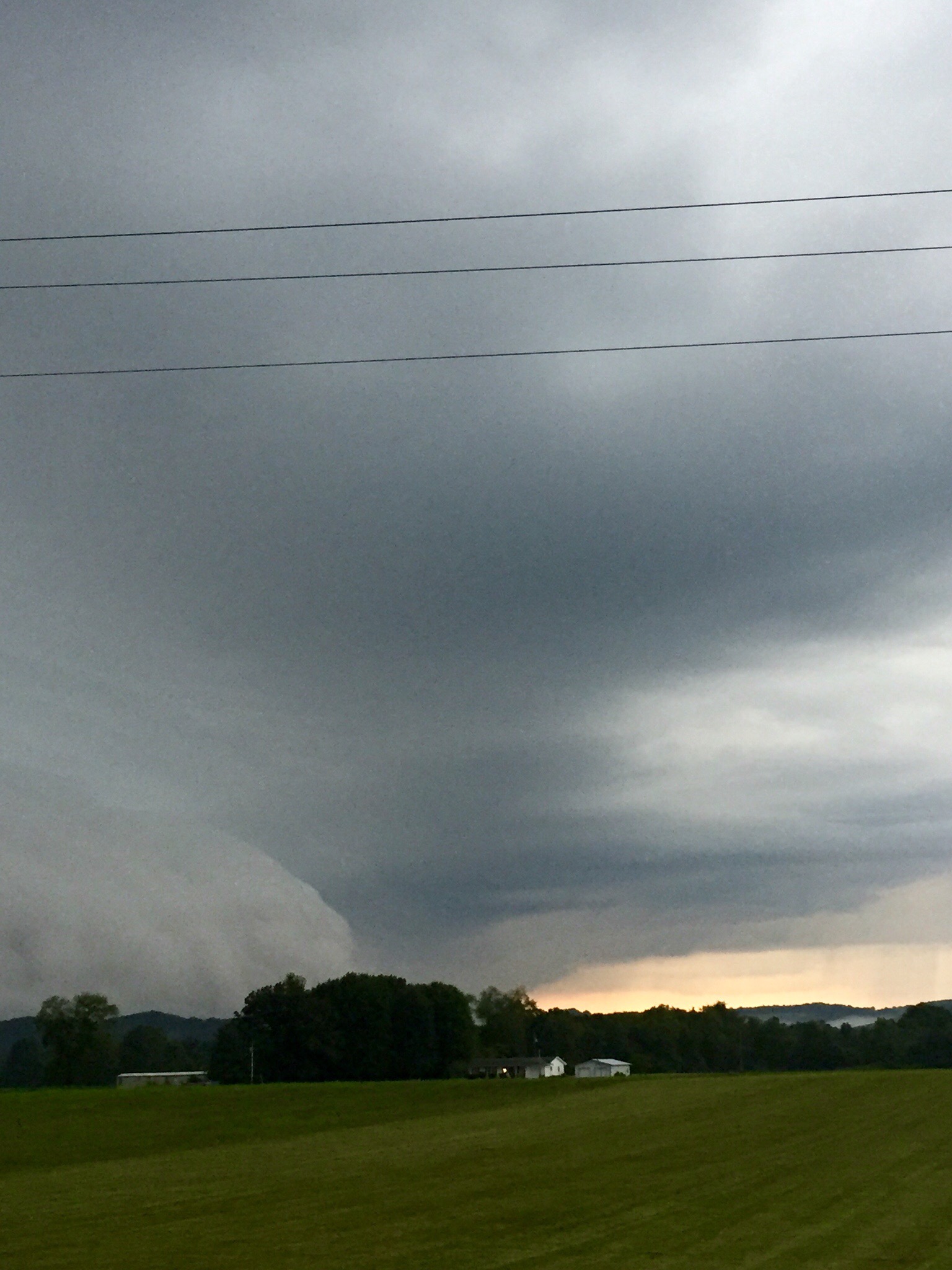
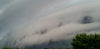
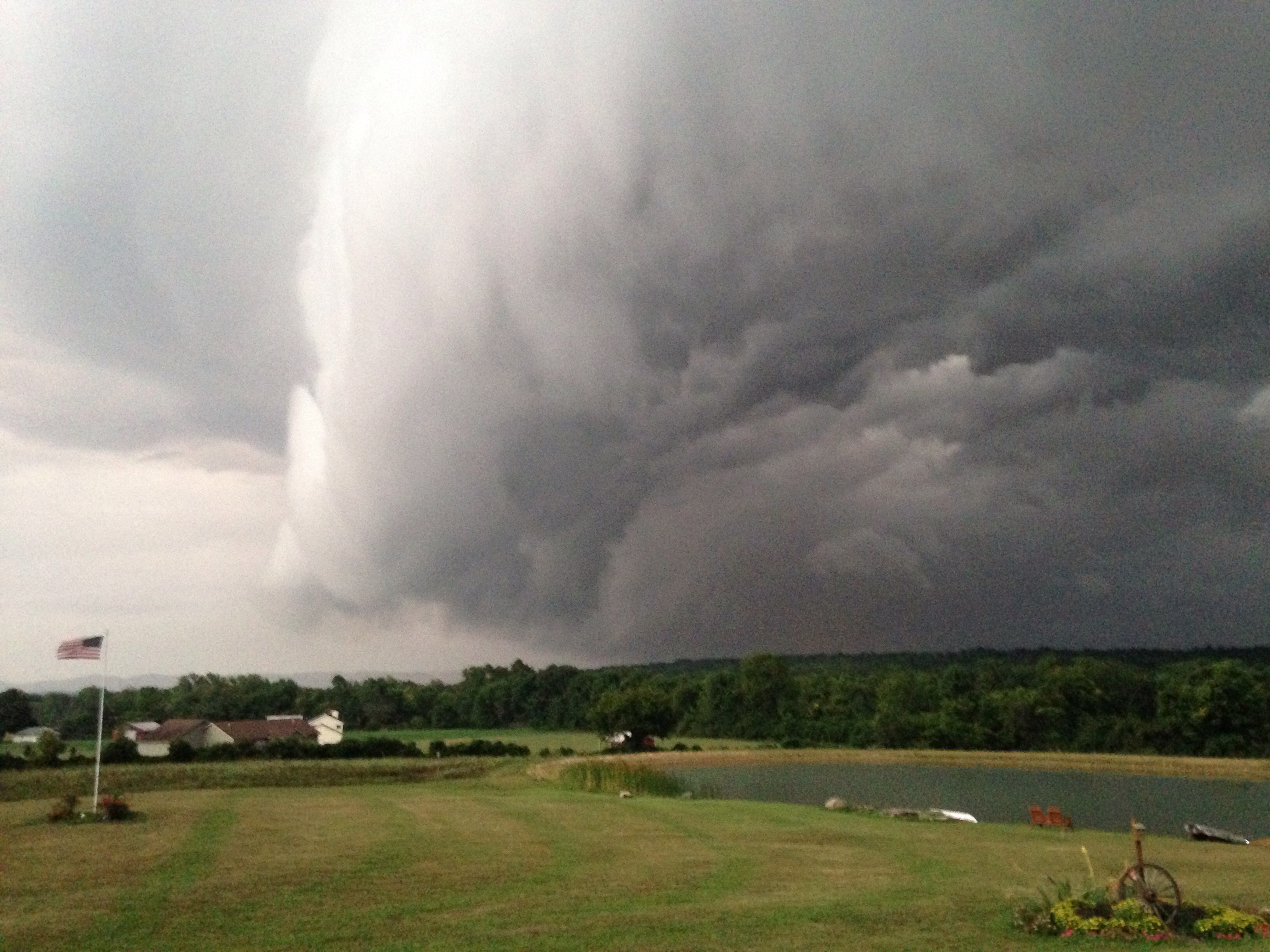
The storms also provided for some awesome looking pictures too! We always encourage you all to SAFELY snap and share pictures.
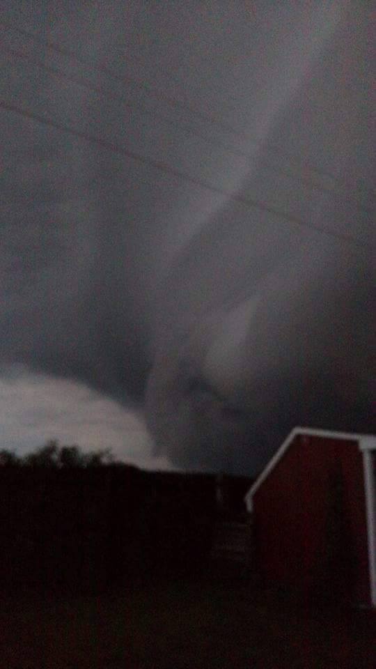
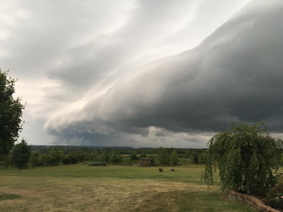
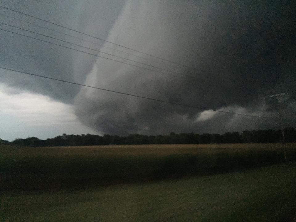
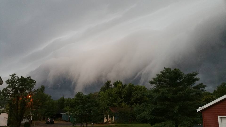
We had a ton of great pictures from the storms & rain tonight, and the bulk of the most scary looking storms came from the south.
Remember, the easiest way to share pictures with us is via our Storm Team 4 Weather app (submit content feature). You can always drop images on my social media pages (use #stormteam4)
And you can always go old school and email us share@nbc4i.com
As always, a major thank you to everyone who sent in these great pictures!
(Below: Candy Chattin – Waverly)
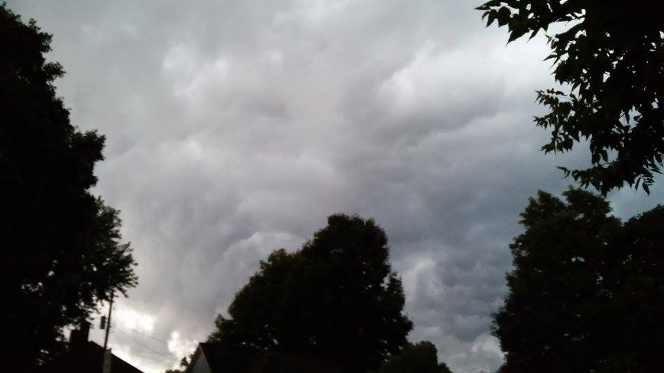
(Below: Jacqueline Hinty)
(Below: Kay Sims)
(Below: Nikki Kettle – Circleville)
(Below – Pamela Hudnell – Bainbridge)
(Below: Phoebe McKell – Chillicothe)
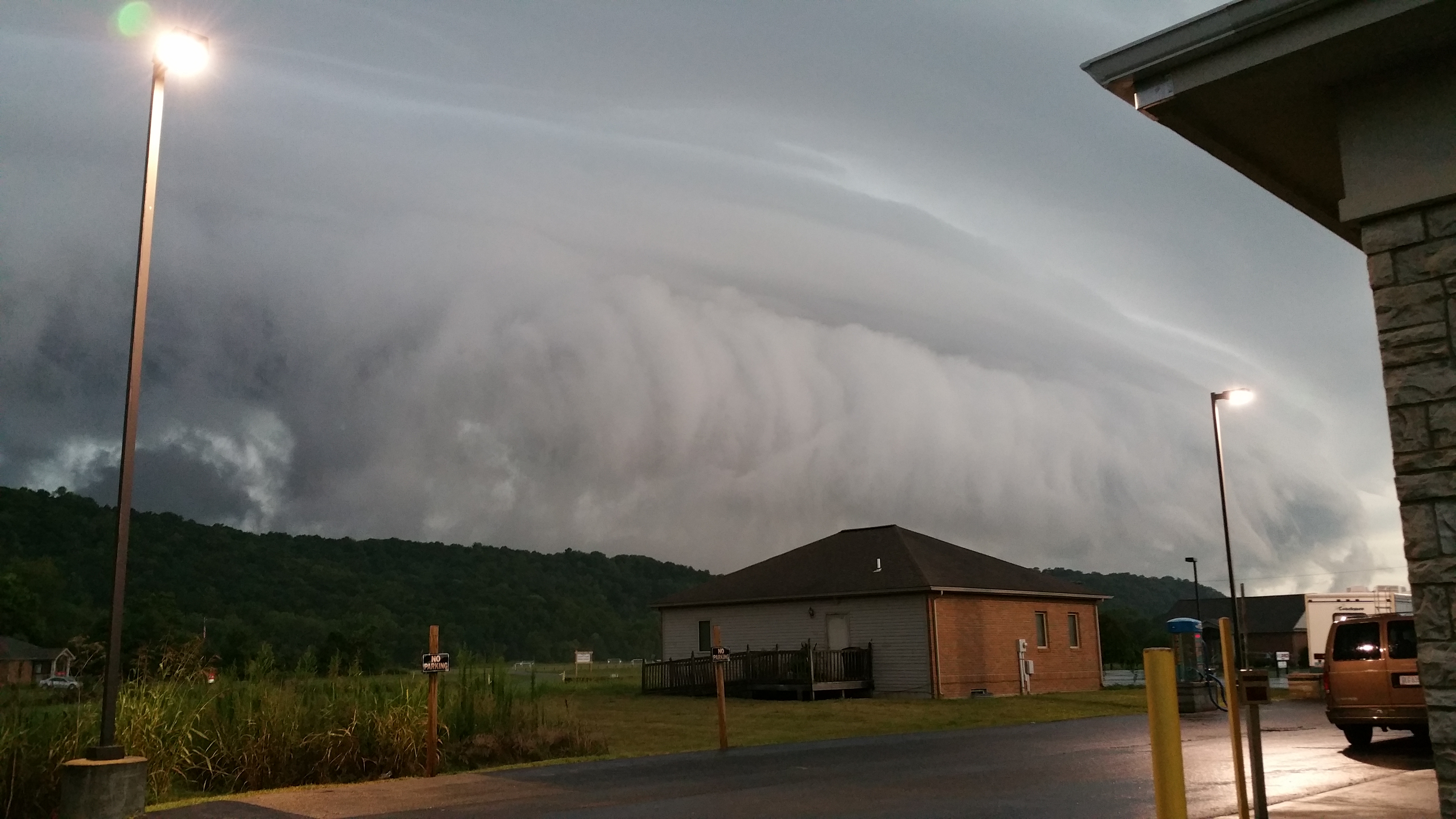
(Below: Roger Lucas – Ross County Fair)
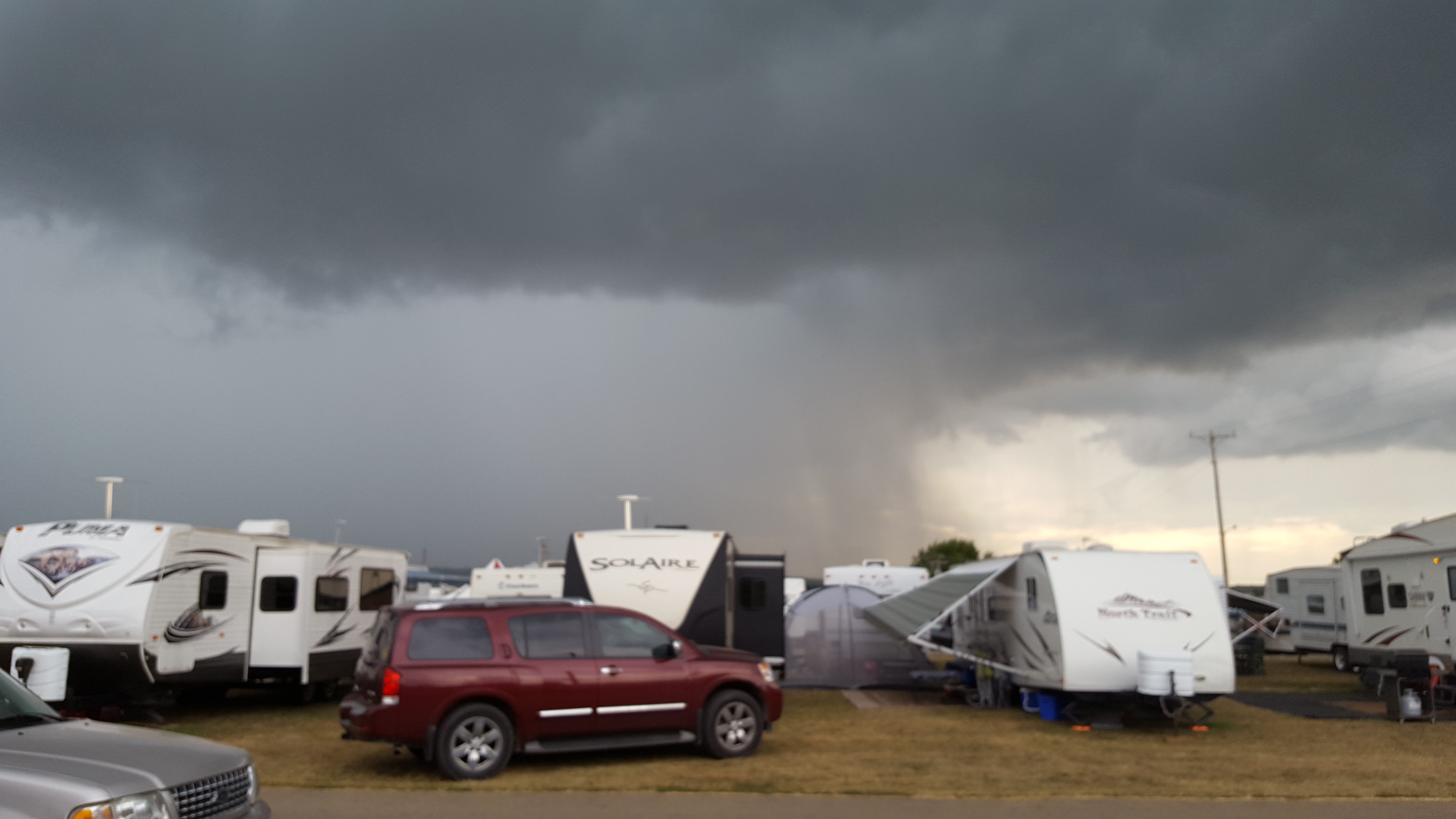
(Below: Sarah Beth Martin – Circleville)

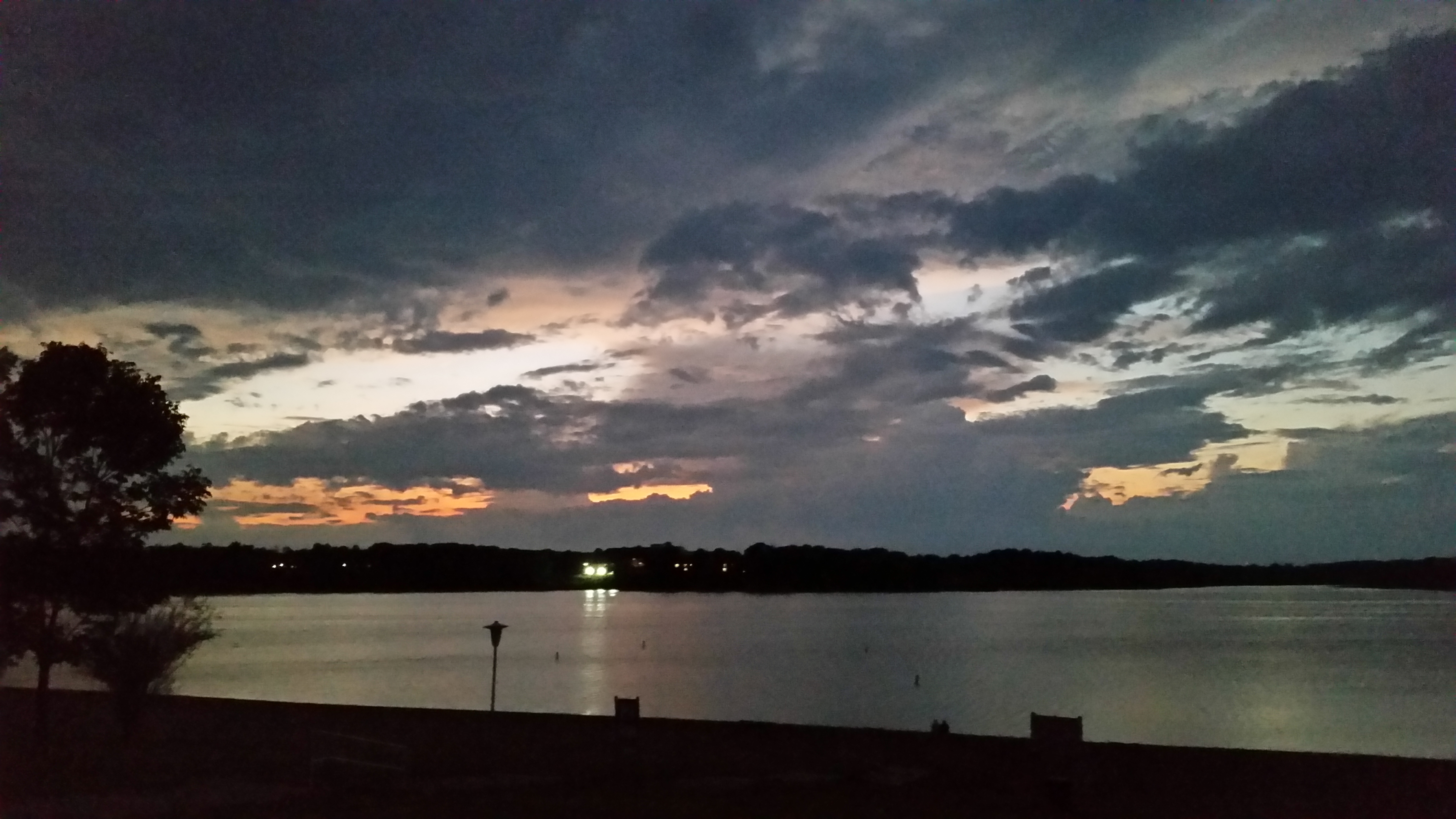
(Below: James Nicholson – Deer Creek Lake Sunset)
(Below: Kimberly Clark – Frankfort)
(Below: Lindsay Frazier Archibal – Ross County)
(Below: Lindsay Ottens – Chillicothe)
(Below: Russ Feinberg – Upper Arlington)

(Below: Shah Douglas – Hancock County)