Columbus (WCMH) – What a difference a week makes!!! Very wet, persistent rainy weather has greatly improved our drought conditions across the state in just 7 days.
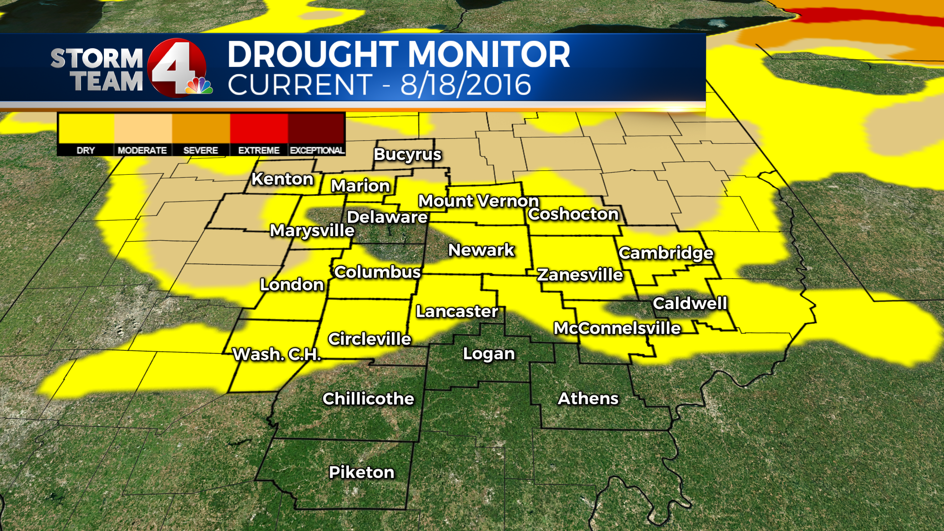
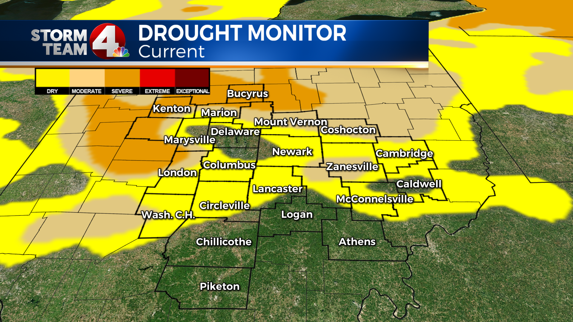
In fact, we had almost 15% of the state under a “Severe Drought” last week, now that number stands at 0%
Here are the other changes:
- Moderate drought down from 46% (last week) to 26% (this week)
- Areas that are Abnormally dry or worse, 74% (last week) to 70% (this week)
- Areas not considered dry, 26% (last week), up to 31% this week
Here is a big part of what helped… this is the Storm Total Rainfall Estimate from the National Weather Service in Wilmington, Ohio.
This radar image starts with rainfall last Saturday morning at 9am, ending Wednesday night around 11pm.
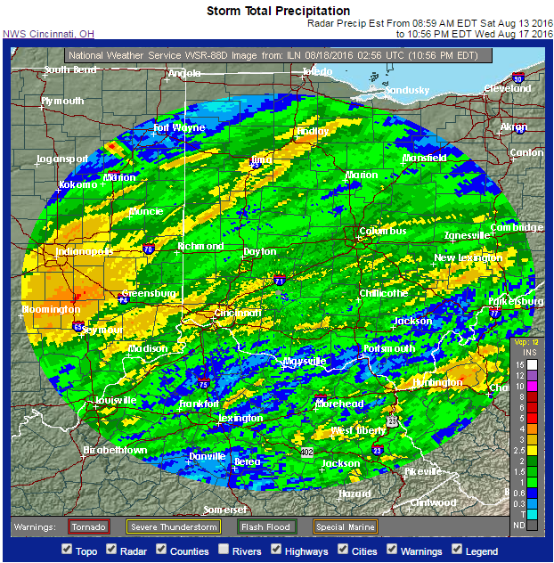
You notice almost the entire area received at least 1″ (green) or rain, with much of the area putting 2″ (dark green-yellow) or more in the buckets.
In fact some parts of the state even put 3-4″ or more in the rain buckets since last weekend.
This has greatly improved our drought status in Ohio too!
– This week all areas of “Severe Drought” have been removed in the state
– This week, “Moderate Drought” has been removed in Coshocton, Hardin, Logan, Knox, Madison, Marion, Morrow, Muskingum, Perry, and Union Counties.
Below is our most recent drought monitor
Below is the drought monitor from LAST WEEK (Thursday, 8/11/2016)
For the record, at Columbus, we are a little more than 1″ above normal for rainfall this month, even for rainfall since June 1st, and about 1.75″ below normal for the year.
-Dave


