Columbus (WCMH) – What a difference a week makes. Last week we had lows of 69, 63, 59, 61, 61, 64, 61, and 65 to start this week.
Tonight, we have lows in the 40s and wind chills that could bottom in the upper 30s! Seems shocking, but not at all rare.
Normally, the low temperature this time of the year should be around 52, so upper 40s is below normal. Compared to last week, when lows were 8-15 degrees above normal, we will only be about 4-8 below normal tonight.
For note, the record low is 36 tonight, we shouldn’t even have a wind chill value that low.
Lows in the low to mid 40s (upper 40s in the city), plus a 4-8 mph wind in most spots, except the east/southeast = brrrrr!!!!
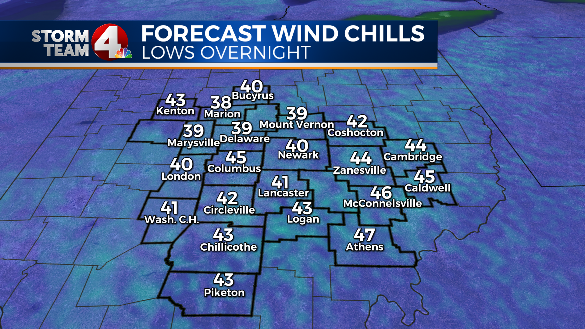
Again, not record cold, but it will require a jacket in the morning. As temps warm up tomorrow, the winds will also pick up and become gusty on Tuesday.If you ever felt like you wish you could calculate wind chills on your own, here is the formula:
Wind Chill = 35.74 + 0.6215T – 35.75(W^0.16) + 0.4275T(W^0.16)
T= Temperature in F, W= Wind Speed in mph
If you have any questions about temperature, wind chills, or any other weather question, send it my way, dmazza@wcmh.com
-Dave


