COLUMBUS (WCMH) – The latest Drought Monitor came out Thursday morning, and as expected, conditions are worse in Ohio than a week ago. Well needed rain this week could put an end to this slide though.
For reference, the majority of our rainfall this week has not been included in this latest drought monitor. The Monitor is measured through Tuesday morning, and then released on Thursday morning.
Below is the latest drought monitor:
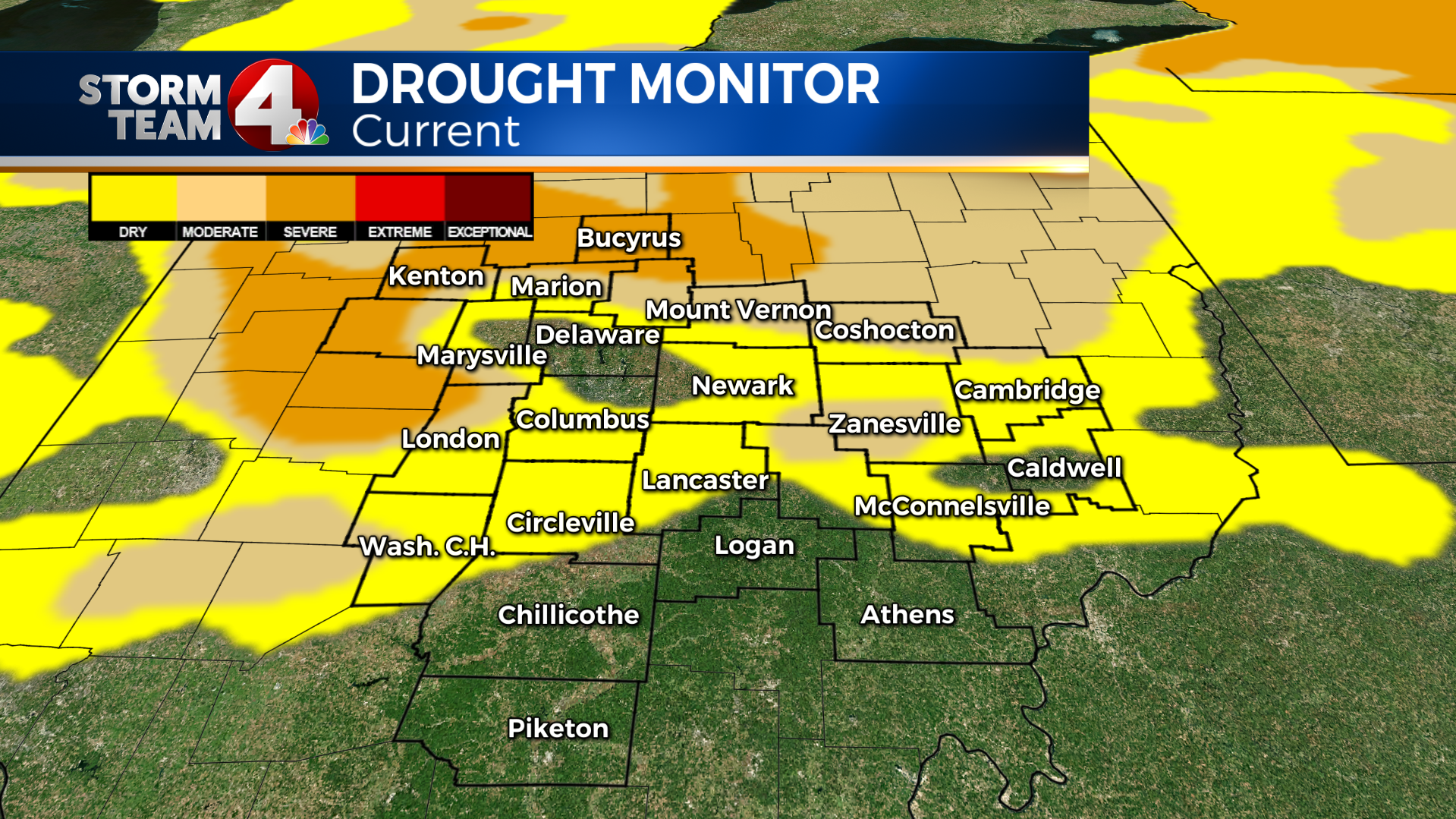
Notice now, we have roughly 15% of the state in a “Severe Drought”. Last week this number stood at 0%.
The last time we had 15% of the state in a “Severe Drought” was on 7/31/12.
Interesting to note, those in Crawford county are entirely in a “Severe Drought” now. Hardin county has more than 2/3rds of the county in the “Severe Drought”, and parts of Logan, Madison, and Union County are under the same drought.
According to the US Drought Monitor, this is considered a short term drought, and shouldn’t last more than 6 months in total.
To back this up, check out the image below, its of the 30 day vs normal rainfall (100% = normal, 0% = no rain, dry)
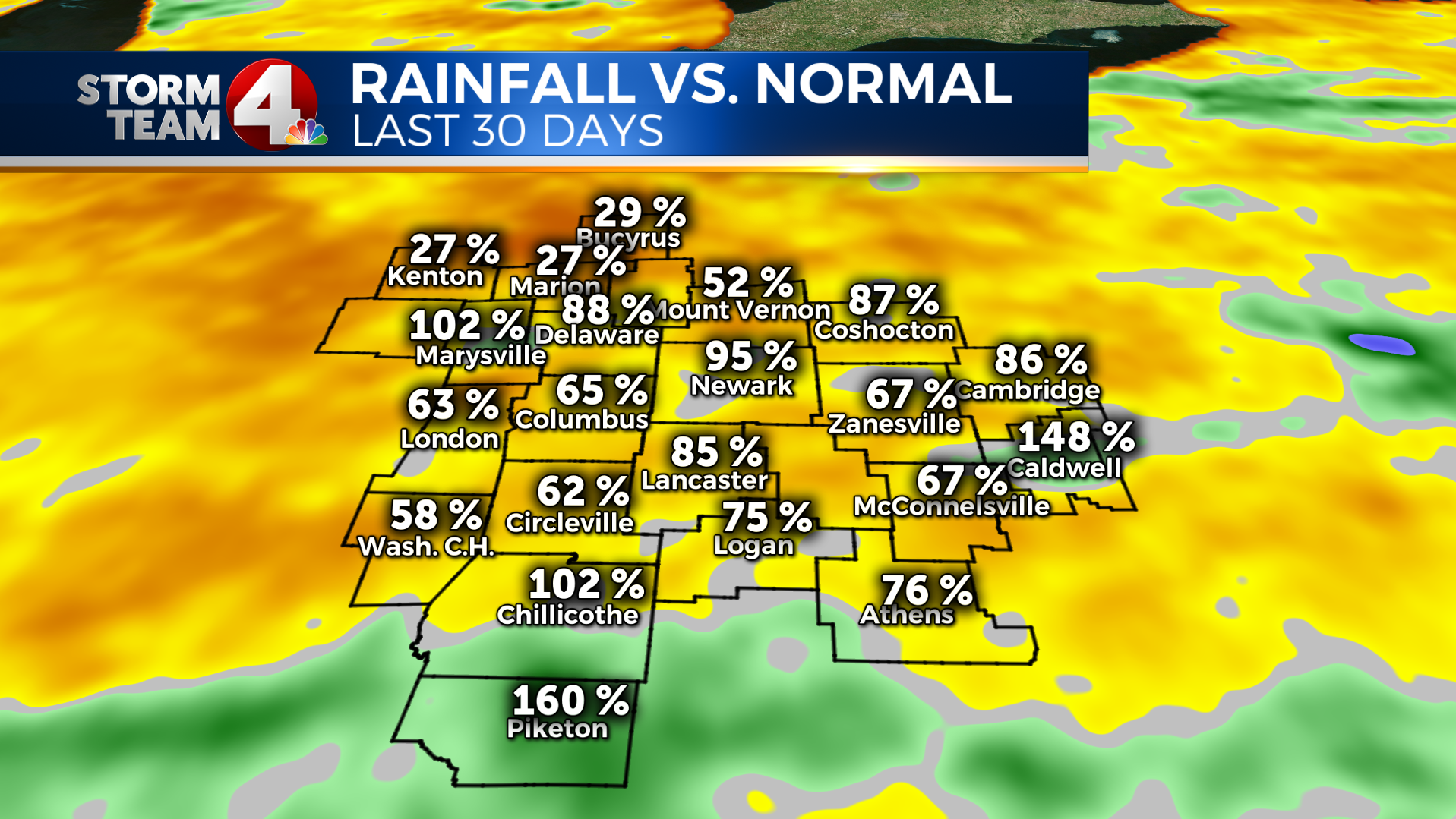
Basically this map mirrors the current drought situation. The north is abnormally dry in the last 30 days (which really extends to most of the summer). The south is abnormally wet, and not in the drought at all.
A few pieces of good news, over the past year we are all running pretty much near normal. Check out the 365 day vs normal below.
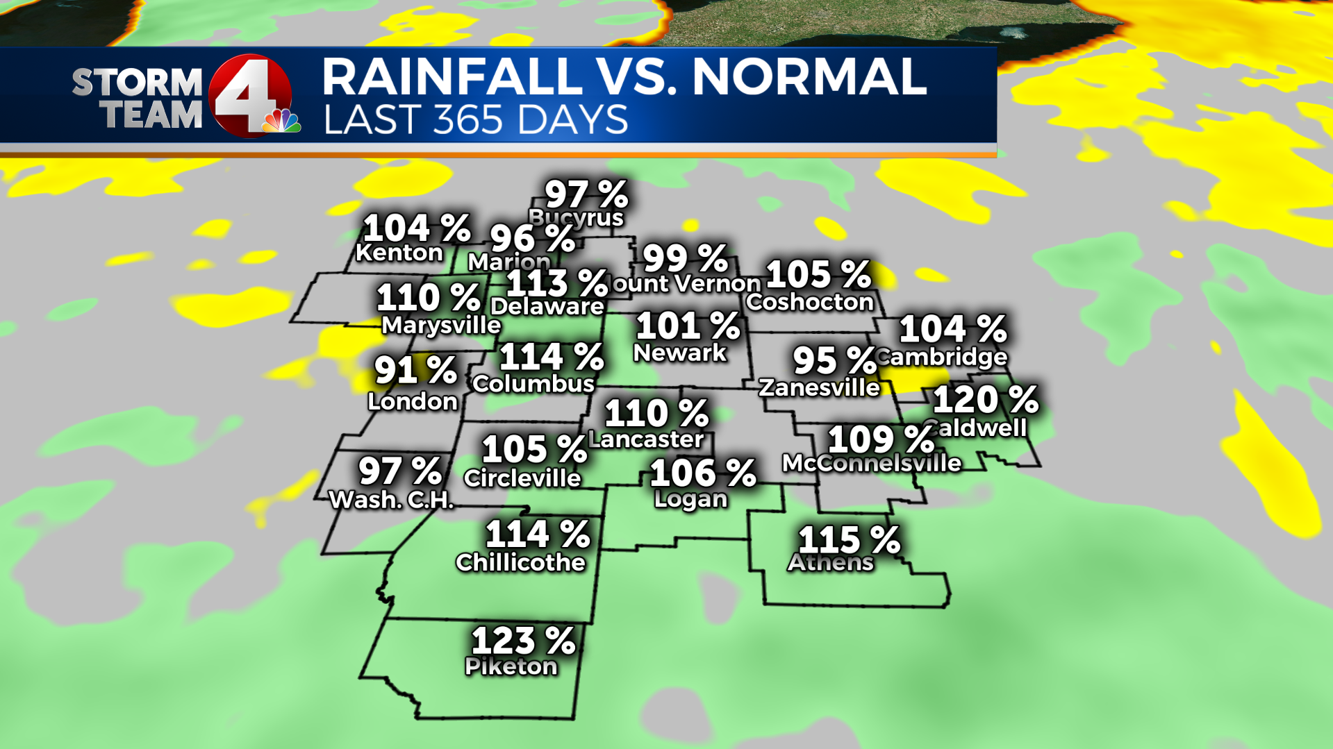
Most of these numbers indicate that we are running close to normal over the past year. So in the short term we need to turn this thing around… and our current pattern is just the thing to put a big dent in it.
We have had many parts of our area see rain the last few days, with today being another day with lower chances across the board. But over the weekend chances should increase in chance, coverage, and amount. With the frontal boundary approaching by the end of the weekend to the start of next week this could add better focused rain.
Here is the kicker too, some models are hinting at a stalling front after it passes south, and then for it to slowly lift back north during the middle of next work week, if this pans out, we could be quite wet and sick of rain by this time next week.
Below for fun, I have added the 7 day rainfall total graphic from the Weather Prediction Center at NOAA.
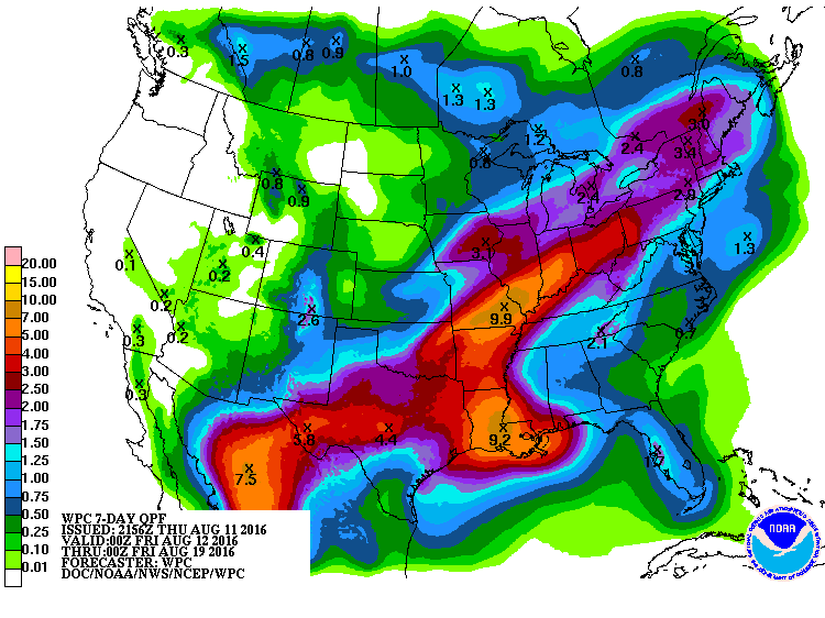
If this holds true, this would bring 1.5 – 2 inches of rain across the entire state, but could possibly mean 4+” of rainfall across the parts of the state that need it the most.
For my rain-free friends this week, keep your chin up, rain is on the way!


