COLUMBUS, Ohio (WCMH) — Spring is only weeks away on the calendar (March 19), but we have certainly felt the change in seasons already, despite a few recent cold snaps.
This week brought a surge of warm, moist air that set records for February heat across the Midwest, where temperatures reached 90 degrees as far north as Arkansas and Missouri, 86 at St. Louis, 80 at Springfield, Illinois, and 74 at Flint, Michigan.
The unseasonable winter warmth culminated in a rare February tornado outbreak that spawned more than 20 tornadoes from Illinois to Ohio on Tuesday evening and early Wednesday. The clash of seasons that triggered the severe weather with a potent storm system brought a nearly 60-degree drop in temperature in 24 hours in Chicago and Milwaukee.
The mercury soared to a daily-record high of 66 degrees in Columbus early Wednesday just ahead of the strong cold front. The predawn warmth on Wednesday marked the seventh time that maximum readings in Columbus topped 60 degrees, in one of the warmest Februarys on record. The mildest days brought a high of 67 degrees on Feb. 26-27.
The winter has been exceptionally mild, outside of a 10-day cold period in mid-January, and with only three respectable snowfalls: Jan. 19-20, Feb. 16 and Feb. 24. The total seasonal snowfall so far is 12.4 inches. (The normal snowfall for an entire winter is 28.2 inches).
In Columbus, December was 7.3 degrees above normal; January 2.1 degrees above normal; and February 8 degrees above normal. The winter as a whole edged past last winter (2022-23) to move into fifth place among the city’s warmest since 1879, based on the three-month period of December-February, which is considered meteorological winter for statistical purposes.
The Upper Midwest region is experiencing its warmest winter in history, with record low ice extent in the Great Lakes coupled with very little snowfall.
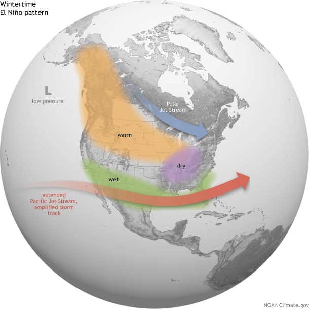
The biggest factor in the anomalous warmth this season is a strong El Niño climate pattern, which produced a persistent southern jet stream, or upper-air flow, that frequently swept mild Pacific air eastward and limited arctic intrusions due to the northward displacement of the polar jet stream.
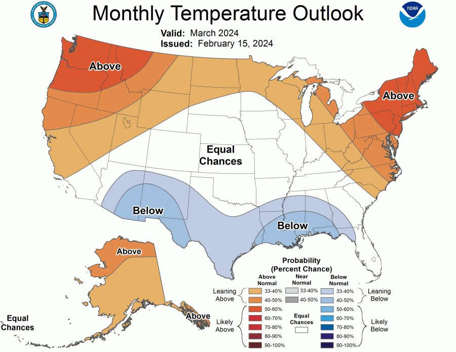
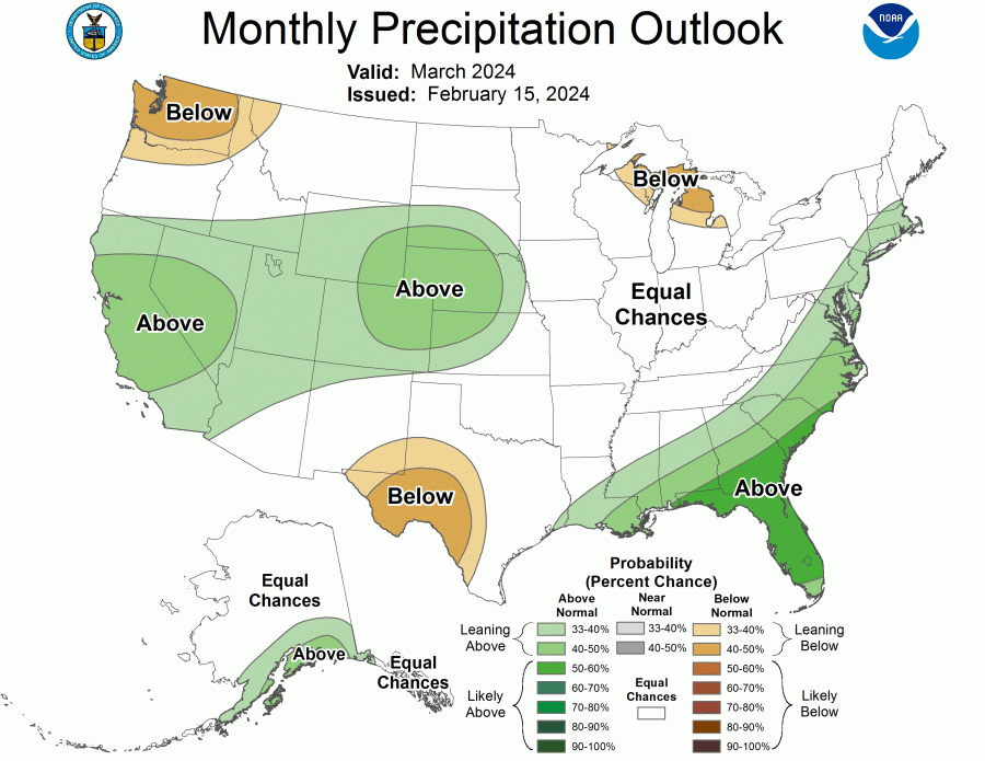
The NOAA outlook for March indicates a continuation of the unusually mild circulation. The average precipitation is given equal chances of above and below normal (near-normal). The West and Southeastern U.S. look to be rather wet and cooler-than-normal, consistent with a southern storm track that follows the prevailing jet stream.
The middle of January brought a southward shift in the polar vortex — the coldest air in North America at high altitudes near the North Pole.
Although there were some model signals that a warming of the stratosphere could realign the jet stream and lead to mid-March cold blast, this scenario is currently looking less likely.
However, we know from experience that the warmest winters sometimes balance out with colder-than-normal periods of spring and even a few late snowfalls, which can play havoc with early emerging crops, such as winter wheat and oats, flowers and fruit trees that leaf out several weeks ahead of schedule.


