COLUMBUS (WCMH) – This morning temperatures dropped to a bone chilling 31° in Columbus this morning. Many spots outside the city fell into the 20s this morning as well.How rare is it to see our first freeze on October 26th?
Not at all! In fact the average first freeze date for Columbus is October 27th, so we were only 1 day earlier than out average 1st freeze.
Below is a listing of the average first freeze dates in our area according to the National Weather Service records:
| Bellefontaine | 14-Oct | |
| Chillicothe | 17-Oct | |
| Circleville | 19-Oct | |
| Delaware | 14-Oct | |
| Kenton | 20-Oct | |
| London | 9-Oct | |
| Marysville | 22-Oct | |
| Newark | 12-Oct | |
| Washington Court House | 21-Oct |
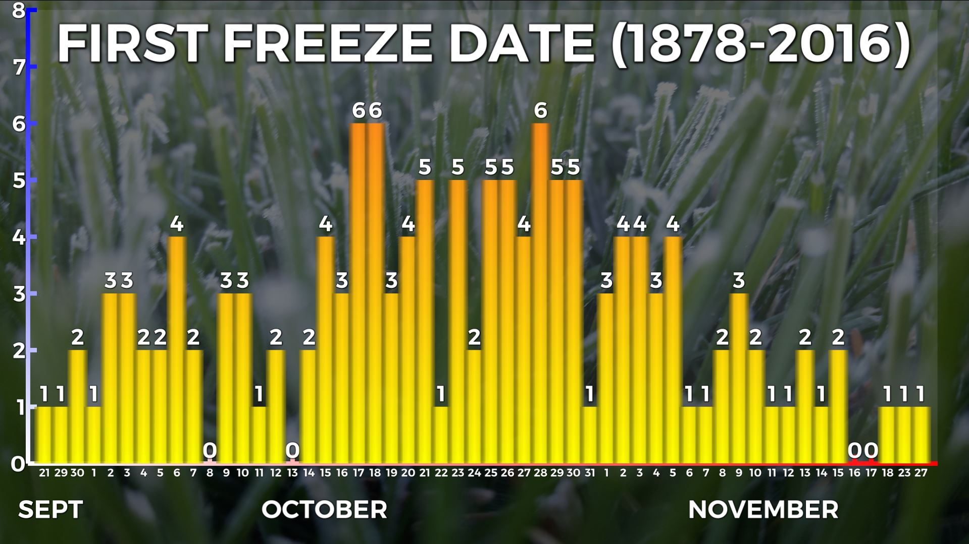
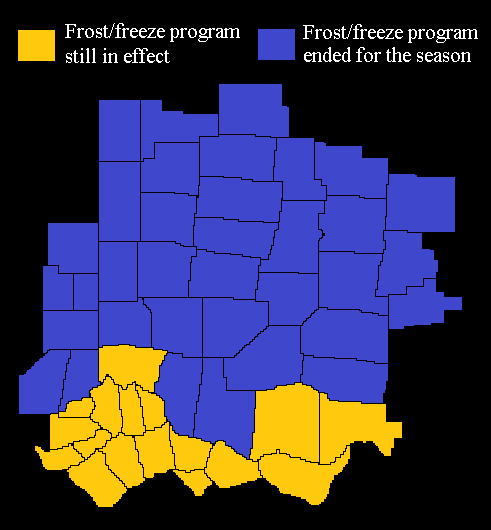
This also ties October 26th now with the most days of a first freeze in Columbus at 6 days.Do not expect any more frost/freeze advisories or warnings til Spring!
The NWS issues these statements, and will do so until a freeze occurs or we get into November. Since we have now had our first killing freeze, the NWS has ended the “frost/freeze program” for the season.
Our ‘warm season’ was 2 days short this year!
If you consider the ‘warm season’ between our first 90° day and our first freeze (32° or below), both were 1 day later and earlier.
We had our first 90° day on June 11th, average is June 10th. Today was our first freeze, a day before our average first freeze.
So what does this mean? Nothing really, it means we were pretty much on track this year compared to history.
Depending on cloud cover Sunday night we could have our next freeze. If skies clear out, we could see equally as cold, if not a degree colder temps to start next work week.
If you have any questions about frosts, freezes, first freezes, or any other weather, email me: dmazza@wcmh.com
-Dave


