Columbus (WCMH) – Today was wet and chilly, or so it seems, but it really was the warmest day of the month. Temps aren’t about to get better either, as several shots of colder air are coming.
Winter officially starts in 2 weeks, while on a bright note, we are only 15 weeks from the start of Spring 🙂As cold as it seems, temps have been near normal for the 1st 1/5 of the month of December:
Highs each day this month have been slightly below normal, but lows have been above making the average temps slightly above normal.
- Dec 1 High 41 (0 Normal)
- Dec 2 High 39 (-1 from normal)
- Dec 3 High 40 (0 Normal)
- Dec 4 High 42 (-1 from normal)
- Dec 5 High 42 (0 Normal)
- Dec 6 High 43 (+3 from normal)
Today ultimately could be our warmest day for the first 2/3rds of the month… or more.
As grim as that sounds, it appears we are not only going to see the coldest air of the season moving in for Thursday, but we could see an even colder push by the middle of next week.
Also, today might go down as the only day of the first 20 days this month to not have below normal high temps 🙁
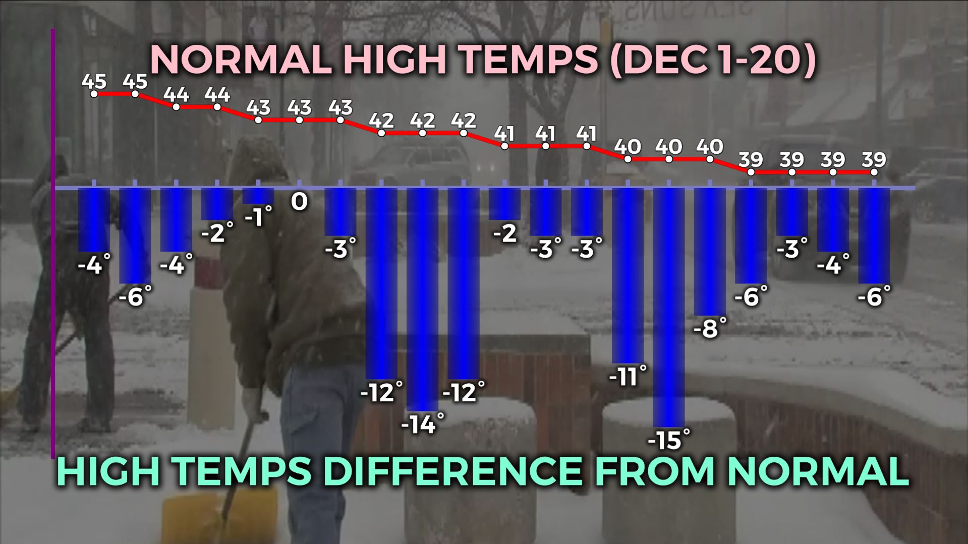
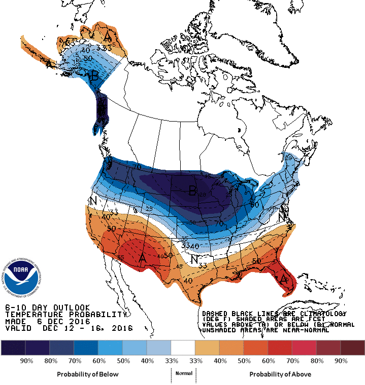
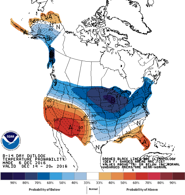
The chart above has our high temps vs. normal for each of the first 6 recorded days, plus the forecast for the next 14 days. I also plotted the normal high temperature above it, which started at 45 and drops to 39 during the month.The Climate Prediction Center mirrors this cold outlook with it’s 6-10, and 8-14 day outlooks:
We are getting into a period of active weather fronts coming our way over the next few weeks:
Several cold shots will be coming our way from the northwest. Starting Wednesday night, and then Sunday night, Wednesday of next week and beyond.
You can see above in the Climate Prediction Center’s outlooks how they shows these system diving south across the mid-section of the country, then driving northeast.
This will generally leave the southwest and southeast above normal for temps, but us pretty cold.
If you ever have any questions about climate, cold temps, December chill or any other weather, email me: dmazza@wcmh.com
-Dave