Columbus (WCMH) – So far, this has been a pretty unreal February in the temperature department. We have caught a warm streak that has us tied for the most January & February days in the 60s, and we still have 8 more days left this month, with at least 4 of them in the 60s or better.Here is what it looked like just 2 years ago tomorrow, when we experienced one of our coldest months ever on record:

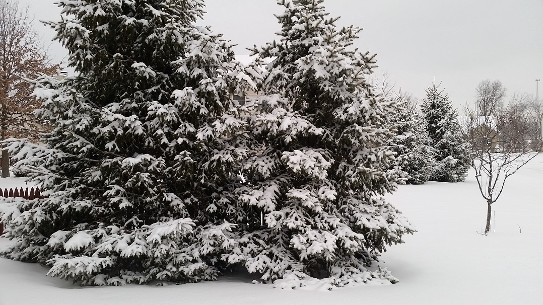
On the 20th of the month we had a morning low of -8, and the afternoon high was only 14. On a plus note, it did warm up significantly on the 21st of the month. We did rise above freezing to 33 degrees, but we also picked up almost 7″ of snow on that day.
It made for a pretty day, but it also locked us in for a very cold finish to the month, with a half foot, to a third of a foot of snow on the ground the rest of the month.
February 20th has been a pretty strange day weather-wise lately:
In the past few years, this is very up and down on this date.
- 2017 High 65°
- 2016 High 68°
- 2015 High 14° Low -8°
- 2014 High 63°
- 2013 High 23°
While today did not set any records, it was close, and more records may fall soon:
- Warmest low temperature for Wednesday is currently 50°, the forecast low for Wednesday is 51°
- Warmest high temperature for Thursday is currently 66°, the forecast high for Thursday is 67°
- The record for most occurrences of 60°+ temps in January & February is 11 times, in 2017 & 1890, we will beat this on Tuesday
We could see our first 70° day of the year this week as well:
Out ahead of our next cold front, we will have temperatures pushing to near 70° in the city, which is not a record for the date, but would be our first 70° day since November 18th, when we hit 75°
If you have any questions about our warm-up, record heat, or any other weather questions, email me, dmazza@wcmh.com
-Dave


