QUICK WEATHER FORECAST:
- Today: Clearing & breezy, high 70
- Tonight: Mostly clear, low 46
- Sunday: Few clouds, high 73 (50)
- Monday: Sunny skies, high 81 (57)
- Tuesday: Sunny & warmer, high 85 (64)
- Wednesday: Clouds increasing, high 87 (67)
A few conditions and ingredients came together to add an unpleasant odor to the air. Wild fire smoke from Canada is moving further into central Ohio. The rain from last light along with warm air aloft helped bring those smoke particles to the surface.
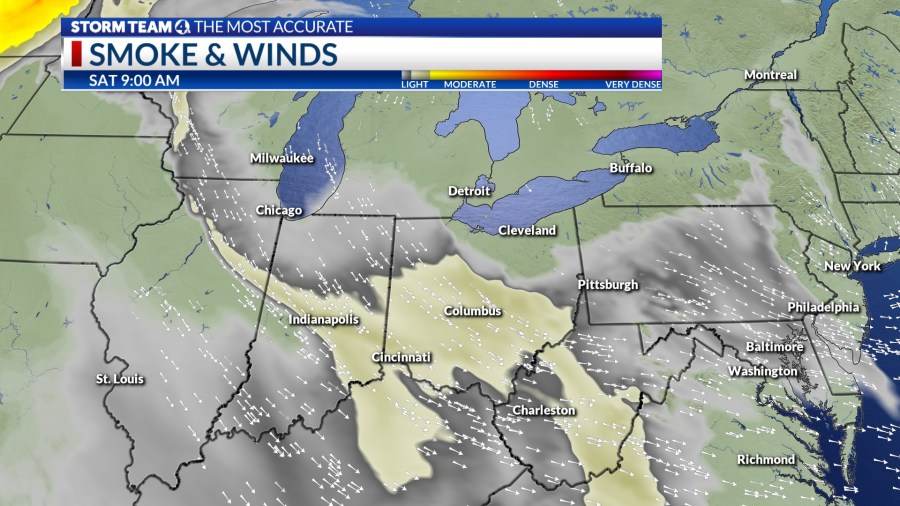
At the moment air quality index numbers within portion of central Ohio are in a range that may be unhealthy for sensitive groups. With a cold front moving through today and other factors, most of the smoke should clear by the evening. Speaking of clearing, skies will as the day progresses. Winds are going to be gusty at times. Expect high temperatures near 70 degrees.
Mostly clear skies will continue during the overnight hours as well. The front is going to knock down temperatures in the mid 40. This is more than 10 degrees cooler than normal. Winds are also going to calm down quite a bit as well.
Mainly sunny skies will be the primary theme for Sunday. With less smoke and clearer conditions this is going to be the better of the two weekend days. Temperatures to kick off the month of June are still going to lean on the cooler side only reaching the low 70s.
Much warmer conditions arrive by the start of the work week. Highs starting Monday will reach the low 80s under mostly sunny skies. Those temperatures will increase every day through the middle of the week. Next chance for showers and storms returns late Wednesday with another cold front.


