QUICK WEATHER FORECAST:
- Tonight: Rain & storms before 2am, tapering showers, low 63
- Wednesday: Partly cloudy, PM rain, high 83
- Thursday: Chance showers & storms, high 73
- Friday: Spotty showers, high 63
- Saturday: Isolated chance, high 66
FORECAST DISCUSSION:
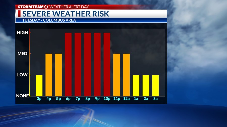
The line of storms that produced tornadic activity in the far western portion of the state, and produced multiple tornado warnings in Central Ohio is moving east and southeast out of our area as of 1230am. We will see most of the rain associated with this storm complex exiting our area by 2-230am.
After midnight, skies will begin to dry. Clouds will mix with sunshine throughout the day Wednesday with temperatures pushing back into the lower 80s. There is another chance to see stronger weather on Wednesday towards the evening and overnight hours.
Spotty chances for rain remain through the rest of the work week with temperatures beginning to cool. We’ll remain in the mid to upper 60s for the weekend with the chance for an isolated shower.
-Joe