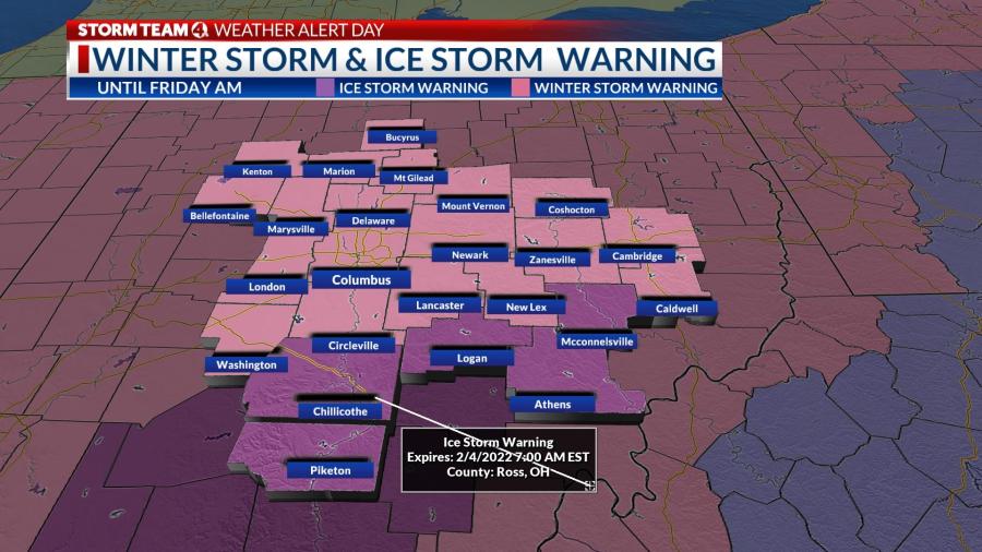
WINTER STORM WARNING UNTIL FRIDAY MORNING
A major winter storm is bringing a treacherous combination of snow, sleet and freezing rain across Ohio, with heavy snow in the northwest, and a wintry mix through the central portion of the state that will turn to mainly snow from northwest to southeast through the evening. Rain in southeast Ohio will gradually turn to sleet and snow overnight and linger Friday morning.
A Winter Storm Warning is in effect statewide, and an Ice Storm Warning has been issued through early Friday for a portion of south-central and southeast Ohio, where ice accumulations could be as high as 1/2″ to 3/4″ by early tonight, with the risk of power outages and tree limb damage.
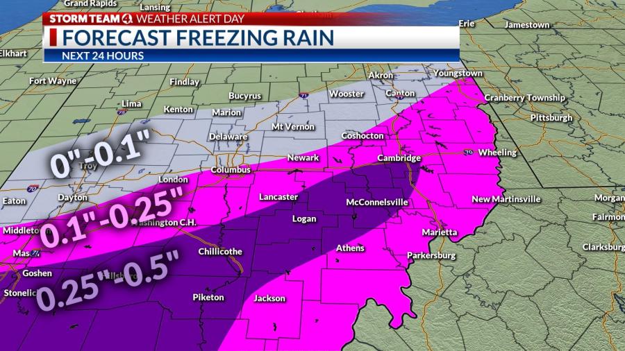
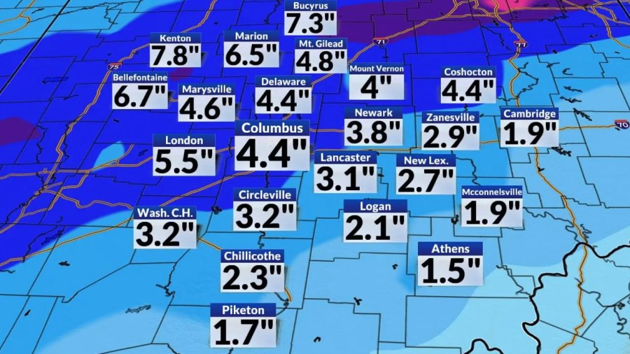
Low pressure will track through the Tennessee Valley and eastern Kentucky, drawing a considerable stream of Gulf moisture northward that will collide with a sagging arctic boundary draped across the middle of the state, resulting in significant icing (.10-.25″), followed by 3-6 inches of snow in central Ohio and 6-10 inches across the northern and west-central portions of Ohio.
Temperatures will settle in the mid-20s, setting up a icy scenario south of the snow boundary. As the air aloft cools, mixed precipitation will shift to snow across the remainder of Ohio, except the southeastern counties until after sunset.
Snow will taper off to snow showers after midnight, although a secondary band of light snow early Friday could add another inch of snow by the Friday morning commute.
Cold, drier air will circulate behind the storm Friday afternoon, and the weekend weather will turn partly cloudy and cold, with some moderation Sunday.
Forecast
- Thursday: Icy mix to snow p.m, windy. Falling to low 20s
- Tonight: Snow, heavy early, tapering to flurries, windy, slick roads. Low 16
- Friday: Light snow a.m., slippery travel. High 22
- Saturday: Mostly sunny. High 23 (-2)
- Sunday: Partly cloudy. High 33 (8)
- Monday: Mix clouds and sun. High 29 (16)
- Tuesday: Mainly sunny High 31 (9)
- Wednesday: Partly sunny. High 37 (19)