COLUMBUS (WCMH) — This is the storm that will never end, or so it feels like. Tropical Storm Harvey continues on, and is finally inland for good.
Just because a tropical storm moves inland, does not mean the threats are over. Here, we are going to see some BIG changes in our area.
Current forecast track of Tropical Storm Harvey:
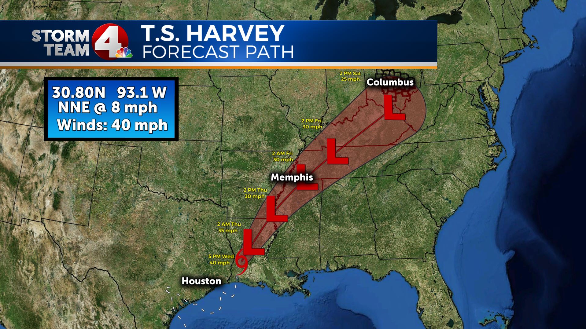
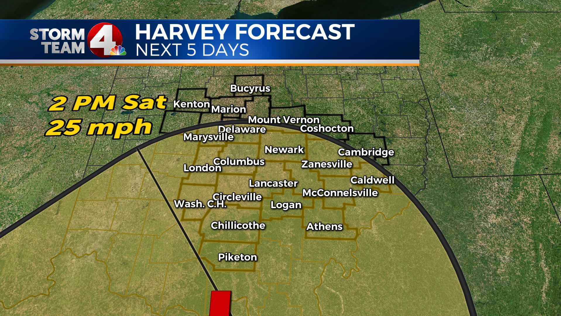
Locally, you will notice Harvey, more like the remnants of Harvey, will arrive here this weekend.
What can we expect here?
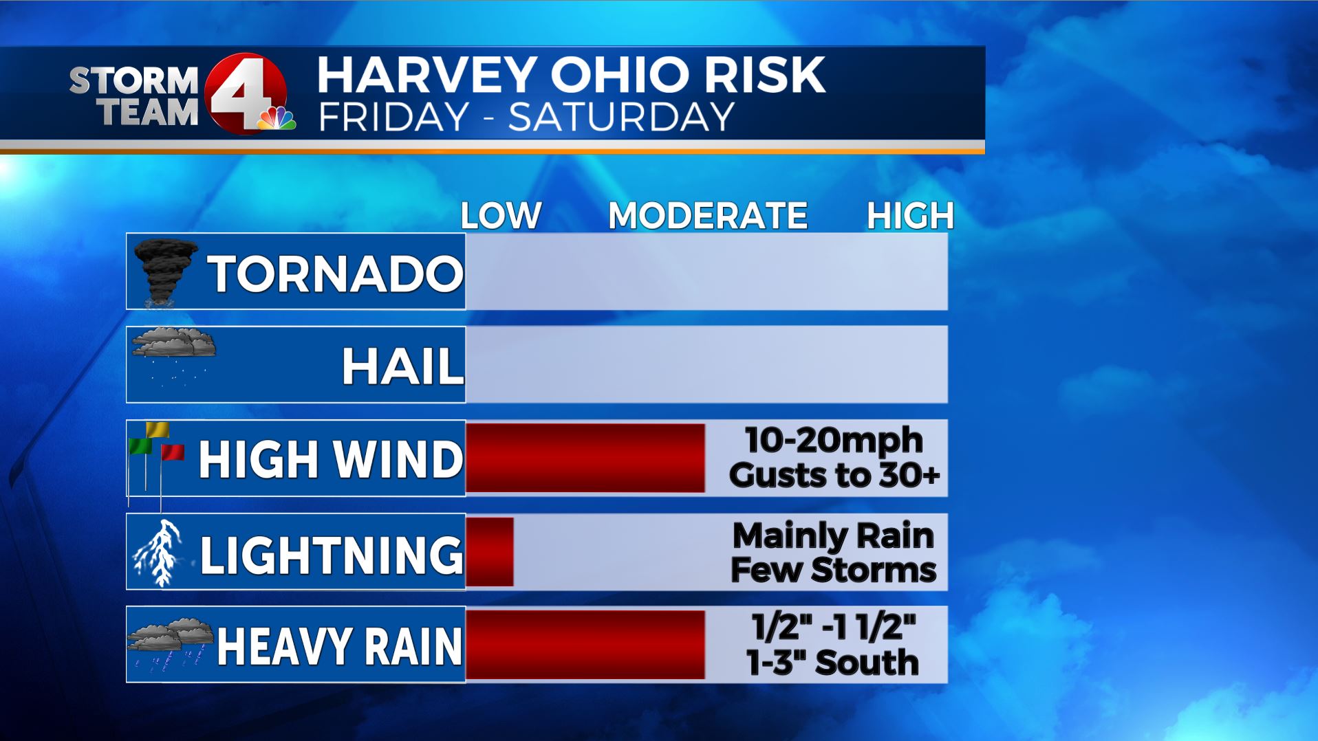
Above is a quick glimpse of our threats from Harvey locally, below, I will outline where and when we can expect all of these.
TEMPERATURES, what can we expect here?
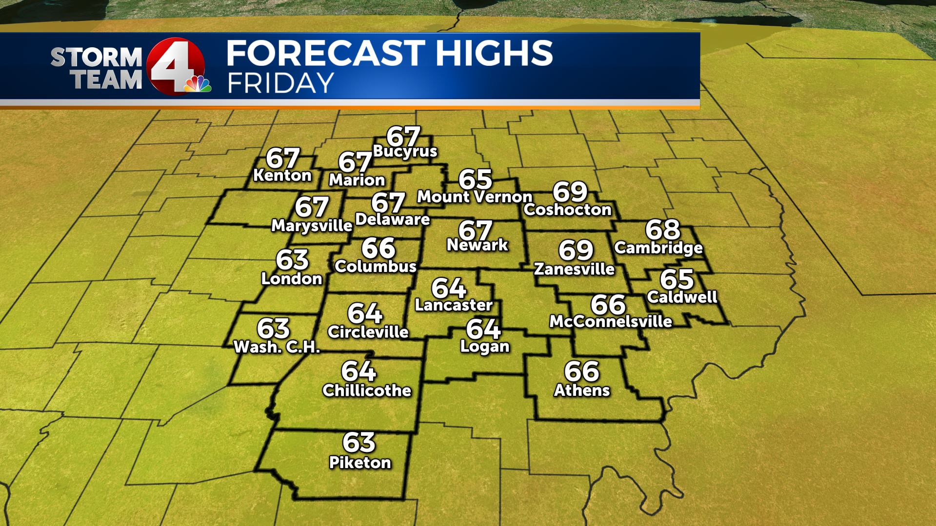
First off, we are going to see a cold front pushing through Thursday (tomorrow) and this will bring in much cooler air. Clouds from Harvey will lock in the cooler air, and not allow much of a warm up on Friday, so temps will stay in the 60s for highs on Friday.
Right now, I have the forecast high in Columbus at 66, which would tie the 108 year record for the coldest afternoon high temperature for the date. It will also be a whole 16 degrees below normal.
Several forecast models are going even cooler on Friday with many having a lot of 50s in our area for highs on Friday, historic!
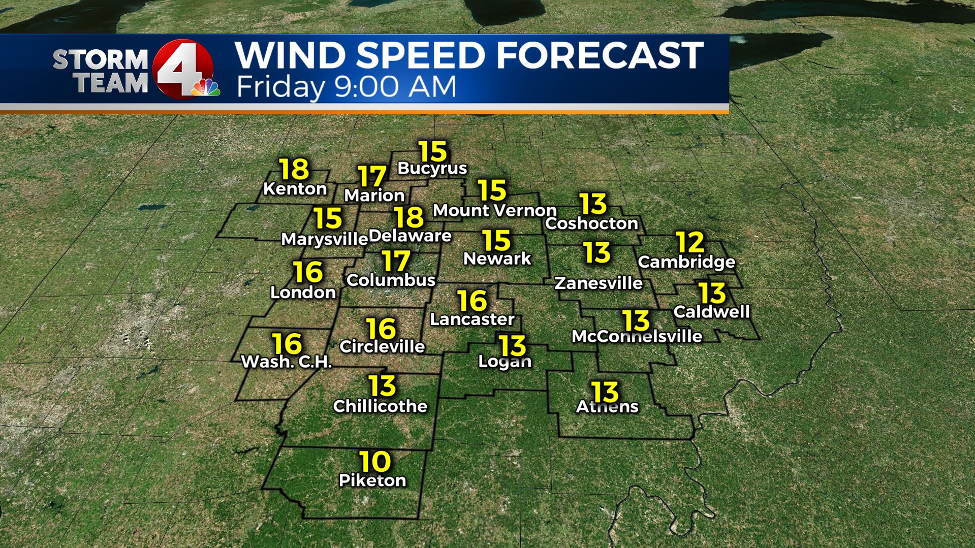
WINDS, what can we expect here?
The official forecast for Harvey has it with winds at 25 miles per hour on Saturday when its near our area. At this point, I expect breezy conditions starting on Friday, with winds in the teens, and gusting above 30 miles per hour.
I think Saturday at least in the first half of the day will be breezy as well. Again, this is breezy, but not severe criteria.
Rainfall, what can we expect?
This will most likely be our biggest threat with Harvey. I expect rainfall numbers to be higher in the south and lower in the north. Rain will start far south late on Thursday night, and it should continue through the evening hours on Saturday.
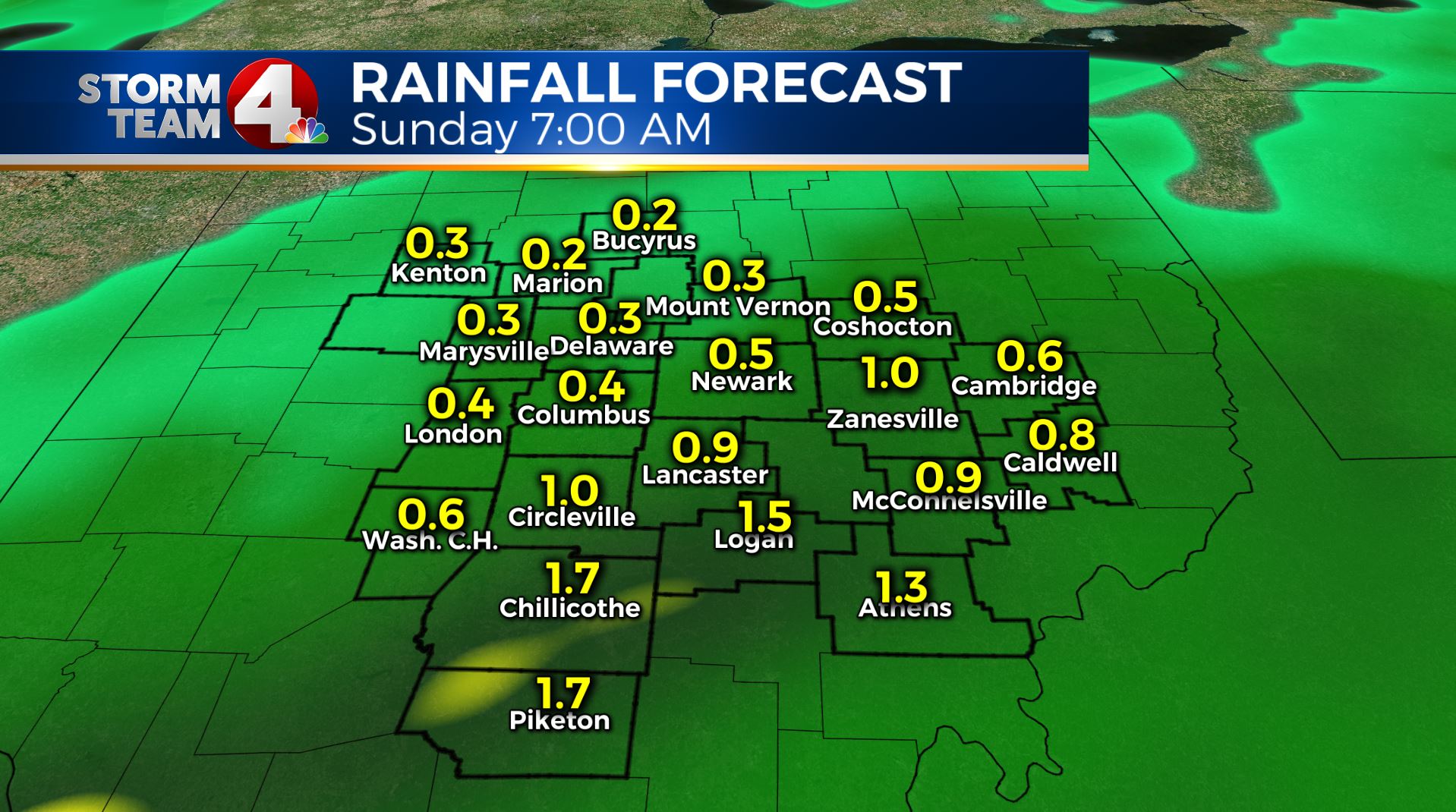
Our latest in-house model run, showing close to 2″ in the south. I think it will be possible to see isolated 2-3″ in spots mainly in the south, but again, a slight shift in track will determine the final totals.
Also, it should be noted, these totals are falling over a roughly 36 hour period.
After this, we should see this moisture getting cleared east quickly Saturday night, and will give us nicer weather Sunday and Monday.
If you ever have questions about Harvey, the tropics, or any other weather, email me, dmazza@wcmh.com
-Dave


