COLUMBUS, Ohio (WCMH) — For the second time in three months, Columbus went more than two weeks without measurable rain before showers arrived late Sunday, although some areas again missed out.
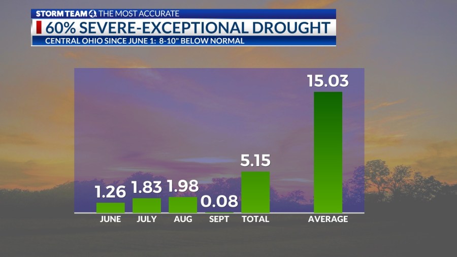
The most recent dry stretch that began on Sept. 7 was finally broken after 16 days, just shy of the 17-day dry period from June 6 to 22. In Columbus, a total of 5.15 inches of rain from June 1 through the first day of fall is nearly 10 inches below normal.
Meteorological summer (June-August) was the third driest on record in Columbus (5.07 inches), only surpassed in 1930 and 1933 during the Dust Bowl era.
The timing in the heart of the growing season resulted in a flash drought, following relatively normal winter and spring precipitation, with rainfall often skirting central and southern Ohio since early June, when the evaporation rate is highest due to the high sun angle.
From Sept. 1-22, only 0.08 of an inch had fallen up to the start of astronomical fall. (The autumnal equinox arrived at 8:44 a.m. Sunday.)
The period from late summer through early autumn is normally the driest time of the year in Ohio, with the fewest number of rainy days on average from August to October. This makes getting out of a drought difficult in the early part of fall.
The most severe drought in southeastern Ohio during the growing season since 1988 has reduced the yields of corn and soybeans to approximately 50 percent of average. Wheat that would normally be stored for the winter for feed is being used on parched pastures to meet the needs of livestock in the driest parts of the state.
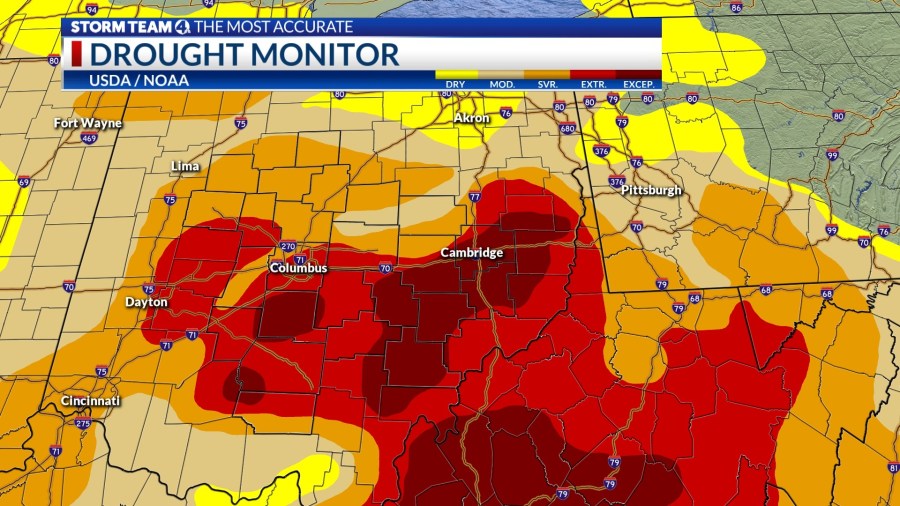
About 60% of Ohio is currently in the grip of a severe to exceptional drought, according to the most recent U.S. Drought Monitor.
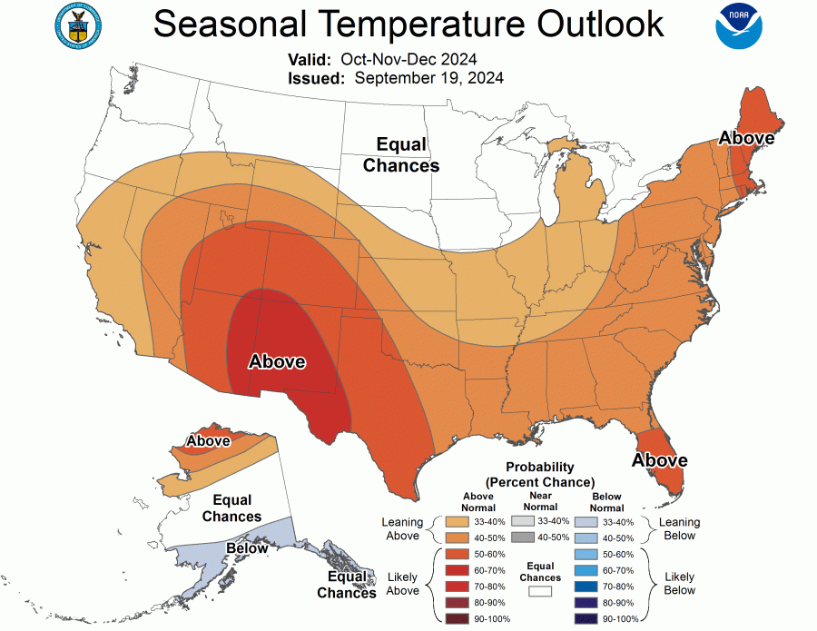
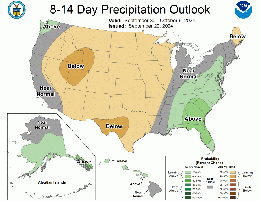
NOAA’s Climate Prediction Center is offering some hope for a return to a more normal pattern of precipitation in the next few months despite warmer-than-average temperatures, based on the most recent October-December outlook.
The best way to make up a serious moisture deficit this time of year is a remnant tropical storm, but the most recent system to move north from the Gulf of Mexico in mid-September, Francine, was blocked by high pressure over the Northeast and Great Lakes.
Potential Tropical Cyclone Nine, a disorganized mass of thunderstorms in the northwest Caribbean Sea, will likely grow into a sizable hurricane named Helene later this week in the Gulf of Mexico and make landfall somewhere in the Florida Panhandle or Big Bend. There is only a small possibility of some of that moisture reaching Ohio next weekend as scattered showers.
Slow-moving frontal systems are occasionally capable of tapping into deep moisture from the Gulf, resulting in rounds of showers and storms.
Low pressure will track across Indiana into northwest Ohio Tuesday, bringing pockets rain and storms that could total between .50 and 1 inch in some areas, providing modest relief from the extreme to exceptional drought conditions.
The question is whether it is too little too late for lawns and garden crops, although the welcome rains will cleanse the air and moisten the topsoil, which will help plants and trees stressed by the lack of water.


