Timing of the rain, snow and ice:
After a sunny and mild start to the workweek, rain, snow and ice are on the way. Wednesday remains mild in the way of temperatures, but we will see rain showers throughout the day, expecting anywhere from 0.5-1″ of rain across portions of the region by Wednesday evening.
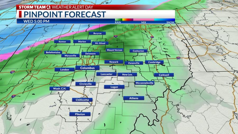
A southerly breeze will keep Wednesday’s daytime highs in Central Ohio in the low to mid 40s, then, we’ll make room for a cold front to slide into Central Ohio Wednesday and Thursday.
As we head overnight into Thursday, temperatures take a nosedive, and the rain we saw Wednesday will turn into a wintry mix and snow as it tracks southeast through the state.
Thursday’s morning commute will get a bit messy, as we’ll be tracking a wintry mix including sleet and ice right along the I-71 corridor.
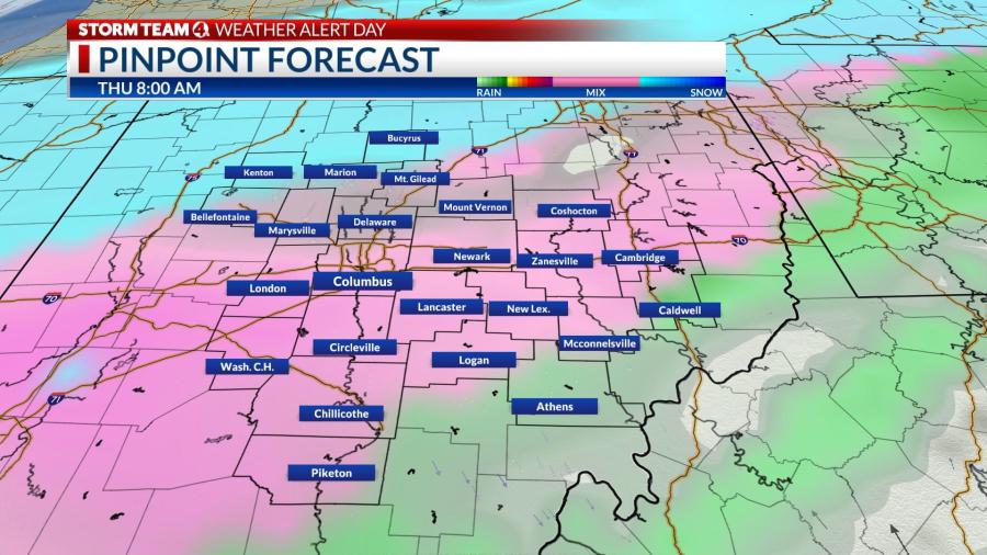
The majority of the heavy snowfall will stick to the northwest of I-71, and southeast of the corridor we will see a wintry mix and rain most of the day Thursday.
The Thursday evening commute is still looking messy as the system tracks southeast through the state. Temperatures will continue to drop throughout the evening, and we’ll see that wintry mix turn into snow across much of the area by Thursday night.
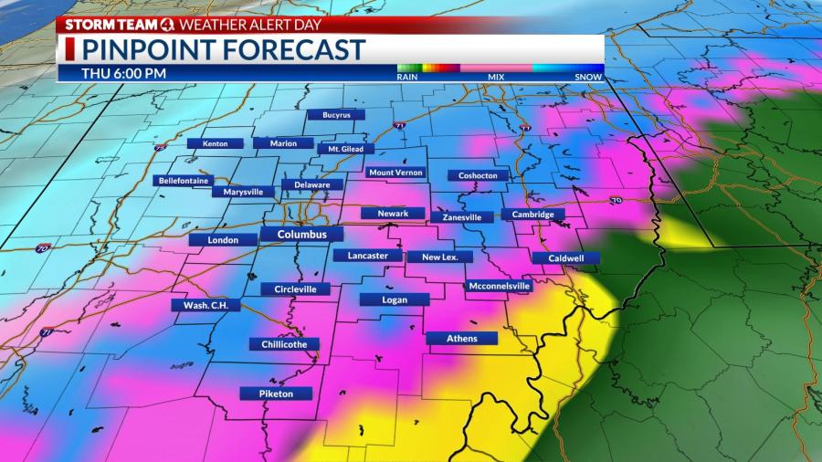
As we head overnight into Friday, snow and ice will start to slide south and east.
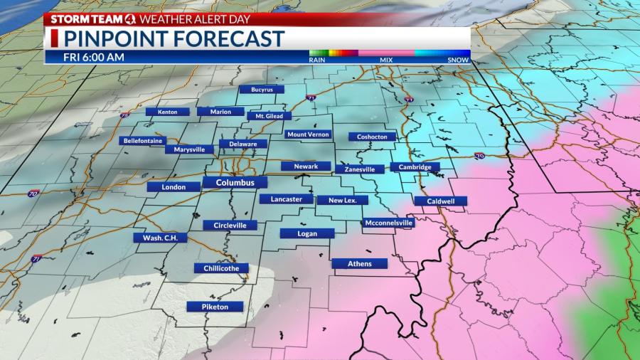
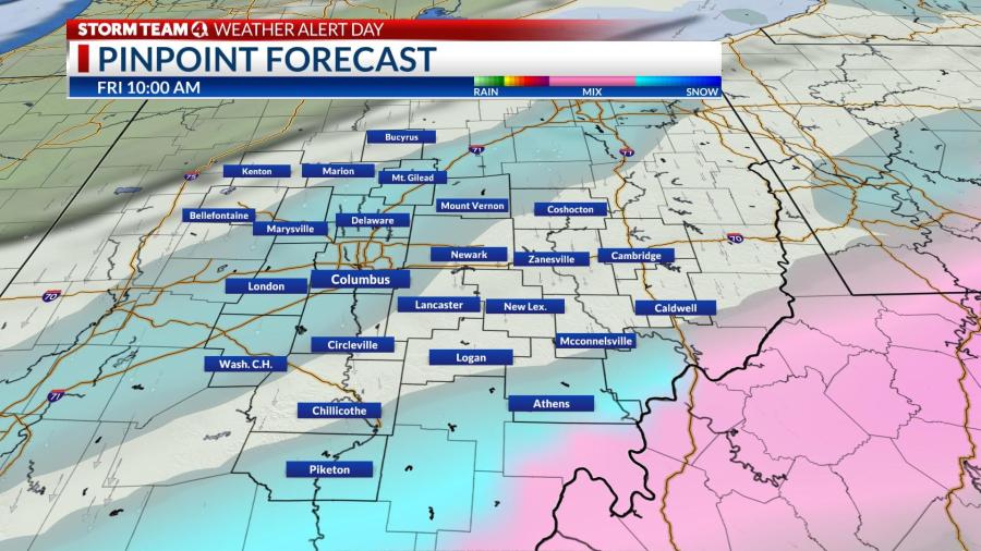
We will continue to see some light showers and flurries Friday morning, but by the afternoon hours, those will have cleared and we’ll be left with cloudy skies to end the workweek.
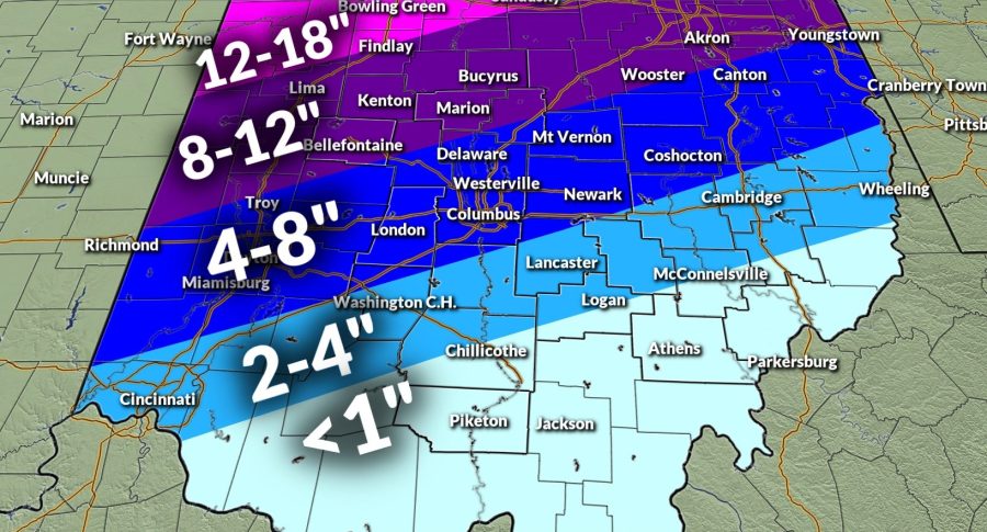
By the time this system exits, this is what we’re expecting in the way of overall snowfall accumulations:
Driving in winter weather:
Roads will be difficult to treat since anything coming down from the clouds will start as rain before turning into a wintry mix.
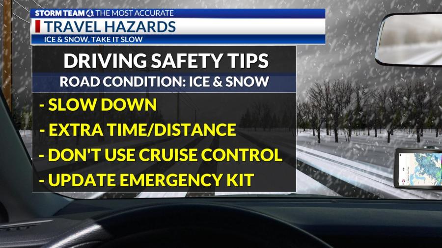
If you have to travel on icy roads, remember “ice & snow, take it slow.” Since roads will be slick, it will be important to remember to plan for extra travel time as well as extra braking distance between yourself and the car in front of you.
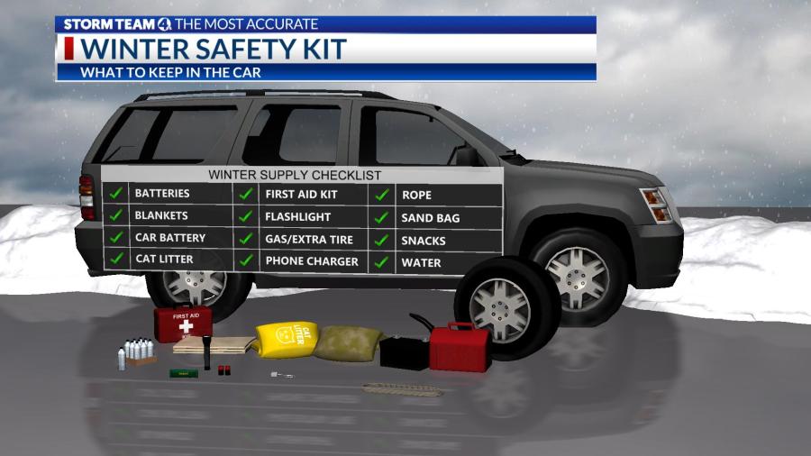
If you have to be on the roads while they are icy or snow covered, make sure that you have an updated safety kit. In this kit, it will be important to pack things like extra warm layers, something to create traction like sand, kitty litter or cardboard in case your car gets stuck, snacks, water, a flashlight and extra batteries.
Totals:
Temperatures and timing will be key to determining how much rain, snow and ice accumulate.
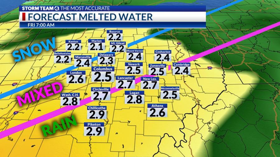
The liquid total of rain, melted snow and melted ice (from sleet and freezing rain) will be around 2-3 inches. Rain and ice will result in lower snowfall totals.
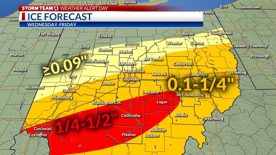
Ice is one of the biggest concerns. Ice totals in Columbus could range from 1/10-1-4″, and anywhere between 1/4-1/2″ to the south, which will result in very difficult driving conditions and extra weight on power lines which could lead to power outages.
For the latest weather information:
Stay connected to the latest forecast for central Ohio by watching NBC4, checking NBC4i.com/weather or downloading the free Storm Team 4 Mobile Weather app on your smartphone or tablet.