Hurricane Ian’s potential impact on Central Ohio this weekend
McKenna King, Dave Mazza, and Ben Gelber
LATEST ON IAN’S TRACK
The National Hurricane Center confirmed Hurricane Ian made landfall near Cayo Costa, Florida, west-northwest of Fort Myers, Florida, at 2:05 p.m. on Wednesday as a Category 4 hurricane, packing 150 mph winds.
The storm weakened moving across Central Florida, downgraded to a Category 1 storm, before moving off the east coast of Florida south of Cape Canaveral early Thursday. A wind gust of 89 mph was recorded at Melbourne.
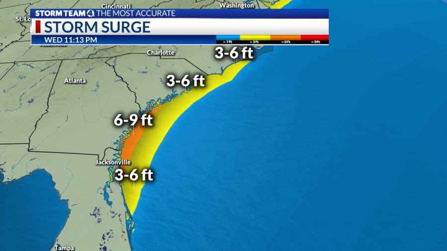
The storm is predicted to remain offshore heading north off the Atlantic coast of Florida.
Atlantic coastal Georgia, South Carolina and Florida will also be looking at potential for storm surge, as the storm moves into the Atlantic east of Dayton Beach Thursday afternoon, with a second landfall near the Georgia-South Carolina border, likely a tropical storm or possibly a Category 1 hurricane, on Friday.
Tropical Storm Warnings are already in effect all the way up into the North Carolina coast, with Hurricane watches under effect all the way up into South Carolina in anticipation of the hurricane’s next US landfall.
CURRENT TRACK OF HURRICANE IAN:
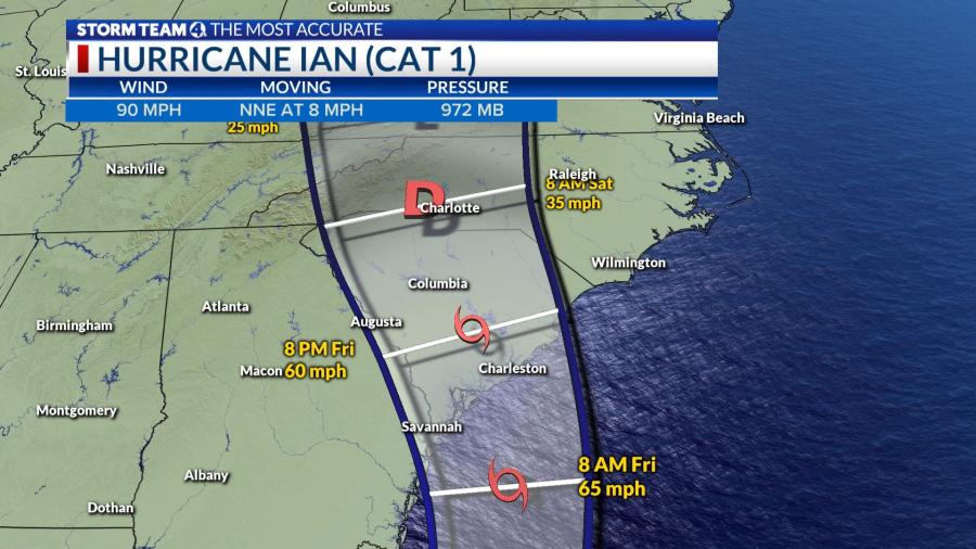
Overnight the storm will continue to weaken as it moves across Florida and enters the Atlantic Thursday morning between Melbourne and Daytona Beach as a possible weak hurricane or likely a strong tropical storm.
The official NHC track takes the storm into the Atlantic Ocean Thursday and most of Friday as a tropical storm, and then pushing it back inland Friday evening between Savannah and Myrtle Beach.
TOPSHOT – Waves hit the Malecon in Havana, on September 28, 2022, after the passage of hurricane Ian. – Cuba exceeded 12 hours this Wednesday in total blackout with “zero electricity generation” due to failures in the links of the national electrical system (sen), after the passage of powerful Hurricane Ian. (Photo by YAMIL LAGE / AFP) (Photo by YAMIL LAGE/AFP via Getty Images)
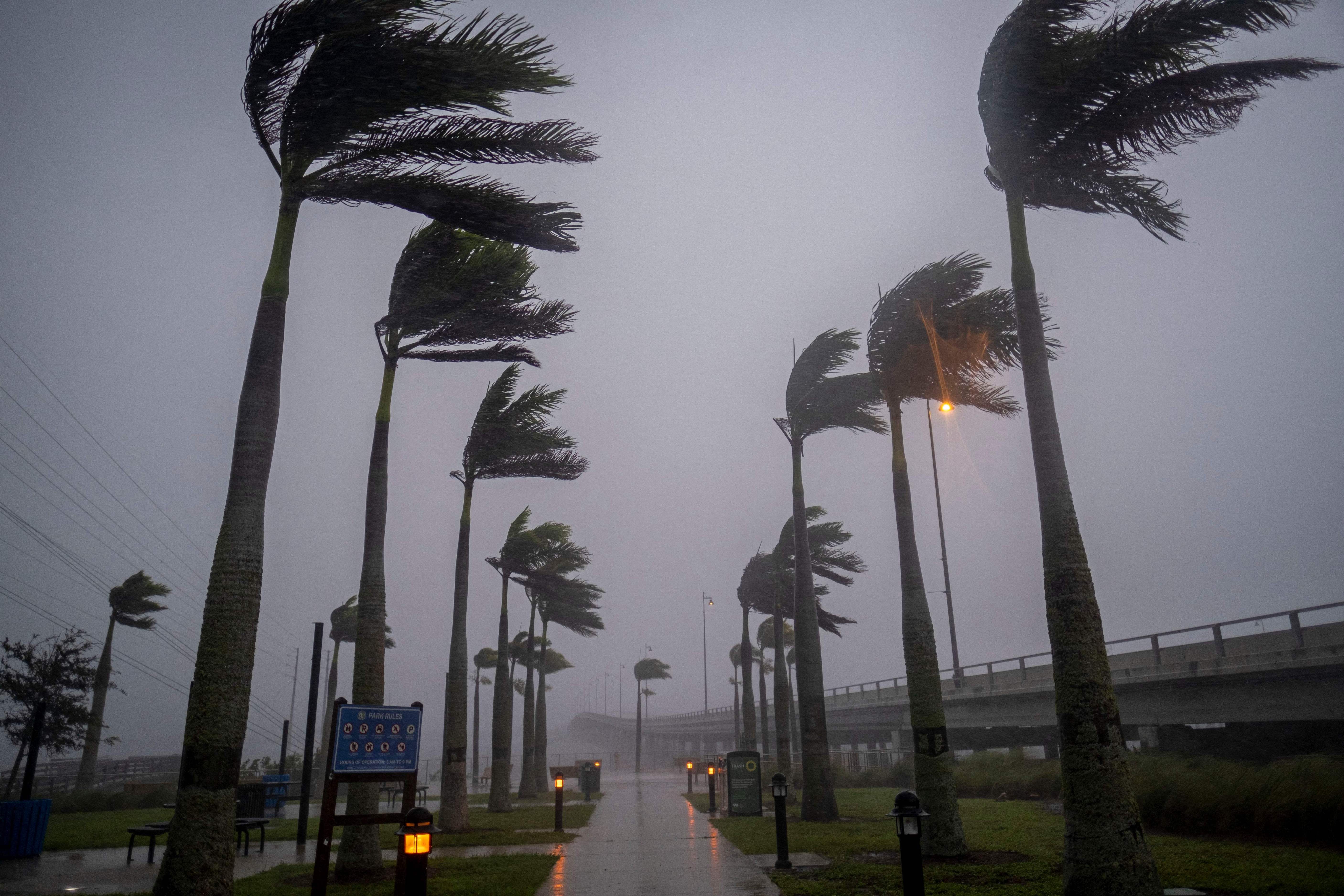
Wind blows palm trees ahead of Hurricane Ian in Charlotte Harbor, Florida, on September 28, 2022. – Ian intensified to just shy of catastrophic Category 5 strength Wednesday as its heavy winds began pummelling Florida, with forecasters warning of life-threatening storm surges after leaving millions without power in Cuba. (Photo by Ricardo ARDUENGO / AFP) (Photo by RICARDO ARDUENGO/AFP via Getty Images)
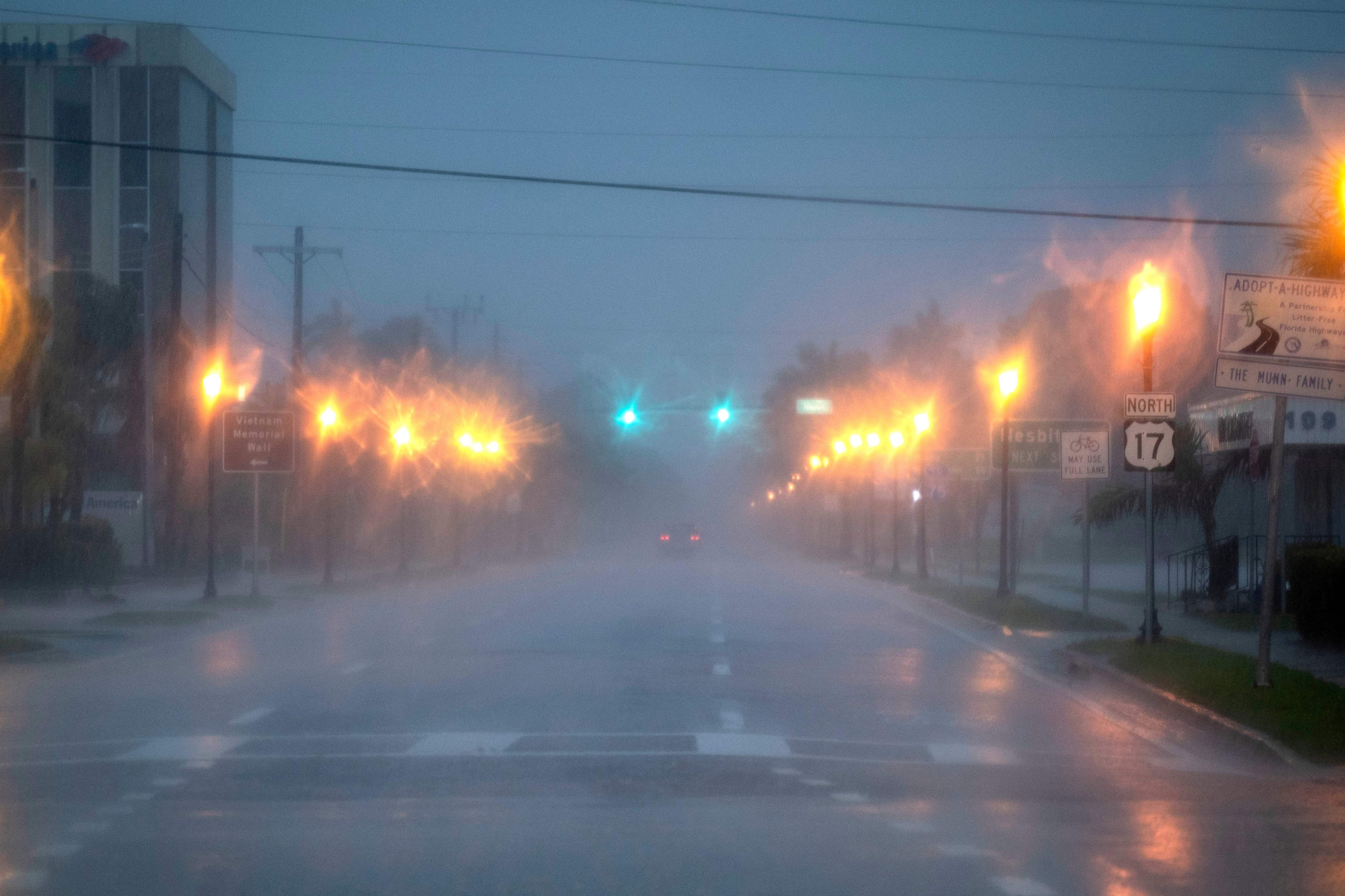
TOPSHOT – A car drives on US Road 17 ahead of Hurricane Ian, in Punta Gorda, Florida on September 28, 2022. – Ian intensified to just shy of catastrophic Category 5 strength Wednesday as its heavy winds began pummelling Florida, with forecasters warning of life-threatening storm surges after leaving millions without power in Cuba. (Photo by Ricardo ARDUENGO / AFP) (Photo by RICARDO ARDUENGO/AFP via Getty Images)
TOPSHOT – An old American car passes through a flooded street in Havana, on September 28, 2022, after the passage of hurricane Ian. – Cuba exceeded 12 hours this Wednesday in total blackout with “zero electricity generation” due to failures in the links of the national electrical system (sen), after the passage of powerful Hurricane Ian. (Photo by YAMIL LAGE / AFP) (Photo by YAMIL LAGE/AFP via Getty Images)
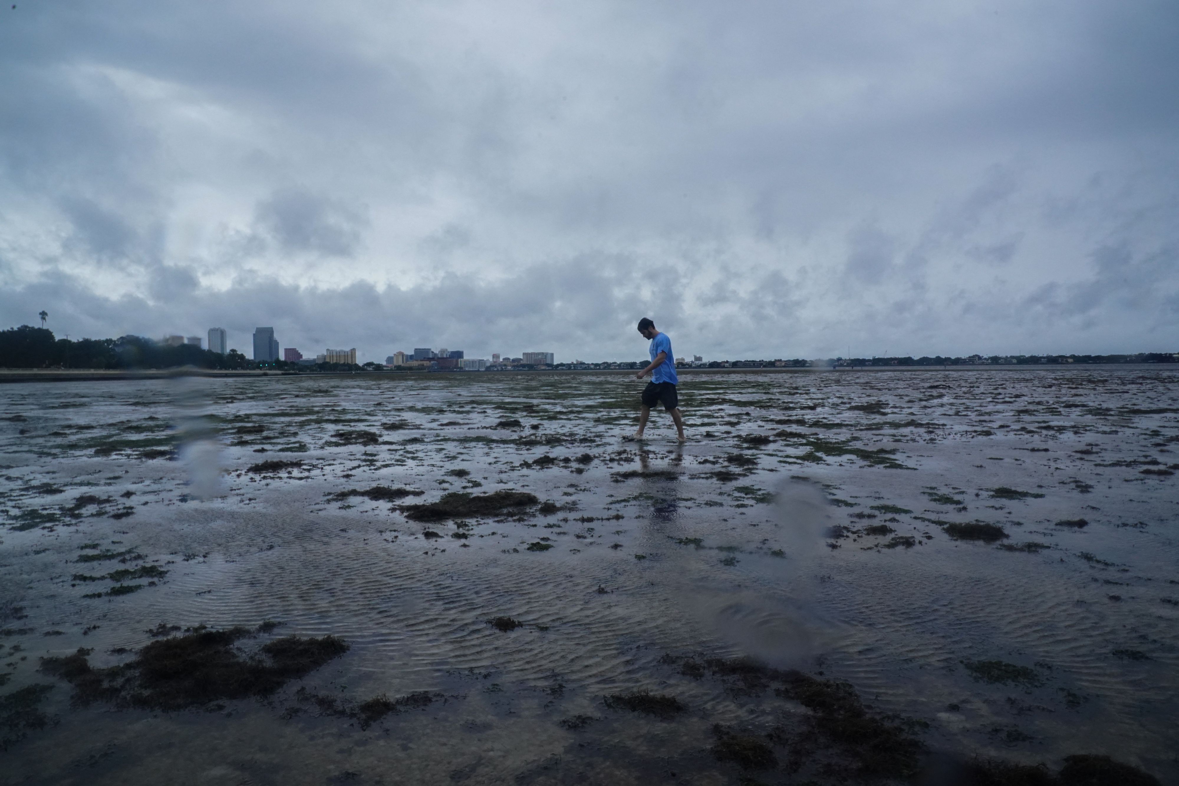
A man walks along the mudflats as the tide recedes from Tampa Bay ahead of Hurricane Ian making landfall on September 28, 2022 in Tampa, Florida. – Ian intensified to just shy of catastrophic Category 5 strength Wednesday as its heavy winds began pummelling Florida, with forecasters warning of life-threatening storm surges after leaving millions without power in Cuba. (Photo by Bryan R. Smith / AFP) (Photo by BRYAN R. SMITH/AFP via Getty Images)
People walk along the mudflats as the tide recedes from Tampa Bay as Hurricane Ian approaches on September 28, 2022, in Tampa, Florida. – Ian intensified to just shy of catastrophic Category 5 strength Wednesday as its heavy winds began pummelling Florida, with forecasters warning of life-threatening storm surges after leaving millions without power in Cuba. (Photo by Bryan R. Smith / AFP) (Photo by BRYAN R. SMITH/AFP via Getty Images)
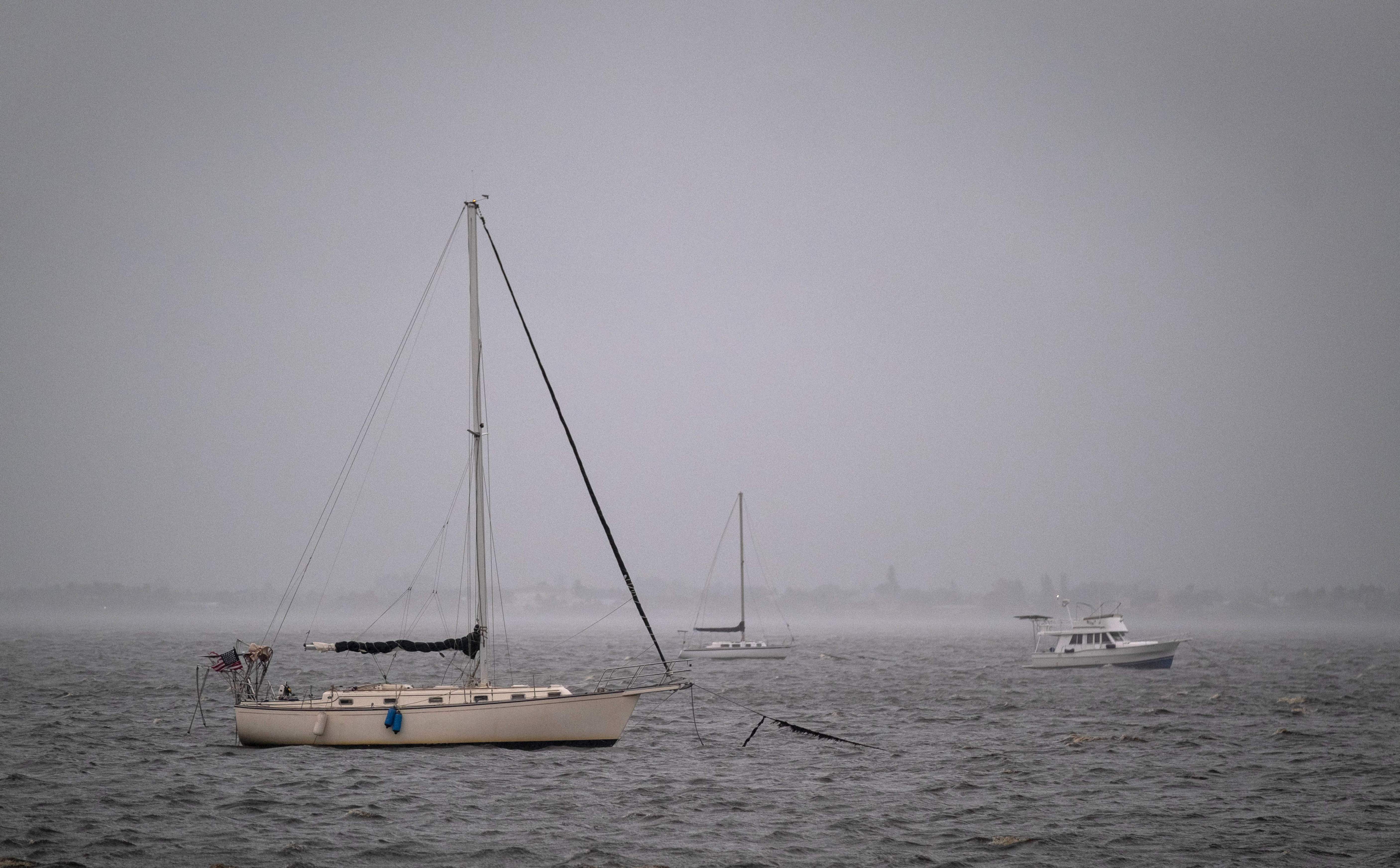
Boats are anchored in Charlotte Harbor ahead of Hurricane Ian, in Punta Gorda, Florida on September 28, 2022. – Ian intensified to just shy of catastrophic Category 5 strength Wednesday as its heavy winds began pummelling Florida, with forecasters warning of life-threatening storm surges after leaving millions without power in Cuba. (Photo by Ricardo ARDUENGO / AFP) (Photo by RICARDO ARDUENGO/AFP via Getty Images)
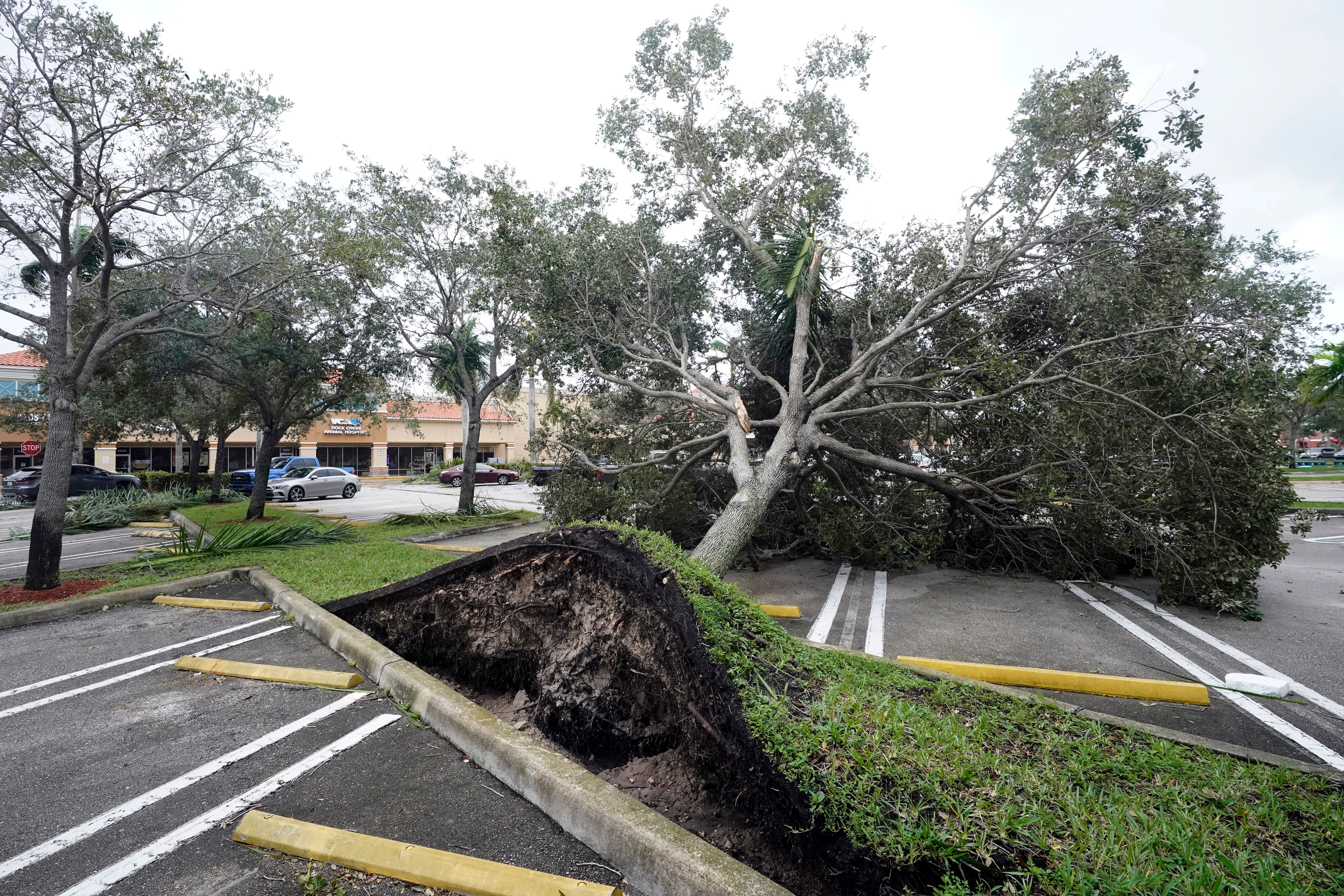
An uprooted tree, toppled by strong winds from the outer bands of Hurricane Ian, rests in a parking lot of a shopping center, Wednesday, Sept. 28, 2022, in Cooper City, Fla. (AP Photo/Wilfredo Lee)
An airplane overturned by a likely tornado produced by the outer bands of Hurricane Ian is shown, Wednesday, Sept. 28, 2022, at North Perry Airport in Pembroke Pines, Fla. Hurricane Ian rapidly intensified as it neared landfall along Florida’s southwest coast Wednesday morning, gaining top winds of 155 mph (250 kph), just shy of the most dangerous Category 5 status. (AP Photo/Wilfredo Lee)
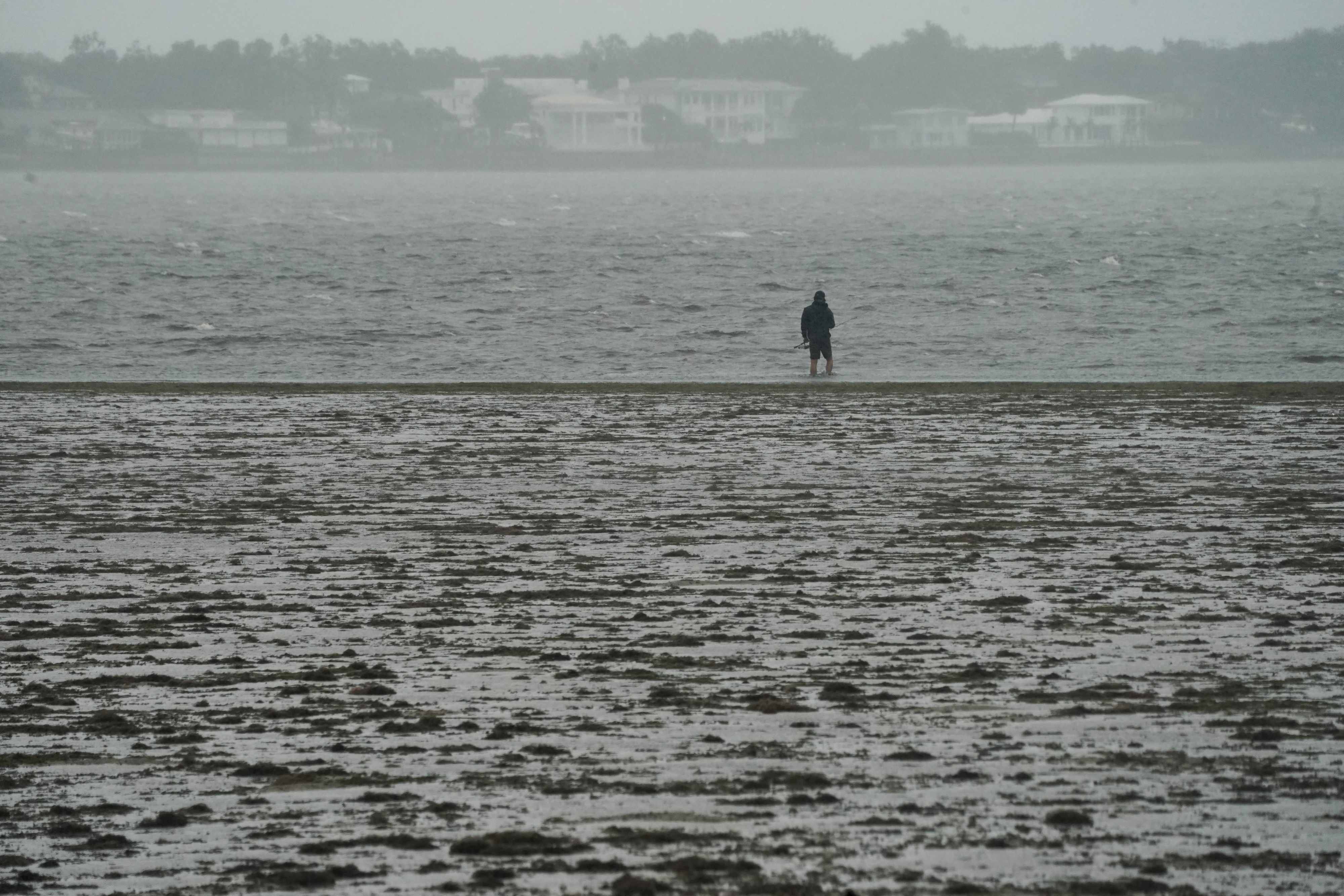
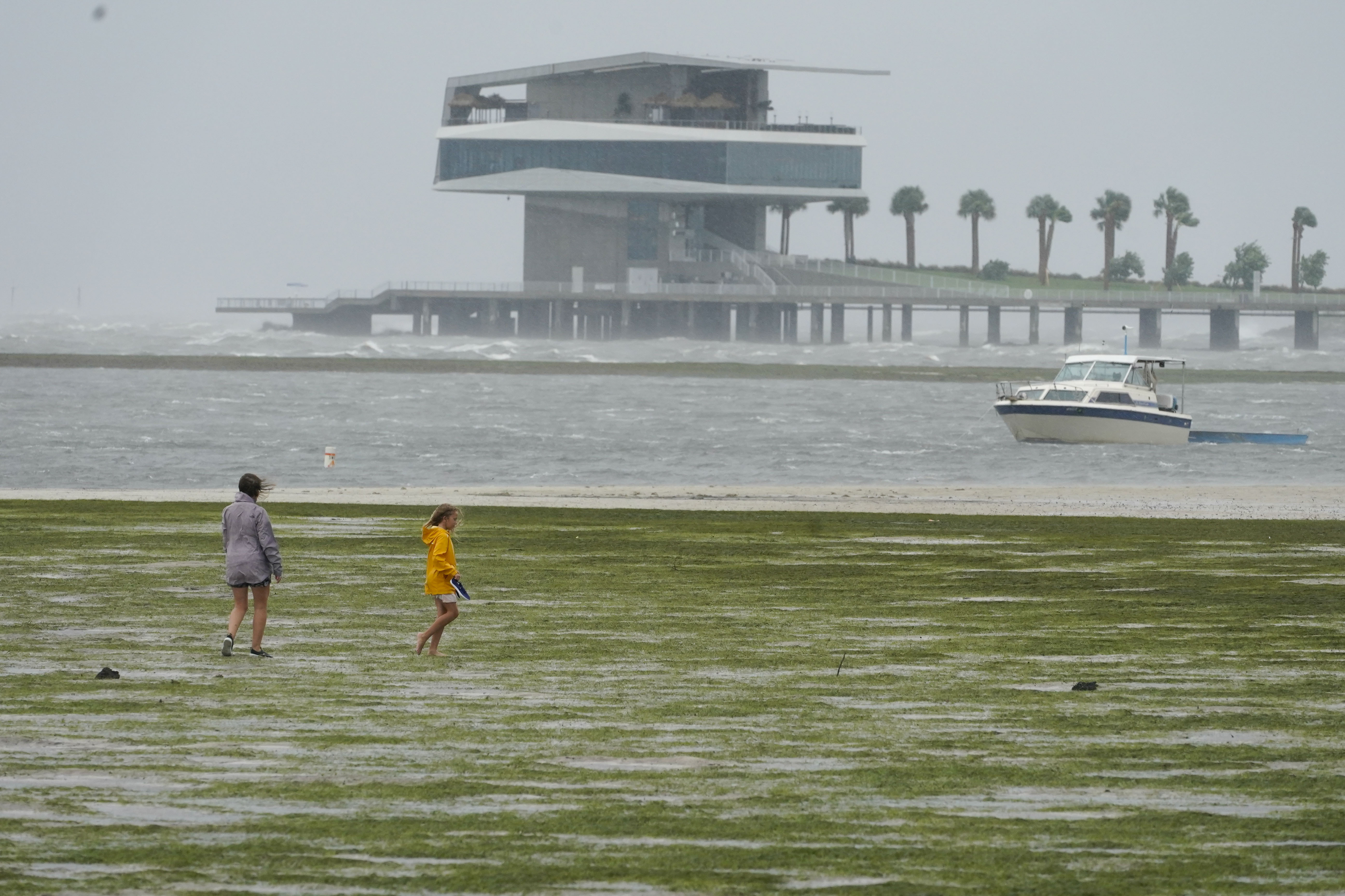
People walk where water is receding out of Tampa Bay due to a negative surge ahead of Hurricane Ian, Wednesday, Sept. 28, 2022, in Tampa, Fla. (AP Photo/Steve Helber)
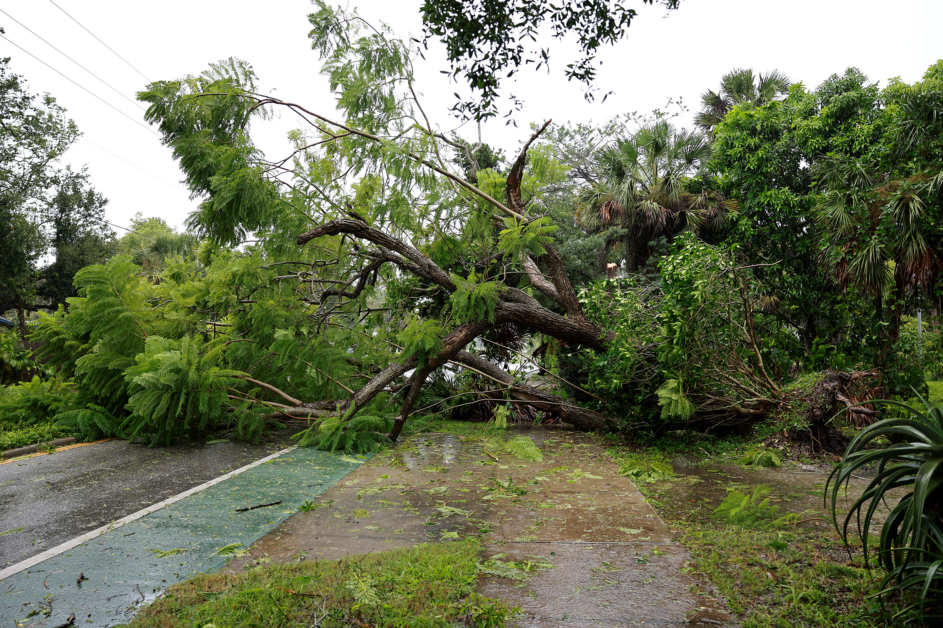
SARASOTA, FLORIDA – SEPTEMBER 28: A downed tree covers the road after being toppled by the winds and rain from Hurricane Ian on September 28, 2022 in Sarasota, Florida. Ian is hitting the area as a Category 4 hurricane. (Photo by Joe Raedle/Getty Images)
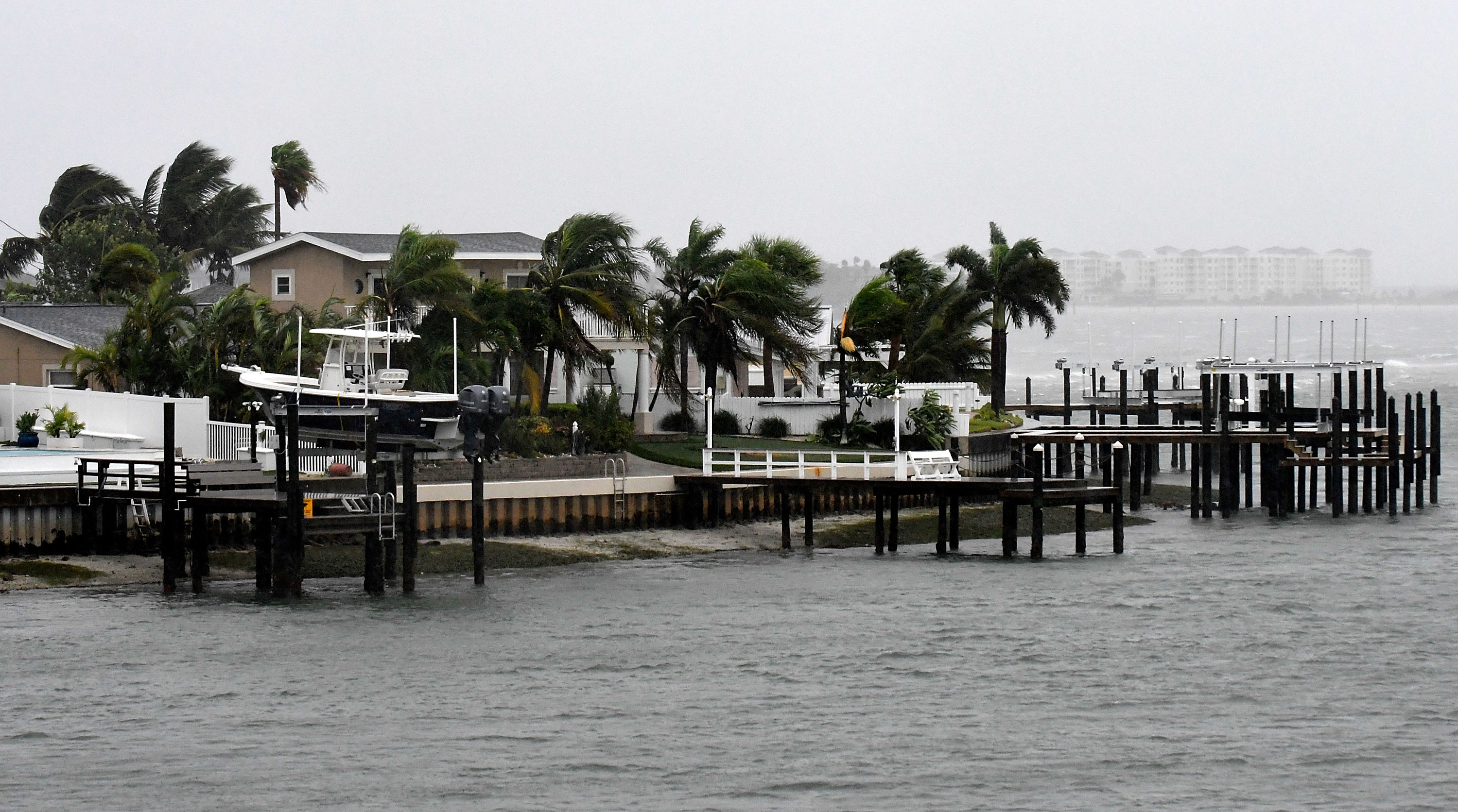
SAINT PETERSBURG, FLORIDA – SEPTEMBER 28: General view of St. Pete Beach bay as the winds from Hurricane Ian arrive on September 28, 2022 in St. Petersburg, Florida. Ian is hitting the area as a Category 4 hurricane. (Photo by Gerardo Mora/Getty Images)
1 / 12
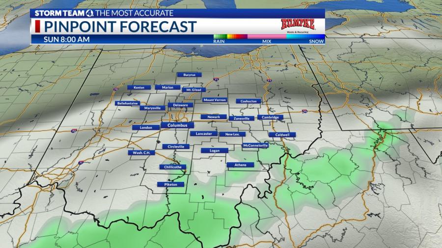
The system will continue inland through South Carolina and North Carolina this weekend. While the storm would not be as much of a wind-maker, it would still produce heavy rainfall, slowing down near the Appalachians.
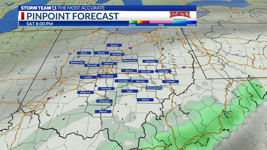
At a minimum, the remnants of Ian will increase cloud cover in the Ohio Valley this weekend, and likely bring showers to the area Saturday evening and into Sunday.
Storm Team 4 will continue to closely monitor the storm, and update this forecast.