Columbus (WCMH) – Today was the 2nd day this month where we have set a record high temperature already! We have a very warm forecast in store this week, but it appears that all the rest of the records should be safe.What happened to our Winter here in Ohio?
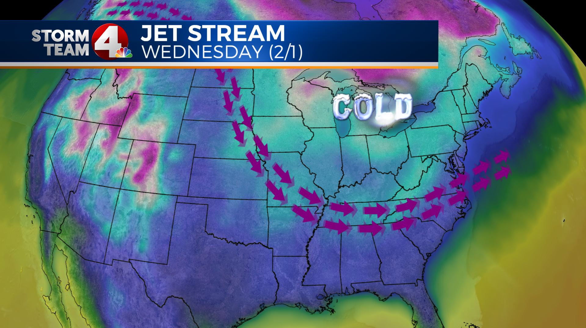
Simply put, our friends out west are robbing us of it 🙂 The Jet stream has been very unfavorable for cold temps and snowfall here, but that is going to change soon!Right now, the jet has been off to our west, and promoting a warming pattern:
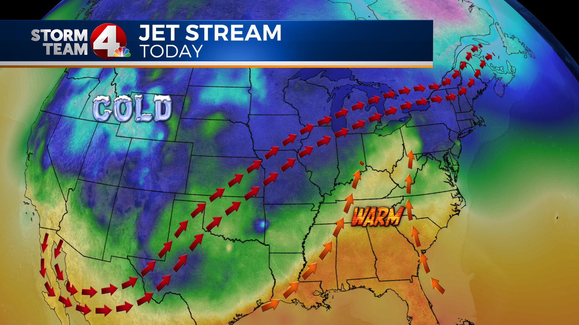
This pattern keep the warm stream of air coming into our area, it also is keeping the bulk of the storm systems riding off to our west. When one of these lows rides up this jet stream, or highways for weather, it bring a warm front and additional rainfall, but not snow.
This pattern is also one that brings more of the icy weather out to the west of us, the the much colder air is stuck off to the northwest.This pattern will amplify a bit as we head to the end of the week, this should increase flow, and temps:
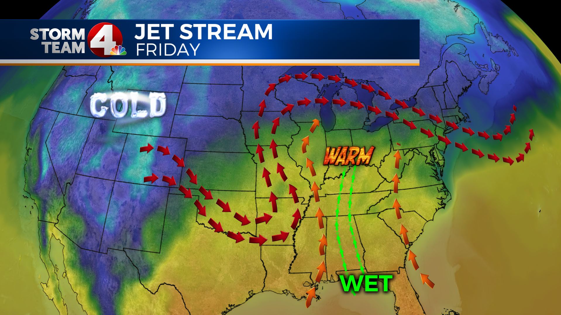
This pattern will push temps into the mid 50s by Friday even with cloudy skies and rainfall. The tap into the Gulf moisture from a digging low out west should increase rain showers Friday and then again later into the weekend into early next week as the low again digs in the mid-section of the country, then pivots northeast above Ohio.Next week, we start to look at swinging back to Winter once again:
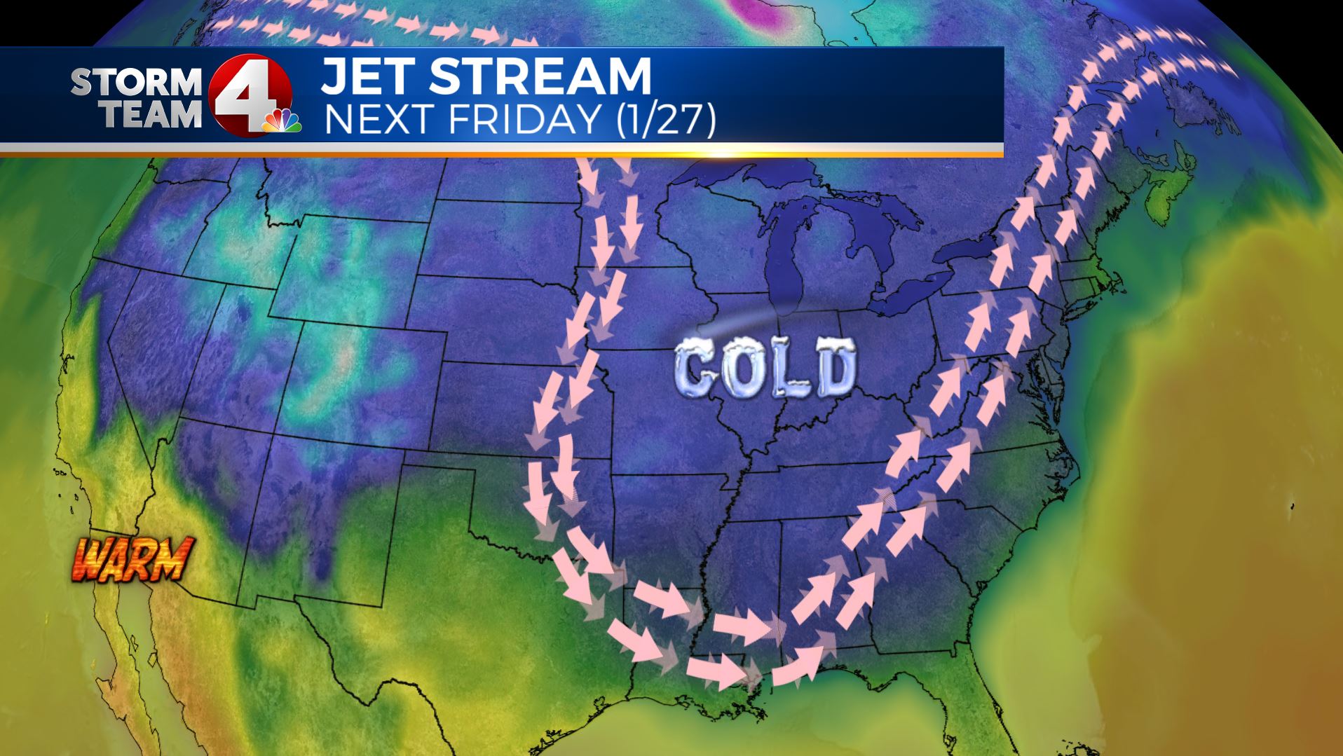
This week we have the Jet stream coming from the southwest to the northeast, but late next week we are going to have a northerly to northwesterly flow. This will bring a big change to the temperature, and will also promote snow to return to our forecast area.Also, the Great Lakes are still fairly open, with just 13.5% ice coverage:
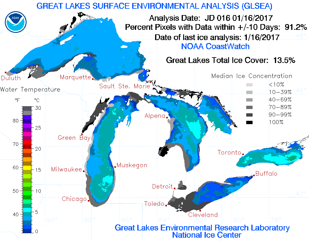
As you can see from this image from the Great Lakes Environmental Research Laboratory, Lake Erie has the most ice in this image (grey shading over the lake). The bulk of the open lakes are areas where we look to for Lake Effect snow.
Below is the lake ice coverage as of today for the 5 Great Lakes:
- Lake Superior 8% coverage
- Lake Michigan 16% coverage
- Lake Huron 15% coverage
- Lake Erie 33% coverage
- Lake Ontario 2% coverage
- Total: 13.5% ice coverage
Mid-late next week we will see a shift in the upper pattern:
This pattern shift will promote a northwesterly flow, which will bring weather systems in over the open lakes, and also bring more progressive snow making system to plunge down into our area.
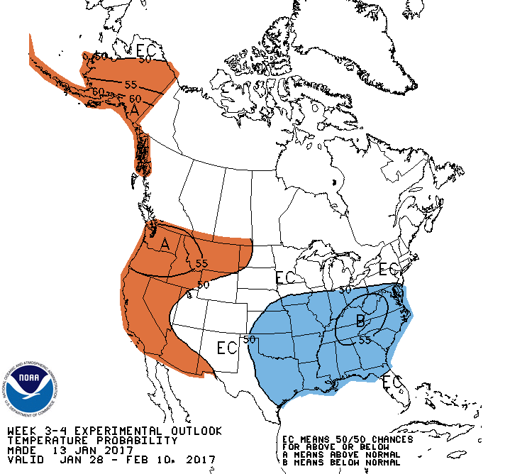
It appears that by late next week into the follow week (first week of February) we are going to see several chances of cold moisture, snow, in our area. You can see from the image above, that we are going to have a good trough developing over the eastern part of the country. This would bring quite a cool down for the start of next month, and would keep any precip. type as snow.This would line up with the Climate Prediction Center’s experimental 3-4 week outlook:
We will have to keep a close eye on the forecast as we always do, but if you like this Spring-like forecast, you better soak up the warmth, because cold will be returning before you know it!!!
If you have any questions about warm, cold, snow, winter weather or any other types of weather, email me: dmazza@wcmh.com
-Dave


