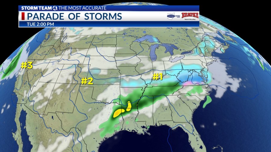
COLUMBUS (WCMH) — The second week of February is shaping up to be an active period for weather systems that will impact wide swaths of the nation east of the Rockies.
The first in a series of cross-country storms will sweep eastward early in the week, accompanied by locally heavy rain and thunderstorms across the South, and snow or a wintry mix from the Tennessee and Ohio valleys to the Mid-Atlantic Coast.
The most likely area in Ohio to receive a moderate snowfall will be in the southern counties, closer to the path of a wave of low pressure.
Light snow will develop across southern Ohio Tuesday morning, but the northward extent will be limited by high pressure to the northwest of the region. A flow of cold, dry air will create a sharp cutoff near the I-71 and I-70 corridors.
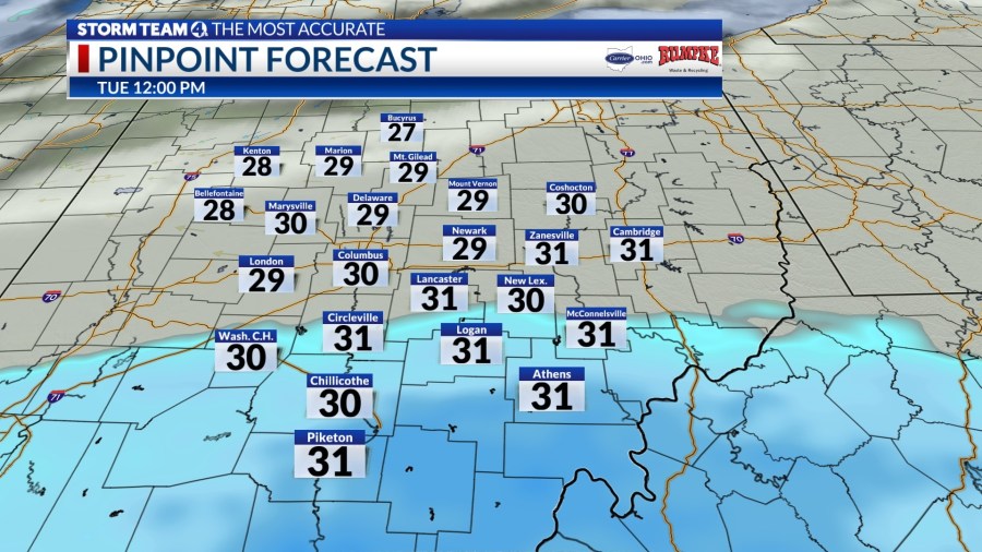
The southerly track, indicated by the latest models, would leave a dusting or no accumulation along the I-70/71 corridor from Columbus westward, and about a half-inch at Circleville and Lancaster.
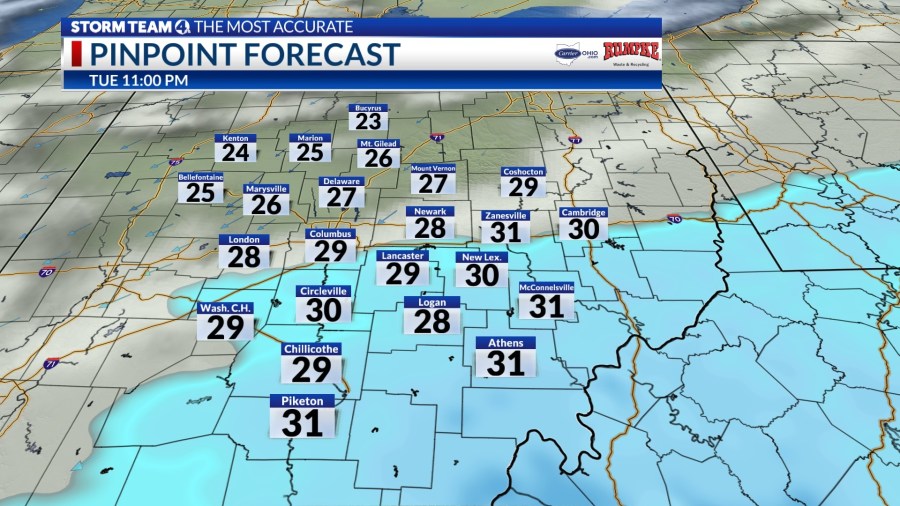
Temperatures in the low to mid-30s will melt the snow on most roads. In the southern part of the state, the snowfall will be range from 1 to 3 inches, and locally up to 4 inches along the Ohio River.
The back edge of any lingering snow showers will shift east of central Ohio later in the evening.
A break between weather systems will amount to little more than 12 hours, as another system developing in the southern Plains will travel quickly northeast across the Tennessee Valley to Ohio Wednesday night.
A path farther west will result in only a brief wintry mix Wednesday evening, before quickly becoming all rain as milder air is drawn northward. A narrow band of heavy snow will accumulate across the northwestern corner of Ohio and west across northern Indiana. Blustery and colder air will follow in the wake of the storm Thursday, with a few snow showers.
A third coast-to-coast storm of Pacific origin will arrive next Saturday, but the details are too far out to make any predictions beyond a likely wintry mix ending as snow showers Sunday, as the weather turns windy and sharply colder, with falling temperatures in the 20s and 10s.


