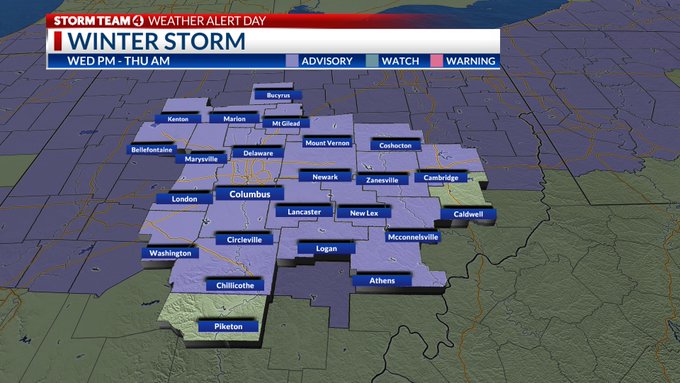
COLUMBUS, Ohio (WCMH) — The next round of wintry weather is expected to impact central Ohio with the chance for freezing rain. Because of this, a Winter Weather Advisory will be in effect for most of the area tonight.
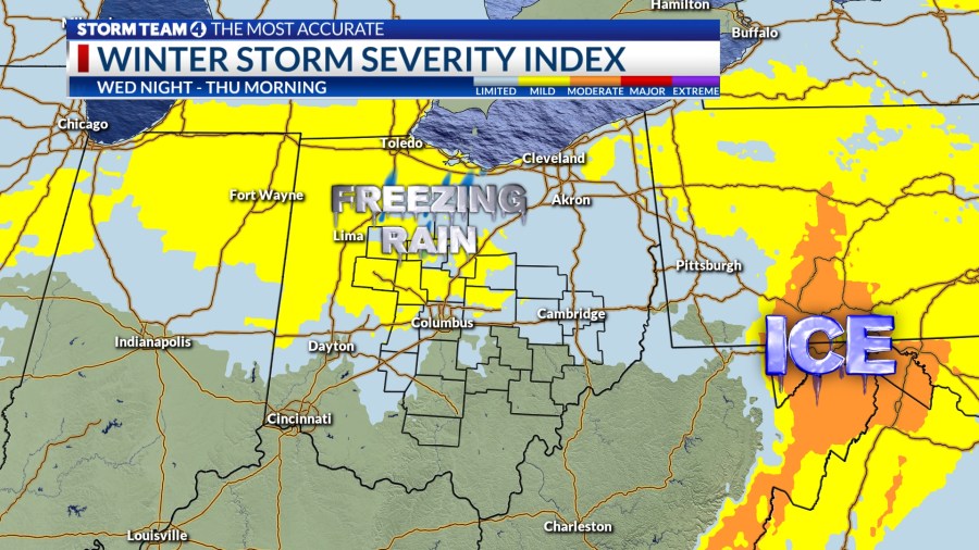
A system that’s moving across the country will bring precipitation chances into central Ohio starting Wednesday evening. Temperatures above the surface are expected to be warm enough for rain showers to fall, but air at the surface will be close to the freezing point. This means along with the rain showers there is the potential for freezing rain and ice formation.
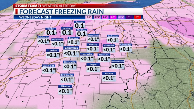
The most problematic time will be late night into early Thursday. That is when the majority of the freezing rain may fall across portions of central Ohio. Columbus and points south are most likely to see a light glaze or even no ice at all.
Most of the freezing rain chances will be highest north of the I-70 corridor. Some areas can see accumulations of ice of at least 0.1”. Better chances for more ice accumulation are expected north of the U.S. 30 corridor.
As Thursday morning progresses, the freezing rain will turn into just rain as air and surface temperatures will continue to rise. Most of the ice that forms, if any, should melt by the middle of the morning commute. That being said, travel during the overnight hours Wednesday may be impacted by icy and slick roads.
Air temperatures by Thursday afternoon will be in the mid 50s. This means virtually all ice that does form overnight should melt by day’s end.