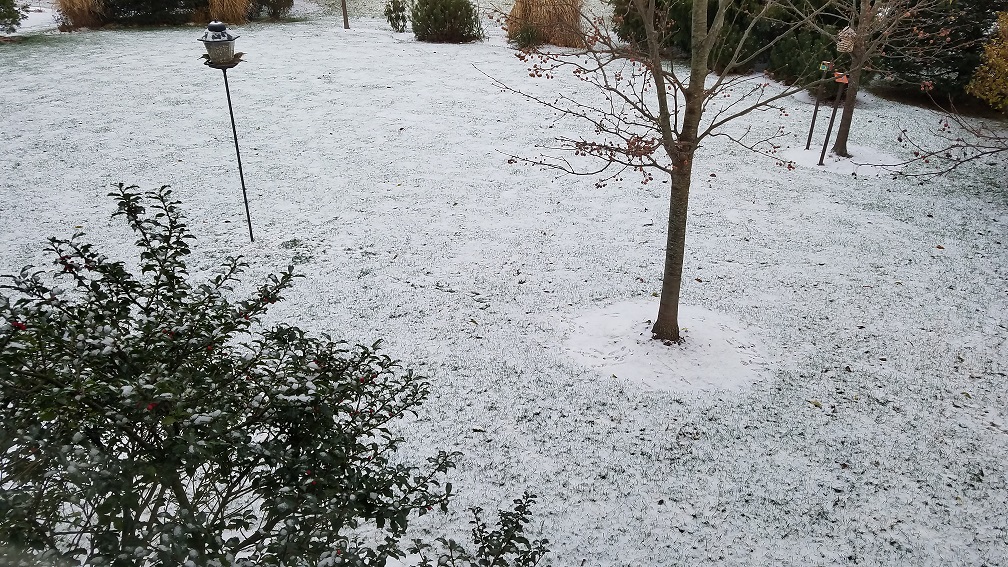
COLUMBUS (WCMH) – First off, we officially had our first measurable snowfall of the season today here in Columbus. We picked up 0.3″ of snowfall.
Why are we making a big deal of a small amount of snow in December?
Because we have not had snowfall for the past two Decembers, only a trace each. In fact, the past 77 December days combined have had less snowfall than we had today.
Now that we have our 1st measurable snow out of the way, what can we expect this weekend?
Saturday is going to be fine, in fact, the winds will relax enough that snow showers should shut down for most everyone except for the extreme north.
Saturday night a system is going to spread moisture into our backyards from the west, as it does so the northern counties will see snow first and then it will spread to the east.
Temps will be cold enough to start the system as all snow overnight.
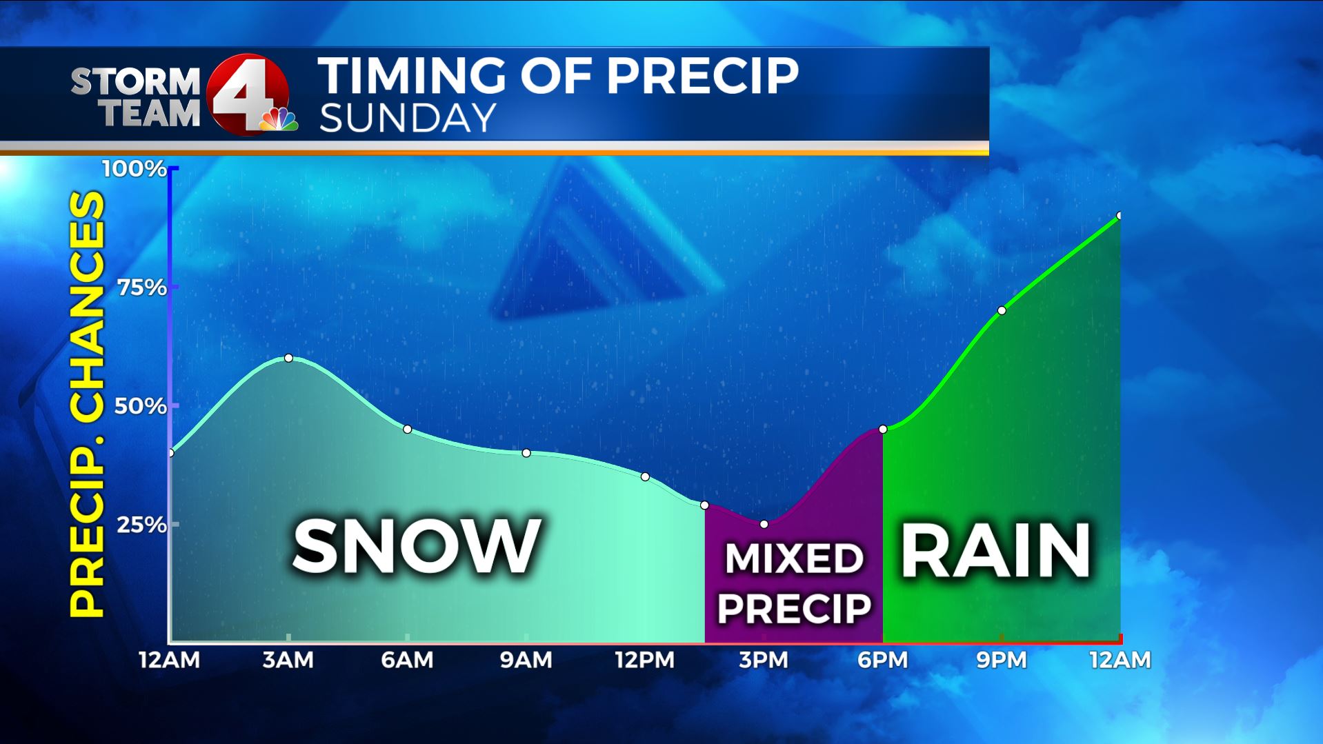
As the day progresses, the bulk of the moisture appears to push more north, and warmer air will move into our area. Warmer meaning mid 30s, but warm enough to change the snow back to rainfall by later in the day. It does appear that if you live in the south, you will see much better chances of rain than anything else.
Click/swipe through a few frames from our latest in-house high res model for Sunday/Monday:
Snowfall and rainfall will mix before everything is wrapped up and over, but the total snowfall expected (before any gets melted or smooshed by rain):
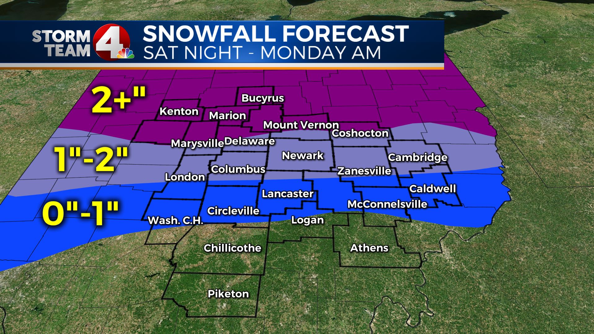
Again, this system is much more than 1000 miles away still and we will have to continue to monitor this as it moves closer. There will be minor tweaks to the forecast so stay tuned.
If you have any questions about snow, snowfall forecasts, winter weather, or anything else, email me: dmazza@wcmh.com
-Dave