COLUMBUS, Ohio (WCMH) — An unseasonably warm and humid air mass over Ohio will provide the fuel for scattered showers and some strong to severe thunderstorms. Storm Team 4 has issued a Weather Alert Day.
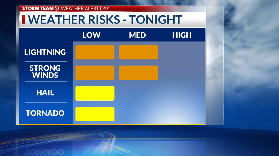
The afternoon and evening will be dry, except for an isolated shower. However, the threat for severe weather ramps up tonight ahead of a cold front. The Storm Prediction Center has placed the southern half of Ohio in a Level 3 of 5 risk for damaging winds, large hail and isolated tornadoes, and a 4-of-5 threat in the Cincinnati area.

Storms that rapidly developed over eastern Missouri Friday afternoon are heading into Indiana and western Kentucky this evening. The storm clusters will gradually congeal into a larger storm complex that could contain a few supercells, or rotating storms, capable of producing large hail (1-1.5 inches in diameter) and possibly a few tornadoes.

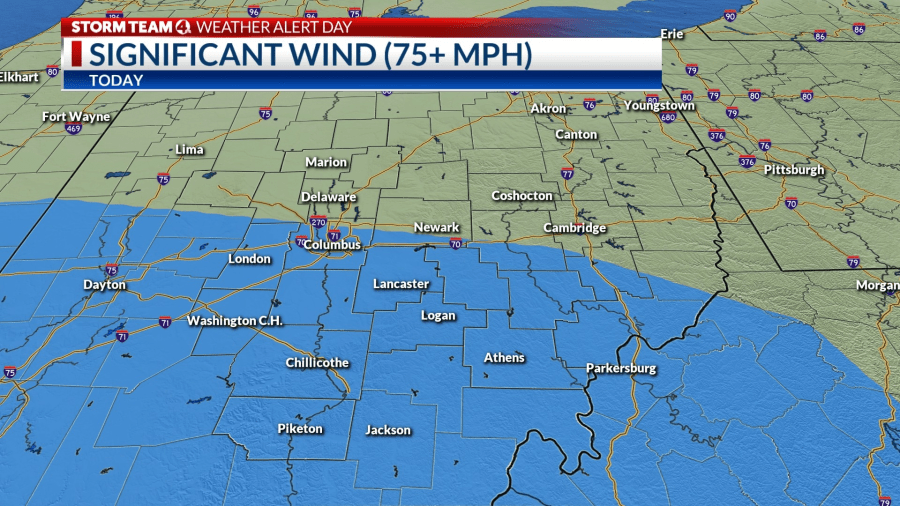
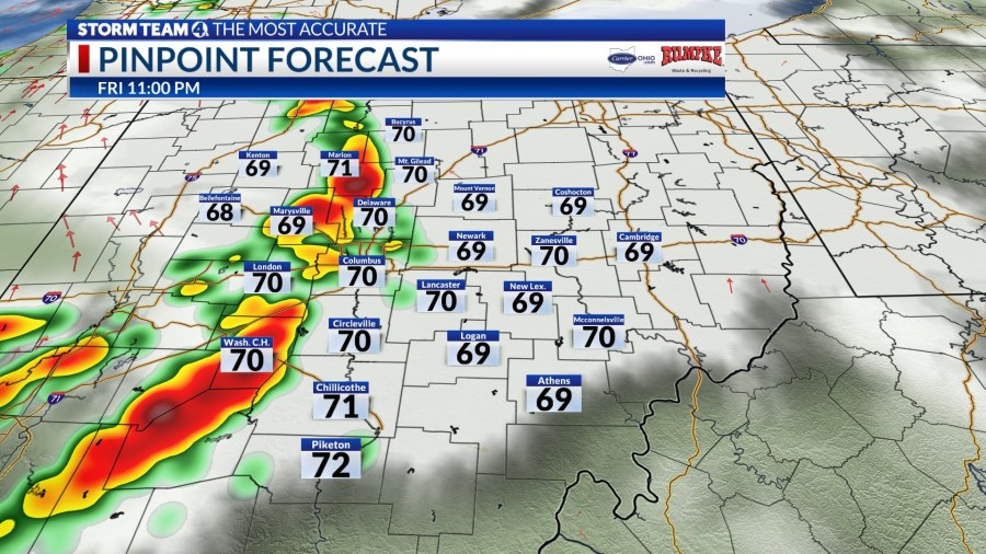
The greatest threat of severe weather will line with areas near and south of I-70 through 10 p.m. A line or complex of strong to severe storms will each central Ohio around 10 p.m. and move quickly east, diminishing in intensity farther east of I-71 around midnight.
The weather will be much more pleasant by Saturday afternoon behind the cold front, with spotty showers moving east of central Ohio around midday. Temperatures will be noticeably cooler, in the low 70s, with very breezy conditions.
Stay tuned to NBC4 and and for the latest weather information, severe weather watches and warnings, and look for updates on your Storm Team 4 weather app.