COLUMBUS, Ohio (WCMH) –Despite a very cold start to December, conditions will moderate, except for a brief arctic outbreak later this week.
Currently, there is no clear signal yet regarding the weather during Christmas week, which will become more evident around Dec. 15, once we are in the wheelhouse of longer-range forecast models.
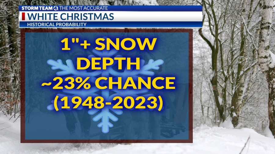
Columbus has experienced a white Christmas about 1 in 4 winters since the mid-20th century, defined by an inch or more of snow on the ground at daybreak, either new snow or from an earlier snowfall.
La Niña winter
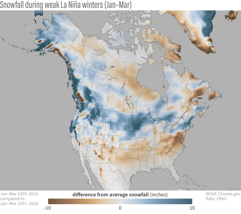
However, there are some clues in the eastern Pacific climate regime. A slowly developing La Niña, reflecting cooler-than-normal water in a band through the eastern tropical Pacific, typically results in a bulge of the jet stream that displaces moisture-laden Pacific storms northward, with a dip over the northern Plains and Great Lakes.
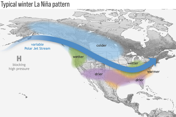
Most La Niña winter seasons bring wetter-than-normal conditions to the Ohio Valley and lower Great Lakes, but the best chance for significant snowfall is usually confined to the northern tier of states, where colder air resides, from the northern Rockies to the Upper Midwest.
Looking at weak La Niña winter seasons since 2000 in central Ohio, when compared with the average snowfall (28.2 inches) and temperature (32.2 degrees), five of the six winters saw below-normal snowfall, compared with the 30-year average (1991-2020).
However, temperatures were above normal in only half of those winters between December and February, allowing for some wintry events and longer cold spells in a typical pattern.
Weak La Niña Winters
| WINTER | SNOWFALL (Oct.-May) | AVERAGE TEMPERATURE (Dec.-Feb.)—Columbus, OH |
| 2000-01 | 26.3 | 29.1 |
| 2005-06 | 12.9 | 34.7 |
| 2008-09 | 23.2 | 29.9 |
| 2016-17 | 17.1 | 31.6 |
| 2017-18 | 29.8 | 32.4 |
| 2022-23 | 12.5 | 37.7 |
There are other key variables such as solar activity, which is approaching a maximum this winter, snow cover extent in northeastern Asia and northern Canada, North Atlantic air pressure cycles, and the strength of the polar vortex in the upper levels of the atmosphere, which usually affect the upcoming winter in ways not predictable this early in the season.
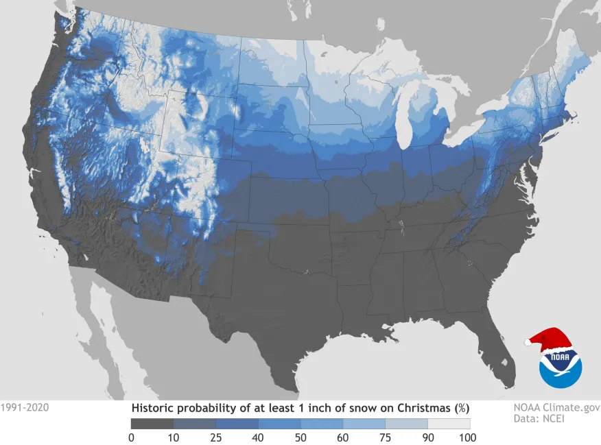
Probability of a white Christmas in lower 48 States
NOAA analyzed historical weather data between 1991 and 2020 to determine which areas of the country have the best odds of seeing a white Christmas.
Looking at the major metropolitan areas, the highest probability, historically, would be cities such as Denver, Minneapolis and Buffalo. Ohio Valley locations have about a 1 in 4 chance of seeing snow on Christmas, based on the past 30 years of records.
NOAA meteorologist Tom Di Liberto reexamined snowfall trends during La Niña winters, and he found they tend to be “banner years” for snow in the Pacific Northwest and the northern Rocky Mountains. The Great Lakes region and parts of New England also tend to see above-average snow when a La Niña pattern is in place, Di Liberto said.
In a weak and probably shorter La Niña, which is most likely this winter, the northern Plains and Upper Midwest usually experience more snow during weak La Niña winters, while the Pacific Northwest is a little less snowy than during a strong La Niña climate pattern.
White Christmases in Columbus
For those of us who dream of a white Christmas every year, there is often disappointment. Statistically, three out of every four Christmas holidays are snow-free in central Ohio, including last year, which saw a near-record high of 62 degrees and .26 inch of rain.
Christmas weekend 2022 was memorable snowy, after the passage of an arctic cold front that sent the Columbus temperature plummeting from 44 degrees on the evening of Dec. 22 to a low of -7 degrees at daybreak on Dec. 23, and a brutal wind chill of -34.
The city was blanketed with 4.9 inches of snow at dawn, which blew everywhere, as wind gusts peaked at 46 mph, making travel dangerous and some roads almost impassable.
The cold was unrelenting through the holiday in 2022; the high was 15 degrees, and the morning low was a frigid 7 degrees on Christmas Day.
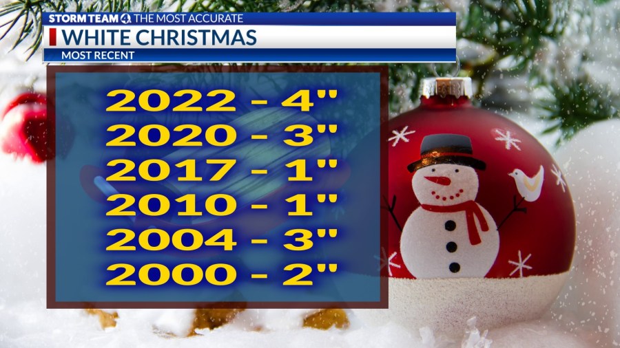
The substantial Christmas 2022 snow cover of 4 inches was equaled in 2020 and 2004, tied for the greatest holiday snow depth in the past 25 years.
A traditional snowy Christmas in 2020 occurred after another extraoridinary drop in temperature on Christmas Eve, from 53 to 17 degrees, accompanied by 3.6 inches of snow, which tapered off early on Christmas morning. Temperatures ranged from 14 to 18 degrees in Columbus on Christmas Day, with a 3-inch snow cover.
We have experienced some remarkable extremes lately. Much like last year, Christmas 2021 was exceptionally mild, also with a high of 62 degrees, and a soaking 0.82 inch of rain, wettest on record.
Winter officially arrives at 4:19 a.m. Eastern time on Dec. 21, known as the winter solstice.